Issue Date: 5/24/2018
Issue Time: 10:15AM
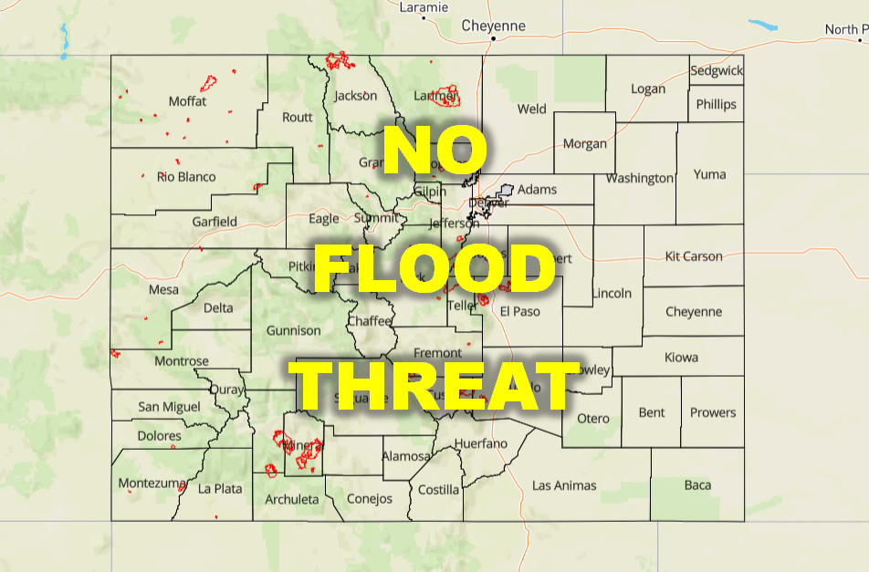
NO FLOOD THREAT IS FORECAST TODAY.
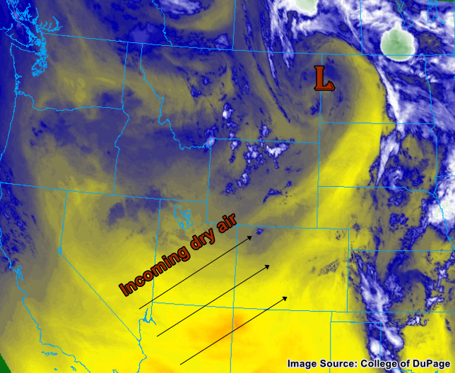
A large ridge of high pressure has been developing off to our west and will continue to build into Colorado as the day progresses. The water vapor image below shows that the low that passed just north of Colorado yesterday is now over Montana/North Dakota, and subsequent dry air and high pressure is replacing it in in its wake. With limited atmospheric moisture, this spells mostly clear and quiet conditions for the vast majority of Colorado throughout the day and evening.
There will not be enough moisture or instability present in the atmosphere to kick off thunderstorms along the western slopes or mountains. For areas to the east of the Urban Corridor, however, potential energy at the surface and middle levels of the atmosphere, aided by still relatively moist air left over from the last round of showers and thunderstorms, may kick off a few spotty showers with the occasional thunderclap as the afternoon and evening commence. Thunderstorm activity should be limited in its strength and organization, however, as the above-mentioned dry and stable air moving in from the west will counteract any major storm development. No flood threat is anticipated for today.
Today’s Flood Threat Map
For more information on today’s flood threat, see the map below (hover over threat areas for more details). For Zone-Specific forecasts, scroll below the map.

Zone-Specific Forecasts
Grand Valley, Southwest Slope, San Juan Mountains, Southeast Mountains, Raton Ridge, Northwest Slope, Northern Mountains, Central Mountains, San Luis Valley, Front Range, Urban Corridor:
Mostly sunny and seasonally warm conditions are anticipated for the day in these areas. Cumulus clouds will likely build during the afternoon, especially for the Front Range and Urban Corridor, with plenty of virga streaks but not much in terms of appreciable rainfall. If you’re along the Urban Corridor, as the sun sets, look for intermittent flashes of lightning far off to your east.
Southeast Plains, Northeast Plains, Palmer Ridge:
In the afternoon, continuing into the early evening, scattered thunderstorms are expected to develop, mainly near and along the Palmer Ridge. The storms will then move east, crossing into Kansas and Nebraska overnight. Below the strongest storms, local rainfall rates up to about 1 inch per hour with small hail may occur, resulting in some ponding of low-lying roads and fields, but no major flooding is expected. More isolated storms may form throughout the Northeast and Southeast Plains as well, near the preferred terrain of the Cheyenne Ridge and Raton Ridge, but precipitation totals will be negligible.
For the Palmer Ridge:
Rainfall rates: < 0.25” per hour, but up to 1.25 inches/hour is possible in isolated, stronger thunderstorms
Primetime: 3PM to 10pm
For the Northeast and Southeast Plains:
Rainfall rates: 0.1-0.3 inches/hour
Primetime: 3pm to 9pm