FTB 06-11-2018: Cooler High Temperatures after the Passage of a Dry Cold Front

Issue Date: Monday, June 11, 2018
Issue Time: 08:55AM MDT

— Flooding is NOT expected today

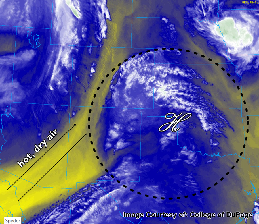
The water vapor satellite imagery below shows the current location of the cold front that came through last night. Unfortunately it is a dry cold front, so there was no precipitation associated with its passing. However with more northerly winds behind it, high temperatures will drop 5-10F today when compared to this weekend. Also decreasing today are the winds, as the trough associated with the gusty winds over the weekend will be passing to the north and east of Colorado. High winds speeds over the eastern plains are expected to decrease by early afternoon.

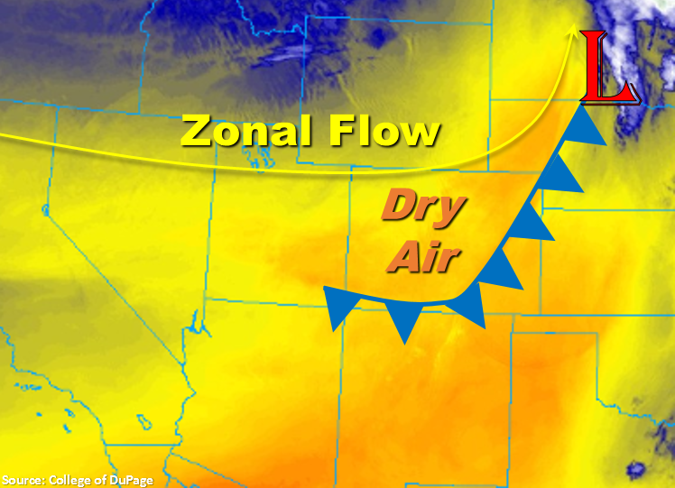
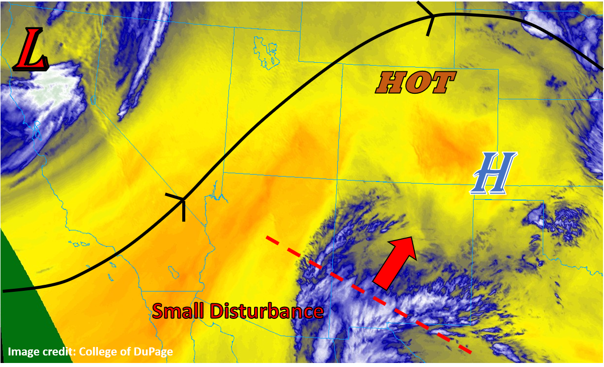
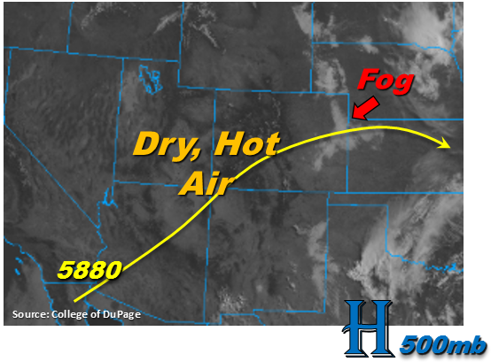
More zonal flow over the state today will continue the drying out the atmosphere and greatly reduce the chances of measurable precipitation. Over Southern Colorado, the ridge will begin to build in again with the center of the High shifting north over AZ and NM. This will decrease the chances to nearly zero for measurable precipitation over this region. Cloud cover over the higher terrains will be lessened as well with all of the dry air this afternoon. Thus, flooding is not expected today. On a side note, the dense smoke advisory remains in effect through this morning over the San Juan Mountains, so please use caution when driving.

Today’s Flood Threat Map

For more information on today’s flood threat, see the map below. For Zone-Specific forecasts, scroll below the map.

Zone-Specific Forecasts:

Palmer Ridge, Front Range, Urban Corridor, Northeast Plains, Southeast Plains, Raton Ridge, Southeast Mountains:

The strong winds that are currently ongoing with the passage of the cold front over the eastern plains will decrease throughout the morning into the early afternoon. High temperatures will still be above average, but 5-10F cooler than this weekend. Precipitation is not expected today and cloud cover will be reduced as well.

San Luis Valley, San Juan Mountains, Northern Mountains, Southwest Slope, Grand Valley, Central Mountains, Northwest Slope:

Dense Smoke Advisory continues for the San Juan Mountains through noon today. Precipitation is not expected today, but decreases in wind speeds have lifted the Red Flag Warning. High temperatures will be 5-10F cooler than yesterday with the passage of a cold front.

FTB 06-10-2018: Gusty Winds and High Heat for Today

Issue Date: Sunday, June 10, 2018
Issue Time: 10:30AM MDT

— Flooding is NOT expected today.

Steady winds from the south/southwest continue to bring in exceptionally hot and dry air throughout Colorado today, and should continue to strengthen as the day progresses. Afternoon high temperatures will range from around 100 in the southeast and southwest, to 90s along the Front Range and Urban Corridor, and to the low- to mid-70s across the high country. The dry, hot air at the surface, along with a large upper atmosphere ridge will also act to stifle any major storm development across the state. There is almost no rainfall and thus no flood threat in the forecast for today.

Today’s Flood Threat Map

For more information on today’s flood threat, see the map below. For Zone-Specific forecasts, scroll below the map.

Zone-Specific Forecasts:

Front Range, Urban Corridor, Palmer Ridge, Northeast Plains, Southeast Plains, Raton Ridge, and Southeast Mountains:

Hot, with temperatures ranging from the lower 90s to lower 100s for daytime highs. This, in conjunction with gusty winds up to 20-30 mph will make for extreme fire danger today, especially for the Southeast Plains and Raton Ridge. Use extra caution when working it anything flammable outside. By late this afternoon and in the evening, there is a very small chance for precipitation in the far northeast areas of Colorado, but due to the dry surface conditions hourly rainfall values of less than 0.1 inches are expected if any rain falls at all.

Northern Mountains, Northwest Slope, Grand Valley, San Juan Mountains, San Luis Valley, Southwest Slope, and Central Mountains:

Temperatures today will range from the mid-90s along the Southwest Slope to the low- to mid-70s in the Northern Mountains and Central Mountains. Winds generally from the southwest will increase during the day, and fire danger exists for the entire part of the state west of the Continental Divide. No appreciable rainfall is forecast, and expect puffy cumulus to develop in the afternoon hours giving temporary shade from the hot sun.

FTB 06-09-2018: Even More Extreme Heat on Tap with Minimal Rain Chances

Issue Date: Saturday, June 9, 2018
Issue Time: 09:15AM MDT

— Flooding is NOT expected today.

Heat continues to be the dominant player in Colorado weather today, as the strong ridge that has been overhead all week continues to control regional weather. Some subtle changes are beginning to take shape, as a powerful trough out west is beginning to break down the ridge over CO, but this will take some time. For today, it will be more hot, dry, and sunny weather statewide, with just a small chance of some storms tonight in the southeastern corner of the state as a small disturbance currently near the Mexico/New Mexico border drifts far enough north to have an influence. The water vapor imagery below illustrates the position of this feature nicely, as well as the position of the trough along the west coast. In between, very dry air dominates. Flooding is not expected today.

Today’s Flood Threat Map

For more information on today’s flood threat, see the map below. For Zone-Specific forecasts, scroll below the map.

Zone-Specific Forecasts:

Raton Ridge, Southeast Mountains, Southeast Plains:

Mostly sunny and hot through the day today, with cloud cover increasing through the afternoon ahead of the disturbance to the south. A few thunderstorms may manage to spring to life this evening, but they will have high cloud bases and a lot of dry surface air to overcome, so rain rates and total rainfall will be limited. Rates of up to 0.75” per hour are briefly possible under the strongest storms, but generally total accumulations will range from nothing to just 0.25”.

Primetime: 7PM to 3AM

Grand Valley, Northwest Slope, Northern Mountains, Central Mountains, Southwest Slope, San Juan Mountains, San Luis Valley, Front Range, Urban Corridor, Northeast Plains, Palmer Ridge:

Mostly sunny and hot today with temperatures easily running 10-15°F above normal today. Expect mid-90°Fs on the eastern plains with 80°Fs and 90°Fs across the western slopes and mountain valleys. Even the high peaks should reach well into the 60°Fs today. Cloud cover should increase this afternoon as diurnal convection gets going, but nothing is expected to produce any precipitation.

FTB 06-08-2018: Dry and Hot with Isolated Rainfall over the far Eastern Plains

Issue Date: Friday, June 8, 2018
Issue Time: 09:00AM MDT

— Flooding is NOT expected today

The visible satellite imagery below shows some dense fog over the eastern plains to start the day. This should quickly burn off this morning with the onset of daytime heating. Elsewhere, it is crystal clear over the state and the southwest US. This is noteworthy because it shows the lack of moisture left under the ridge. For today, the stubborn ridge continues to build over the state with the 5880 meter line making its way to the northern Colorado border. Southwesterly flow begins to become more westerly this afternoon, which should push the high moisture east of the state. There still may be some moist, low-level easterly flow over the far northeastern plains, but expect higher dew points to remain east over Kansas. Most storms that fire over the higher terrains this afternoon will evaporate before they are able to drop any rainfall; however, this will provide some shade from the well above average temperatures. High temperatures and low moisture means rainfall is expected to be even more isolated in coverage this afternoon when compared to yesterday. The best chance for measurable rainfall today is over the southeast corner of the state and Cheyenne/Kit Carson/Yuma Counties. Flooding is not expected today.

Today’s Flood Threat Map

For more information on today’s flood threat, see the map below. For Zone-Specific forecasts, scroll below the map.

Zone-Specific Forecasts:

Palmer Ridge, Front Range, Urban Corridor, Northeast Plains, Southeast Plains, Raton Ridge, Southeast Mountains:

Very isolated shower and thunderstorm coverage today with westerly flow off the mountains mixing out moisture eastwards. Best storm coverage today will be over the eastern Palmer Ridge and southeast corner of the state. High rainfall is expected to remain east of Colorado. Max 1-hour rain rates up to 0.7 inches are possible further east, but outflow driven storms will likely produce 1-hour rain rates in the 0.3 to 0.5 inch/hour range. Flooding is not expected today.

Primetime: 4PM – 9PM

San Luis Valley, San Juan Mountains, Northern Mountains, Southwest Slope, Grand Valley, Central Mountains, Northwest Slope:

Dense Smoke Advisory continues for the valleys near the 416 fire this morning. Smoke is expected to decrease as drainage winds will shift later this morning. Expecting another day of hot and dry weather. The cloudless skies across the southwestern US indicate the clear skies over western Colorado will continue throughout the day. Rainfall is not expected.