Issue Date: Sunday, July 24th, 2022
Issue Time: 10:30AM MDT
— The flood threat persists into the overnight hours
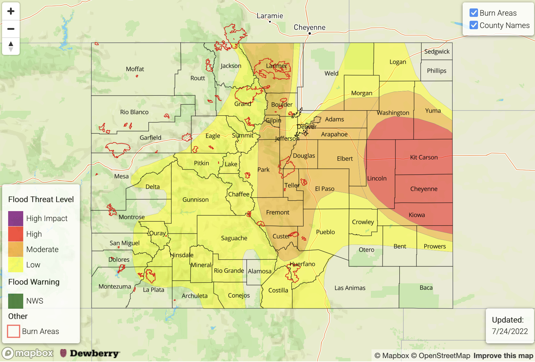
— A HIGH flood threat has been issued for the Northeast Plains, Southeast Plains and Palmer Ridge
— A MODERATE flood threat has been issued for the Front Range, Southeast Mountains and Urban Corridor
— A LOW flood threat has been issued for the Northern Mountains, Central Mountains, San Juan Mountains and portions of the Grand Valley and Raton Ridge
— Fire-Burn Forecast Summary: 2 burn areas under HIGH IMPACT, 4 burn areas under HIGH threat; 3 burn areas under MODERATE; 2 burn areas under LOW threat; click HERE for more info
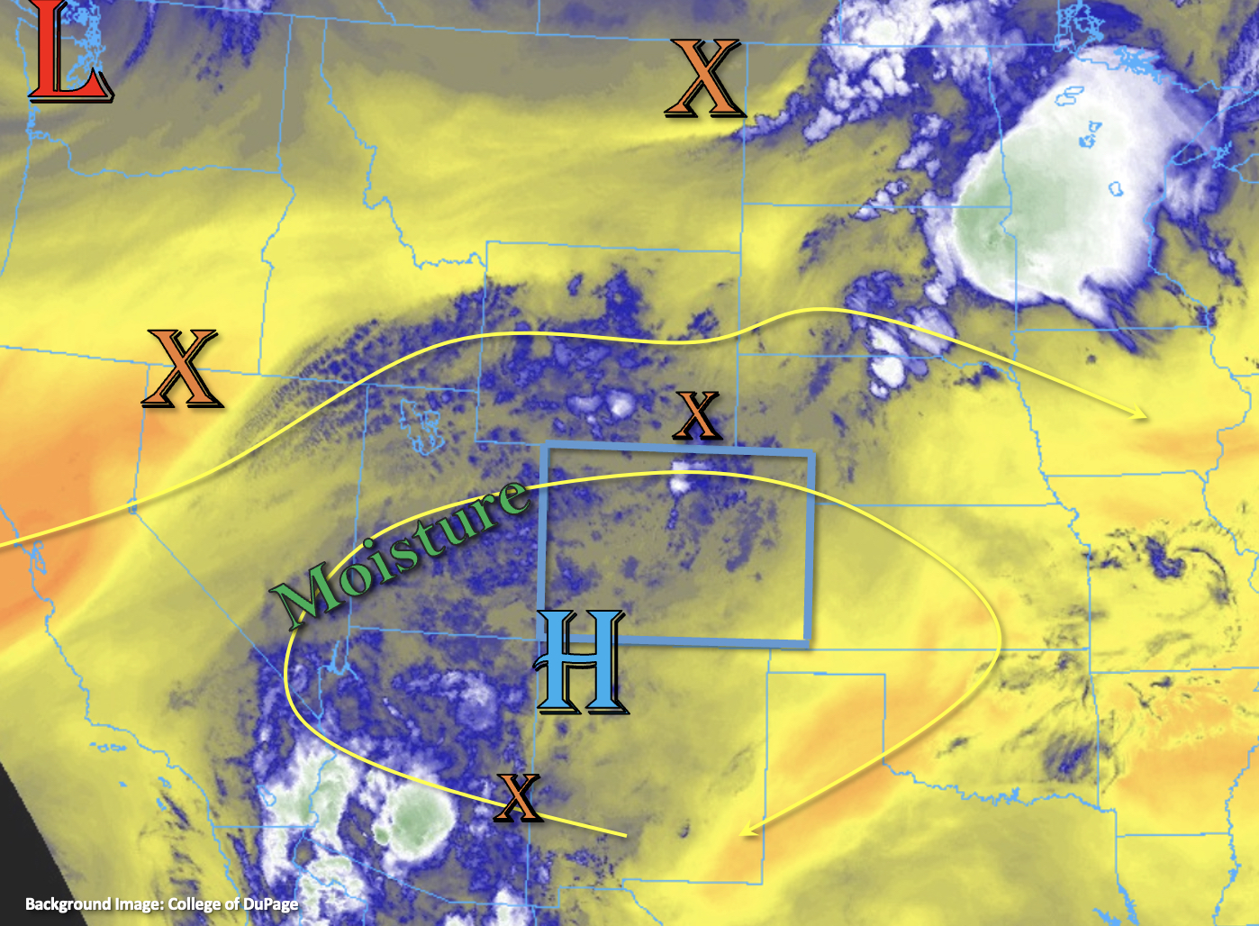
A very active rainfall day is on tap with a solid increase in monsoon moisture over the state as an incoming Low begins to the push the center of the High to the east. This will create WSW flow aloft, and this moisture combined with robust mid-level lift moving through the flow should help to produce numerous to widespread storms across the state. PW at Grand Junction has risen to 1.08 inches, and rainfall has already begun this morning over portions of the Northern Mountains, Grand Valley and Southwest Slope. Over eastern Colorado, a post-frontal upslope flow pattern will help to hold high dew points (mid-50°Fs and 60°Fs) in place. With steering flows decreasing across the state, very heavy rainfall will be possible under the stronger storm cores that develop. In addition to this threat, as storms move into the eastern plains, the threat for a couple severe thunderstorms increases with the main threat being damaging outflow winds.
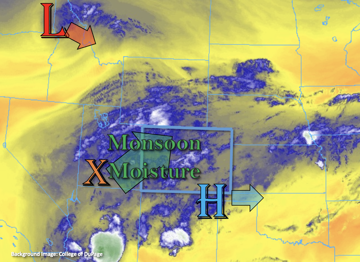
With rainfall already beginning over northwest Colorado, a little more morning heating should expand the showers and weak storms fair quickly. It will be unlikely then that much instability can develop, so the heavy rainfall threat should be more limited over this area. Better instability is likely to build over the eastern and southern mountains, so as upslope flow and the mid-level lift combine, stronger thunderstorms and heavy rainfall are more likely. A LOW/MODERATE flood threat has been issued. As storms move into the adjacent plains, heavy rainfall is anticipated with slower steering flows, a couple rounds of rainfall and high dew points banked up against the high terrains. The one exception will be over the northern Urban Corridor where downsloping winds set up from the Denver cyclone. Upscale growth and a couple severe storms are anticipated as the storms move into deeper moisture over the far eastern plains. A MODERATE/HIGH threat has been issued that lasts into the overnight hours due to a few hours of widespread rainfall forecast. Flood threats today include mud flows/debris slides (steeper terrains), road flooding, heavy field and low-lying area ponding and flooding along local streams and creeks.
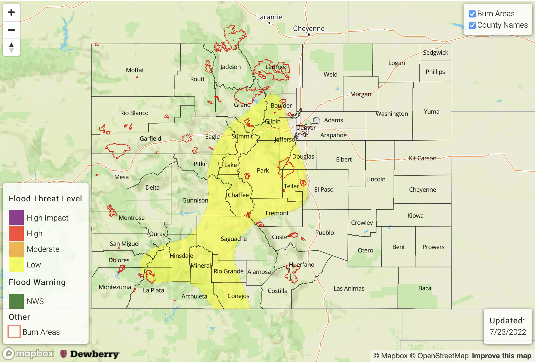
Today’s Flood Threat Map
For more information on today’s flood threat, see the map below. If there is a threat, hover over the threat areas for more details, and click on burn areas to learn more about them. For Zone-Specific forecasts, scroll below the threat map.
Zone-Specific Forecasts:
Central Mountains, Front Range, Southeast Mountains, Raton Ridge & San Juan Mountains:
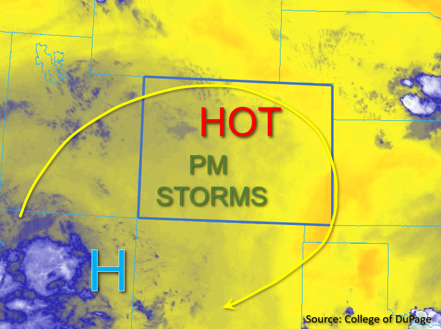
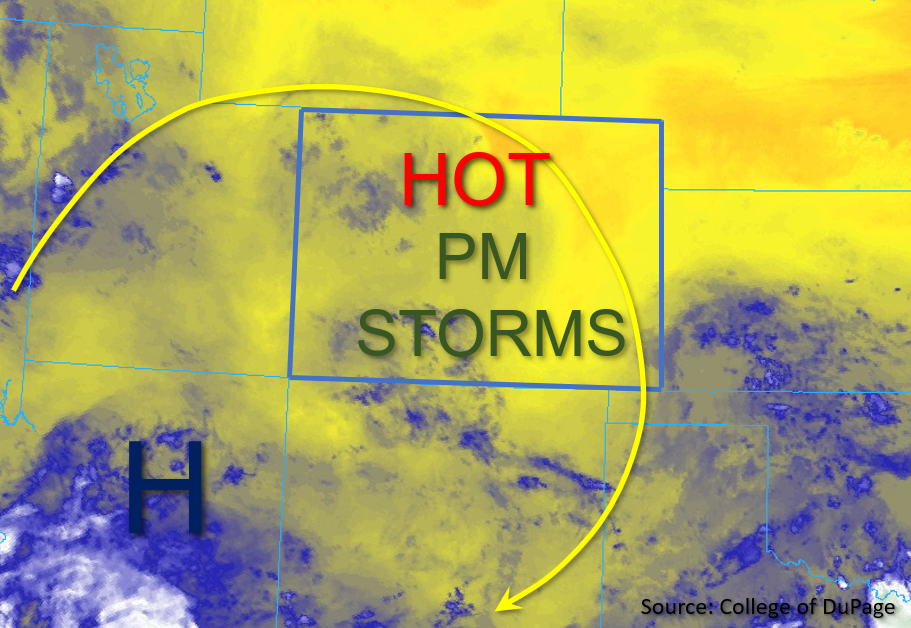
Scattered to numerous storms are forecast to develop over the mountains by early afternoon with a couple stronger thunderstorms possible. These could produce small hail as well as strong outflow winds. Max 1-hour rain rates up to 1.75 inches (south) and 30-min rain rates up to 1.5 inches (north) are possible under the stronger storms that develop. This could cause mud flows and debris slides over the steeper terrains as well as road flooding and excessive runoff. A MODERATE/LOW flood threat has been issued. Storms should begin to end this evening (north), but rainfall will likely linger over the San Juan Mountains into tomorrow morning.
Primetime: 11:30AM to ongoing
Urban Corridor, Palmer Ridge, Southeast Plains & Northeast Plains:
Heavy rainfall is anticipated this afternoon and tonight with the scattered to numerous storms that develop. Max 1-hour rain rates up to 1.75 inches and storm totals up to 2.25 inches will be possible over the immediate adjacent plains. Over the far eastern plains, max 1-hour rain rates up to 2 inches are forecast under the stronger storm cores. Where storms linger for a few hours (border counties), isolated 3-hour totals around 4 inches will be possible. Flood threats today include the potential for heavy field ponding, road/low-lying area flooding and rises on local streams/creeks. In addition to heavy rainfall, damaging wind gusts will be possible over the far eastern plains where an MCS is likely to develop. Light rainfall may linger over the plains into tomorrow morning. A HIGH/MODERATE flood threat has been issued.
Primetime: 3PM to 3AM
Northwest Slope, Grand Valley, Southwest Slope, San Luis Valley & Northern Mountains:
Rainfall has already started over northwest Colorado. Max 1-hour rain rates up to 0.25 inches and storm totals up to 0.75 inches will be possible for the area. Over the central and southern high terrains isolated 30-minute rain rates up to 0.5 inches are forecast. A couple storms may make it into the interior of the San Luis Valley with the WSW steering flows, and isolated totals up to 0.4 inches will be possible. Light showers may linger overnight for the high terrains (central/south). Flooding is NOT expected today.
Primetime: Ongoing to Midnight