Issue Date: Monday, July 9, 2018
Issue Time: 09:10AM MDT
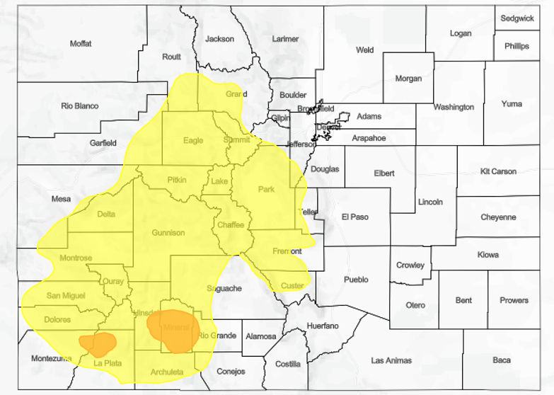
— A LOW flood threat has been issued for the Burro and 416 burn areas
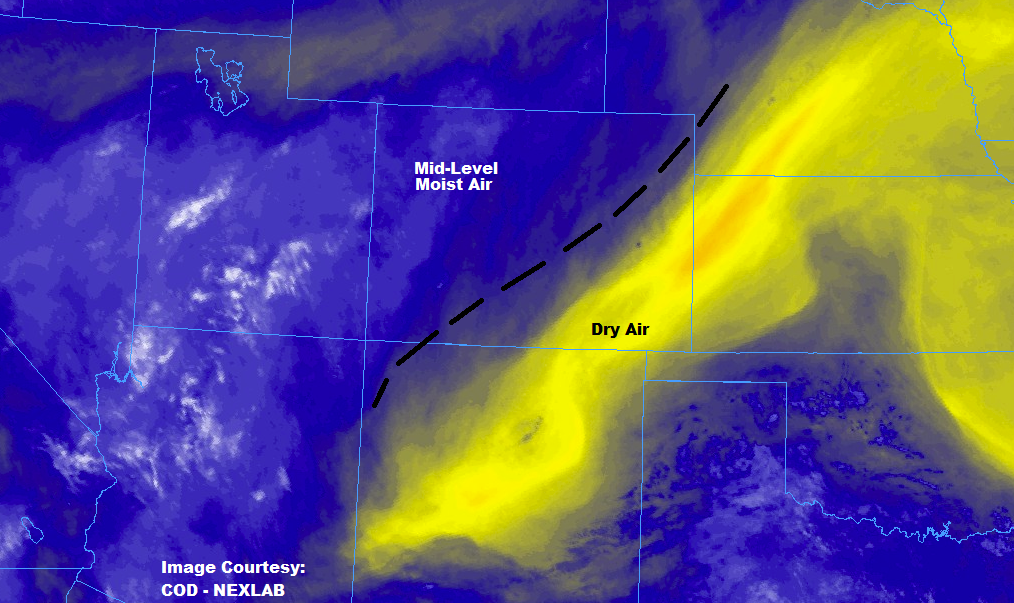
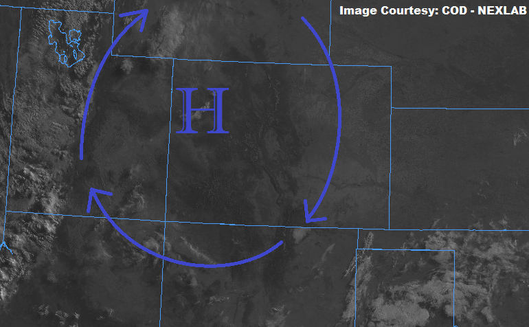
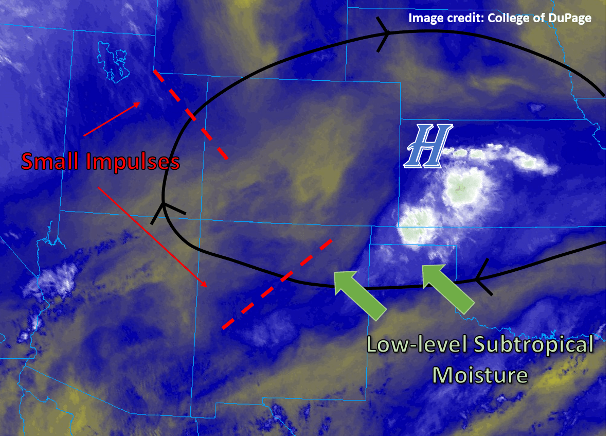
The center of 500mb ridge is currently over the Nebraska, Colorado and Wyoming intersect. The subtropical moisture on its west side has shifted westward out of Colorado as seen in the water vapor imagery below. Drier air has worked its way in on the east side of the high and the Precipitable Water measurement at Denver this morning was 0.74 inches. Flow aloft will be from the east over eastern Colorado, so this should keep the dry air in place and downward motion should nix thunderstorm activity over the lower elevations. Any clouds or isolated storms that form this afternoon will be over the mountains due to the eastward motion aloft.
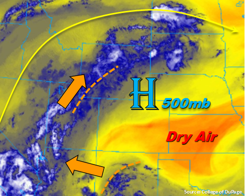
As the center of the ridge continues its eastward progression today, small disturbances over Utah and Wyoming may work their way into the northwest corner of the state, which would help trigger some showers and thunderstorm activity. Further south over NM/AZ, the disturbance marked in the image below may also graze the southwest corner of the state as it propagates to the WNW around the high. If it makes it into the state, this would affect the southern San Juan Mountains by helping to enhance upslope flow thunderstorms. Precipitation Water in Grand Junction is still quite high, but dry air in the lower levels will reduce the intensity of the rain rates this afternoon when compared to the last couple of days. There is still a chance for a thunderstorm or two to move over the 416 and Burro burn areas with intensities greater than 0.25 inches/hour, and these rates would be enough to trigger mud flows and debris slides. Thus, a Low flood threat has been issued for the two burn areas. Elsewhere over the western mountains, rain rates will remain under flood threat criteria.
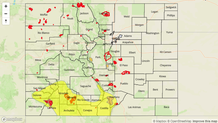
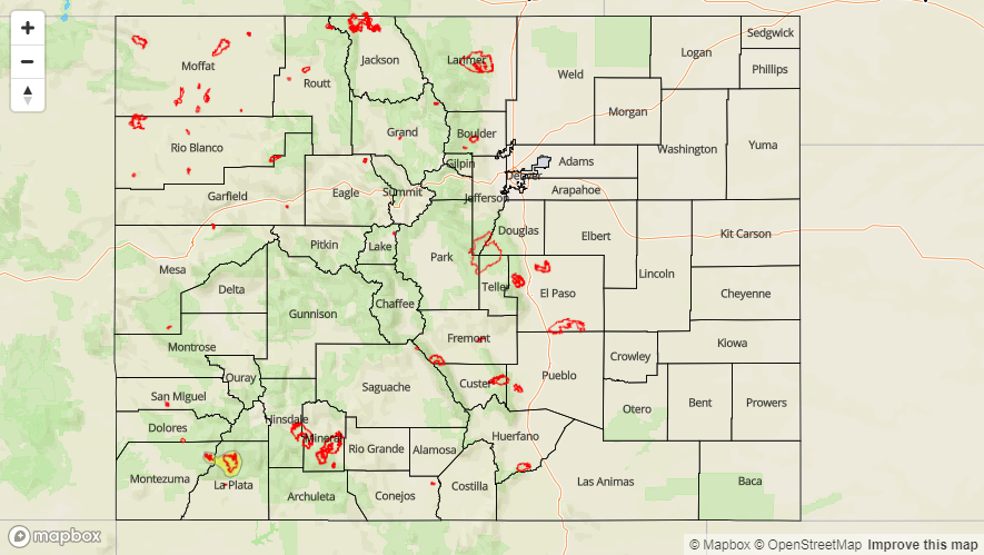
Today’s Flood Threat Map
For more information on today’s flood threat, see the map below. For Zone-Specific forecasts, scroll below the map.

Zone-Specific Forecasts:
Front Range, Urban Corridor, Palmer Ridge, Southeast Mountains, Raton Ridge, Southeast Plains, Northeast Plains:
Dry air will continue to be pulled into these areas from the east, which should limit thunderstorm coverage this afternoon to the mountains. Not expecting anything more than a few isolated thunderstorms and showers over the higher terrains. Max 1-hour rain rates up to 0.1 inches/hour are possible, but virga and brief windy conditions are more likely. High temperatures should be similar to yesterday with mid to upper 90Fs over the lower elevations. Flooding is not expected today.
Primetime: 3PM to 8PM
Northern Mountains, Southwest Slope, Grand Valley, Central Mountains, Northwest Slope, San Juan Mountains, San Luis Valley:
A couple disturbances may move into the northwest and southwest corners of the state as they propagate around the high pressure this afternoon. If this occurs, this would enhance the chance for showers and thunderstorms over the northwest corner of the state. Rain rates would be under 0.1 inches/hour for these storms. The best chance for thunderstorms this afternoon is again over the San Juan Mountains. Rain rates of these storms are forecast to be up to 0.5 inches/hour (less intense than the previous few days), but if they were to move over a burn area, flash flooding could occur. The main threats would be mud flows, debris slides and local stream flooding. A Low flood threat has been issued for the 416 and Burro burn scars. Elsewhere, flooding is not expected.
Primetime: 2PM to 10PM