Issue Date: 7/21/2018
Issue Time: 7:30 AM
A LOW FLOOD THREAT IS FORECAST FOR PORTIONS OF THE FRONT RANGE, CENTRAL MOUNTAINS, SOUTHEAST MOUNTAINS, URBAN CORRIDOR, PALMER RIDGE, RATON RIDGE, NORTHEAST PLAINS, AND SOUTHEAST PLAINS.
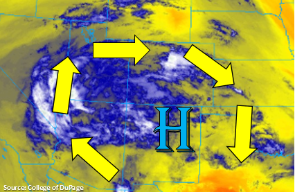
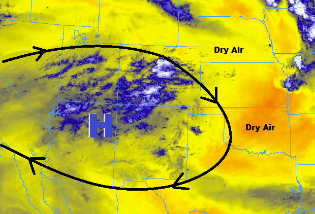
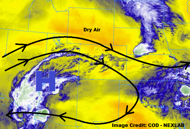
The upper-level high will shift back towards the west-northwest today, in response to a deepening upper-level low over the eastern United States. This will reduce the impact of monsoonal moisture over Colorado, keeping the deepest moisture over Utah, and reducing the threat of heavy rainfall over the mountains. Another day of scattered showers/thunderstorms is on tap for the High Country west of the Front Range/Southeast Mountains, thanks to orographic forcing and residual moisture underneath the ridge, but expect them to produce more gusty winds than rain as low-level moisture is lacking. For these reasons, no flood threats are warranted for the High Country west of the Continental Divide. However, due to the sensitive nature of recent/ongoing burn scars, it would be a good idea to monitor them, just in case.
For areas east of the Continental Divide, an influx of low-level moisture from the Great Plains will provide fuel for scattered showers/thunderstorms. Initially, storms will mainly produce gusty winds and periods of light rainfall as precipitation has to overcome meager relative humidity in the low-levels caused by the hot temperatures. However, as storms mature, and produce enough precipitation to sufficiently saturate the low-levels, periods of moderate-to-heavy rainfall will be a concern. Decent enough storm motions will mitigate the flood threat somewhat, so recent/ongoing burn scars over the Front Range/Southeast Mountains, low-lying intersections, poorly drained locations, and field ponding will be the main concerns for the low flood threat area. For more details on rain rates and timing, please see the zone-specific forecast discussions below.
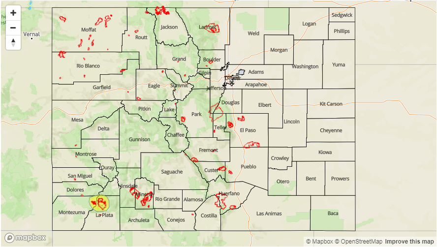
Today’s Flood Threat Map
For more information on today’s flood threat, see the map below (hover over threat areas for more details). For Zone-Specific forecasts, jump below the map.


Zone-Specific Forecasts
Front Range, Southeast Mountains, Urban Corridor, Palmer Ridge, Northeast Plains, Southeast Plains, and Raton Ridge:
Scattered showers/thunderstorms are expected today, in response to the influx of low-level moisture from the Great Plains. Eventually, storms will be capable of producing periods of moderate-to-heavy rainfall, for reasons outlined in the main discussion above. Storm motions will mitigate the flood threat somewhat, so the main concerns will be for recent/ongoing burn scars in the mountains, poorly drained intersections and low-lying urban areas, as well as low-lying fields/roads where ponding can occur. Maximum rain rates are as follows:
Front Range and Southeast Mountains: 0.8-1.2 inches/hour
Urban Corridor, Palmer Ridge, and Raton Ridge: 1.0-1.4 inches/hour3
Northeast Plains and Southeast Plains: 1.25-1.75 inches/hour
Timing: Noon – 10 PM for the Front Range/Southeast Mountains, 1 PM – 11 PM for the Urban Corridor, Palmer Ridge, and Raton Ridge, and 2 PM – 2 AM for the Northeast Plains and Southeast Plains
Northern Mountains, Northwest Slope, Central Mountains, Grand Valley, San Juan Mountains, Southwest Slope, and San Luis Valley:
Garden-variety scattered showers/thunderstorms are expected today, with relatively dry air in the low-levels reducing precipitation efficiency at the surface. The main threat from any activity will be gusty winds, light rainfall, and lightning. Storm motions and rain rates preclude the issuance of any flood threat, but as mentioned above, it will be a good idea to monitor sensitive burn scars, just in case. Generally speaking, rain rates will be below 0.1 inches/hour, with maximum rain rates around 0.2-0.4 inches/hour. The best chance at moderate rainfall (0.3-0.6 inches/hour) will be eastern sections of the Central Mountains region.
Timing: 11 AM – 9 PM. During the overnight hours, monsoonal moisture will begin to work back into far western Colorado, so a couple showers will linger near the CO/UT border into tomorrow morning.