Issue Date: 7/19/2018
Issue Time: 6:30 AM
NO FLOOD THREAT IS FORECAST TODAY.
A near repeat of yesterday is on tap for today, with plenty of sunshine and hot temperatures being the main weather story. Just as yesterday, high pressure aloft sits just to the west/southwest of Colorado, keeping the flow of drier air coming, while also acting to suppress most attempts at precipitation. Even so, a few isolated showers/thunderstorms are expected to overcome the relatively unfavorable conditions over the higher terrain along/south of I-70. Periods of light-to-moderate rainfall will be about all the atmosphere can muster, as drier air in the low-levels limit intensity of storms and rain rates at the surface.
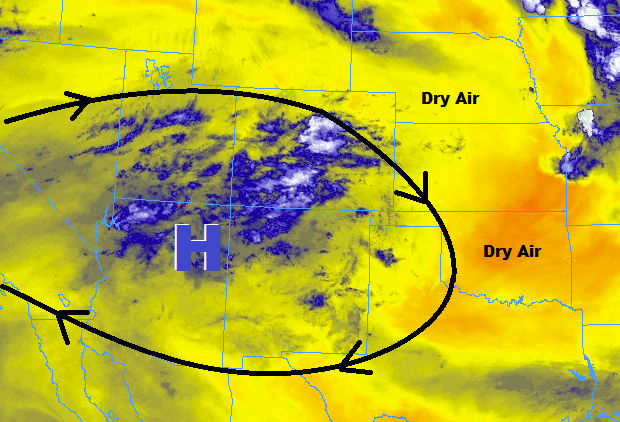
East of the mountains, hot and dry conditions will dominate, with high temperatures pushing into the upper 90s across most areas, with more than a couple locations reaching into the low-100s. An isolated high-based storm or two will be possible over the Raton Ridge and far Southeast Plains near the CO/KS border, where dewpoints will hang on in the low-to-mid 40s, providing just enough fuel for development. Heavy rainfall resulting in flooding is not a concern, as dry air below cloud bases will limit rain rates at the surface.
Today’s Flood Threat Map
For more information on today’s flood threat, see the map below (hover over threat areas for more details). For Zone-Specific forecasts, jump below the map.


Zone-Specific Forecasts
Urban Corridor, Palmer Ridge, Northeast Plains, Southeast Plains, and Raton Ridge:
Hot and dry is the weather headline today, with abundant sunshine blanketing the area. A few cumulus clouds will bubble during the afternoon hours, with a few streaks of virga dotting the sky. A couple isolated, high-based storms during the afternoon/evening over the Raton Ridge and the far Southeast Plains near the CO/KS border cannot be ruled out, with the main impacts being gusty winds, lightning, and brief periods of moderate rainfall. Maximum rain rates will be 0.25-0.5 inches/hour.
Timing: 1 PM – 10 PM
Northern Mountains, Northwest Slope, Front Range, Central Mountains, Grand Valley, San Juan Mountains, Southwest Slope, Southeast Mountains, and San Luis Valley:
Mostly sunny skies and hot temperatures are on tap today, with a few isolated storms over the higher terrain along/south of I-70 to break up the monotony. The majority of any shower/thunderstorm activity will occur over the higher terrain of the San Juan Mountains and Southwest Slope regions where moisture is best (relatively speaking). Drier air below cloud bases will limit precipitation efficiency, so heavy rainfall is not expected. Like yesterday, it would be a good idea to keep an eye on sensitive burn scars that have received rainfall over the past few days, just in case. Generally, rain rates will be less than 0.15 inches/hour, with maximum rain rates of 0.2-0.4 inches/hour.
Timing: 1 PM – 9 PM, with a couple lingering showers until Midnight or so over southern mountains.