Issue Date: 7/29/2018
Issue Time: 7:45 AM
A MODERATE FLOOD THREAT IS FORECAST FOR PORTIONS OF THE NORTHEAST PLAINS, SOUTHEAST PLAINS, AND PALMER RIDGE.
A LOW FLOOD THREAT IS FORECAST FOR PORTIONS OF THE SOUTHWEST SLOPE, SAN JUAN MOUNTAINS, CENTRAL MOUNTAINS, NORTHERN MOUNTAINS, FRONT RANGE, SOUTHEAST MOUNTAINS, URBAN CORRIDOR, PALMER RIDGE, RATON RIDGE, NORTHEAST PLAINS, AND SOUTHEAST PLAINS.
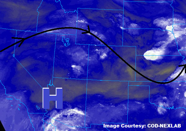
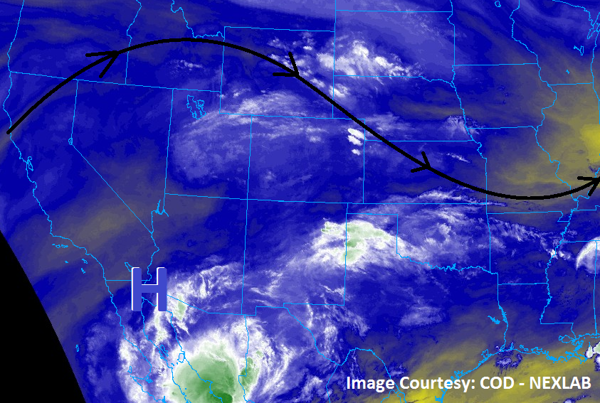
Colorado continues to sit underneath west/northwesterly flow aloft thanks to the upper-level high to our southwest that has refused budge. This means, yes, another day of scattered showers/thunderstorms, with most of the concerns for heavy rain/flash flooding east of the Continental Divide thanks to low-level easterly flow reinforcing good moisture for those areas. Relatively quick storm motions will be our friend and keep today from being a higher threat day than low-to-moderate; thunderstorms are expected to dump heavy rainfall as they quickly race to the southeast and east. Heavy rainfall has impacted much of far eastern Colorado the last few days, and that antecedent soil moisture combined with today/tonight’s heavy rainfall potential has prompted the moderate flood threat for those areas.
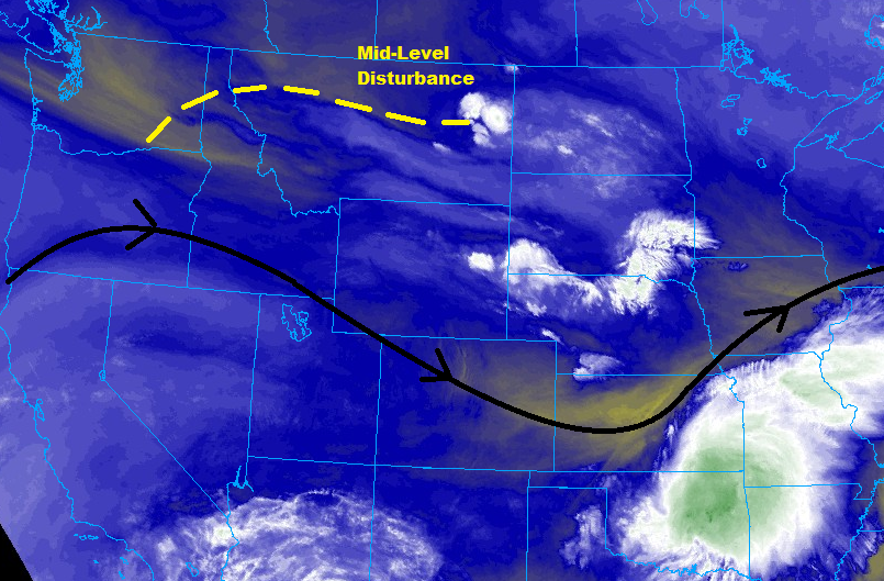
West of the Continental Divide, drier low-level air is expected to lead to a downtick in thunderstorm coverage and intensity. Orographic lift (and the close proximity of the mid-level disturbance) will generate isolated showers/thunderstorms, mainly south of I-70. In fact, north of I-70, dry low-levels combined with gusty winds have led to the issuance of Red Flag Warnings for some of those areas – please check with your local NWS office for more details. The low flood threat over the Southwest Slope and San Juan Mountains is largely due to the sensitive burn scars and the potential for brief moderate-to-heavy rainfall. In general, the main impacts from any activity will be gusty winds, light rain, and lightning. For more information on rain rates and timing, please see the zone-specific forecast discussions below.
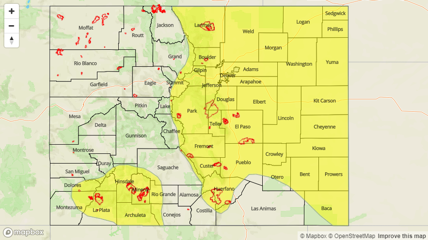
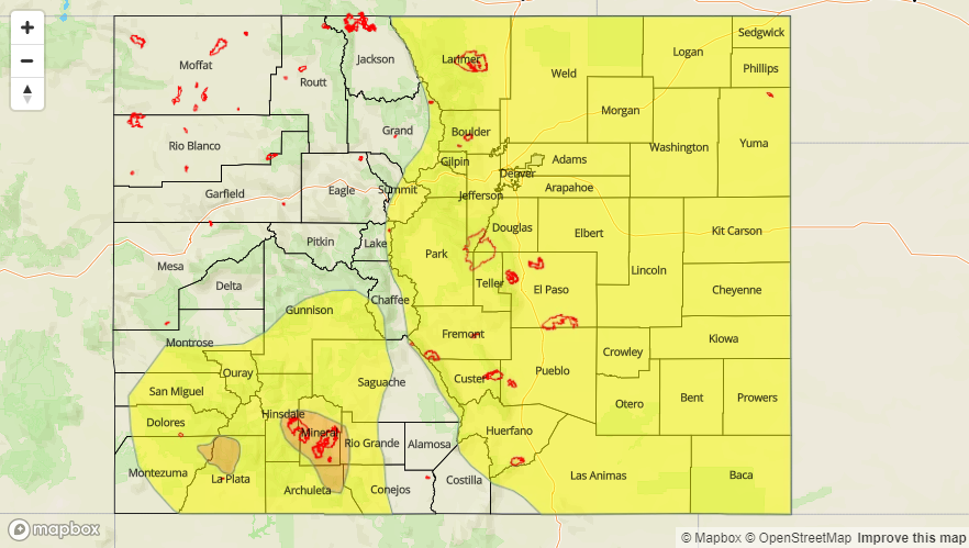
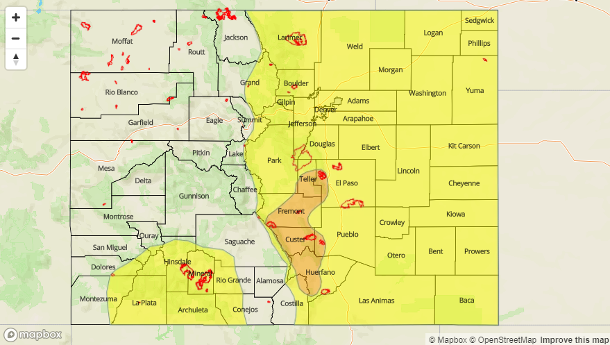
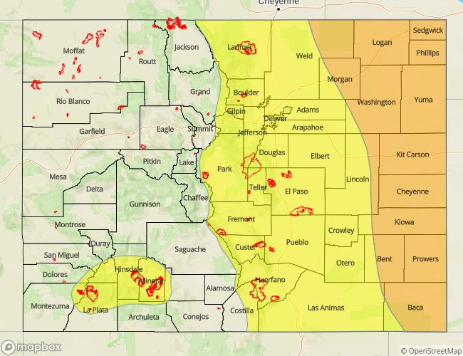
Today’s Flood Threat Map
For more information on today’s flood threat, see the map below (hover over threat areas for more details). For Zone-Specific forecasts, jump below the map.

Zone-Specific Forecasts
Front Range, Southeast Mountains, Urban Corridor, Palmer Ridge, Northeast Plains, Southeast Plains, and Raton Ridge:
Scattered showers and thunderstorms are expected again today/tonight. A few strong-to-severe thunderstorms will impact the area, mainly east of I-25, with the main threats being heavy rainfall, damaging straight-line winds, and large hail (up to 2.0 inches in diameter). An isolated tornado or two cannot be ruled out. While daytime heating/instability will drive the afternoon/evening thunderstorms, scattered storms are expected to continue into the early morning hours as the mid-level disturbance generates lift over the region. Plenty of moisture is available, and thunderstorms are expected to dump heavy amounts of rainfall in short periods of time. However, storm motions will be quick, helping to mitigate the flood threat. Maximum rainfall rates are as follows:
Front Range and Southeast Mountains: 0.6-1.0 inches/hour
Urban Corridor, Palmer Ridge, and Raton Ridge: 1.0-1.75 inches/hour
Northeast Plains and Southeast Plains: 1.75-2.50 inches/30 minutes
Timing: Noon – Midnight for the Front Range and Southeast Mountains, 1 PM – 2 AM for the Urban Corridor and Palmer Ridge,1 PM – 3 AM for the Northeast Plains, 2 PM – 5 AM for the Southeast Plains and Raton Ridge
Northern Mountains, Northwest Slope, Central Mountains, Grand Valley, San Juan Mountains, Southwest Slope, and San Luis Valley:
Isolated showers/thunderstorms, mainly south of I-70. Low-level moisture has been reduced, so the main threats will be gusty winds and brief periods of light-to-moderate rainfall from the strongest storms. Sensitive burn scars over the San Juan Mountains and Southwest Slope have been issued a low-end, low flood threat. To the north of I-70, breezy and dry conditions have led to the issuance of a Red Flag Warning for the Northwest Slope – please check with your local NWS office for more details. East of the Continental Divide in the Northern Mountains and Central Mountains regions, brief heavy rainfall remains a threat, albeit a low one, so a low flood threat has been issued. Maximum rainfall rates are as follows.
San Juan Mountains and Southwest Slope: 0.3-0.7 inches/hour
Northern Mountains and Central Mountains: 0.4-0.8 inches/hour
Northwest Slope: N/A
Grand Valley and San Luis Valley: 0.2-0.4 inches/hour
Timing: Noon – 9 PM, with a few showers/thunderstorms continuing along/east of the Continental Divide until midnight