Issue Date: Thursday, July 28th, 2022
Issue Time: 11AM MDT
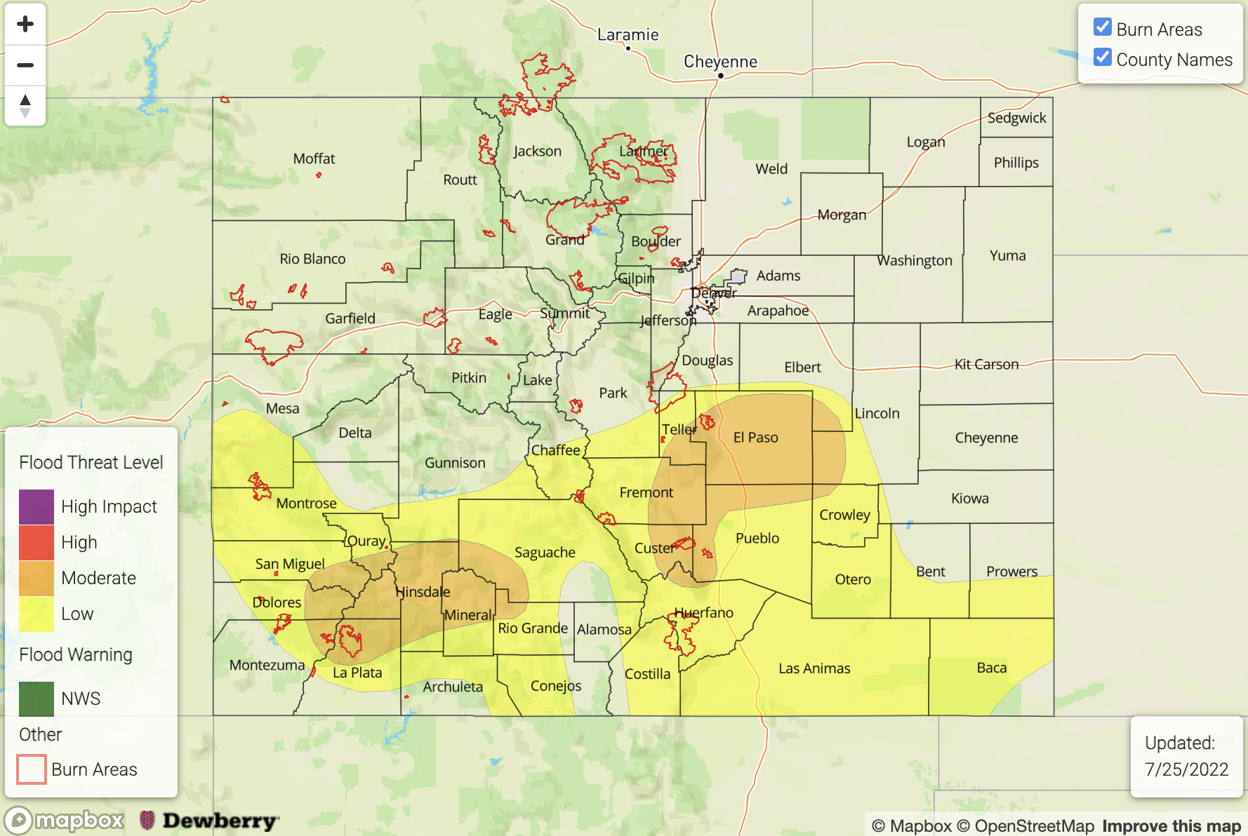
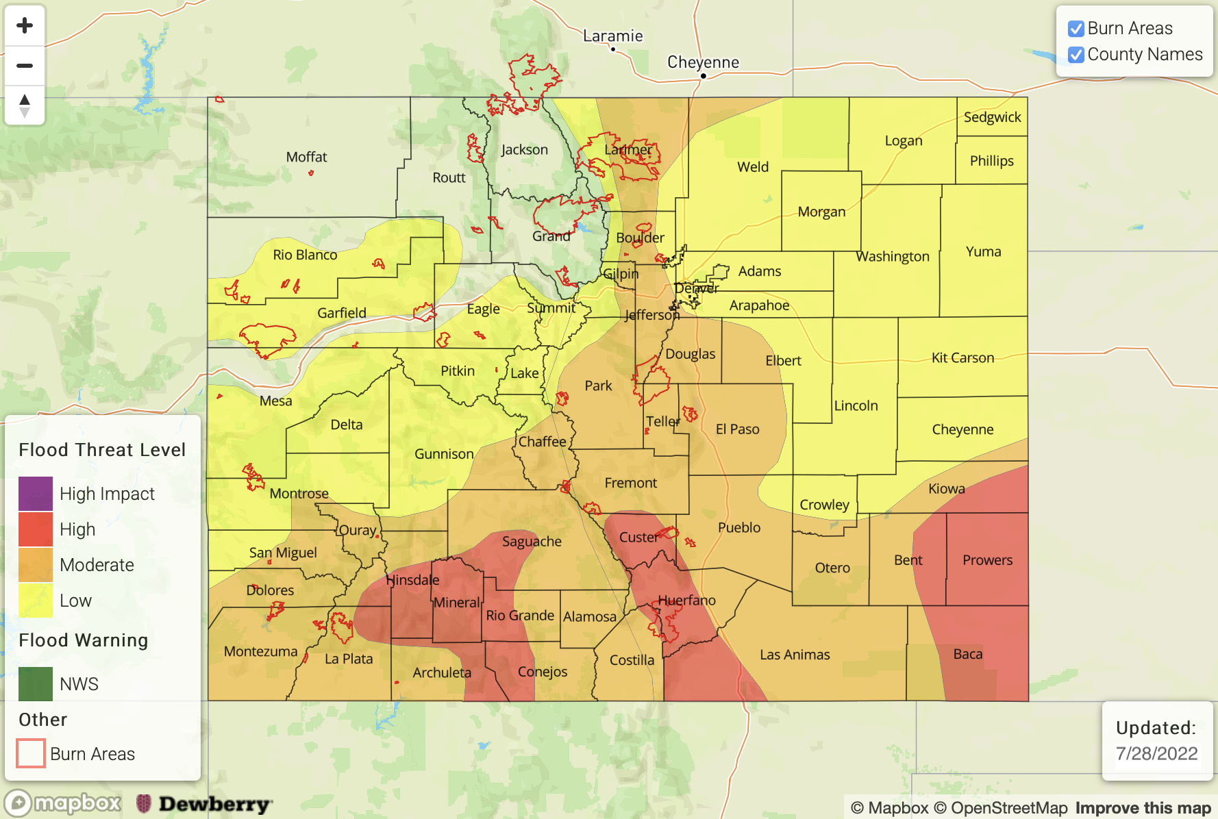
— A HIGH flood threat has been posted for parts of the Southeast Plains, Southeast Mountains, Raton Ridge and San Juan Mountains
— A MODERATE flood threat has been posted for parts of the Front Range, Urban Corridor, Palmer Ridge, Central Mountains and Southwest Slope
— A LOW flood threat has been posted for parts of the Northeast Plains and Grand Valley
— The flood threat extends into the overnight hours
— A PM update is possible today
— Fire-Burn Forecast Summary: 4 burn areas under HIGH flood threat; 5 burn areas under MODERATE threat; 2 burn areas under LOW threat; click HERE for more info
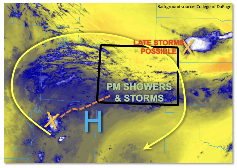
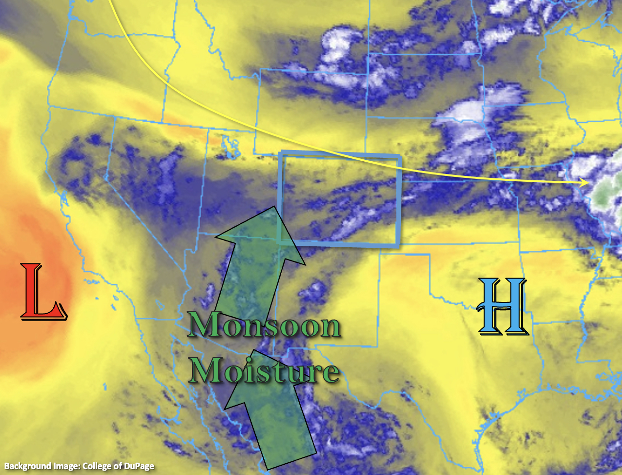
As expected in the previous Outlooks, a very busy pattern for heavy rainfall has developed across Colorado. Although the subtle details change daily, the common ingredient has been ample moisture of monsoon origin. This morning, PW at Grand Junction measured 1.07 inches, and was well distributed through the atmospheric column. Across the Continental Divide, PW was measured at 1.15 inches at the Platteville research station northeast of Denver. Higher PW, up to 1.4 inches exists in far eastern Colorado. As shown in the water vapor image, below, high PW is also being imported into southern Colorado with values as high as 1.2 inches expected by later this afternoon.
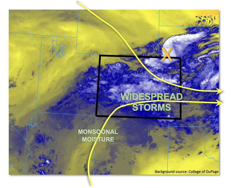
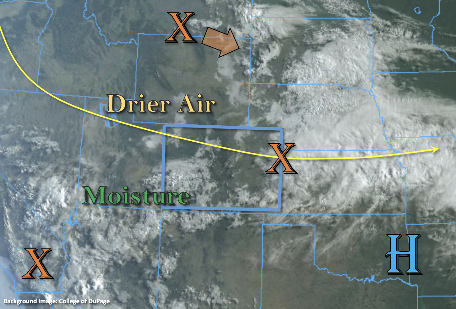
The primary concern regarding today’s heavy rainfall potential is the widespread thick cloud deck across a large portion of the state. This will certainly limit the instability. However, with this much moisture in place, instability becomes less important if the entire atmospheric column becomes saturated and there is low-level convergence taking place (as is the case today). Dynamics-wise, an interesting confluent flow pattern is observed across Colorado with deep SSW flow over southern areas and NW/NNW flow across northern areas. In brief, the higher flood threat today will occur along and to the south of where these two streamlines meet. This will occur over southern Colorado, and several rounds of showers and storms are expected today. With relatively slow steering flow (slower flows towards the south), very heavy point rainfall is expected. In addition, prolonged rainfall will cause concern in the 3-6 hour duration, where over 3.0 inches is expected over parts of the San Juan Mountains and over 5 inches is possible along the KS border. In all, a HIGH flood threat is warranted beginning this afternoon and lasting into the overnight hours across southern areas. Further north, coverage over heavy rainfall will be more isolated, so a MODERATE/LOW threat is in place.
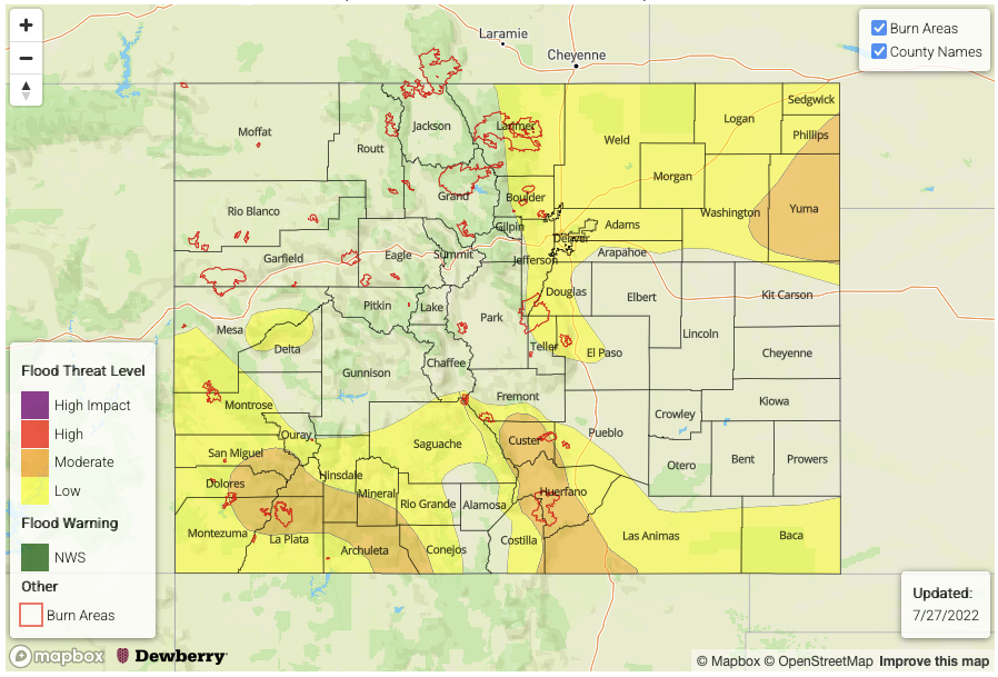
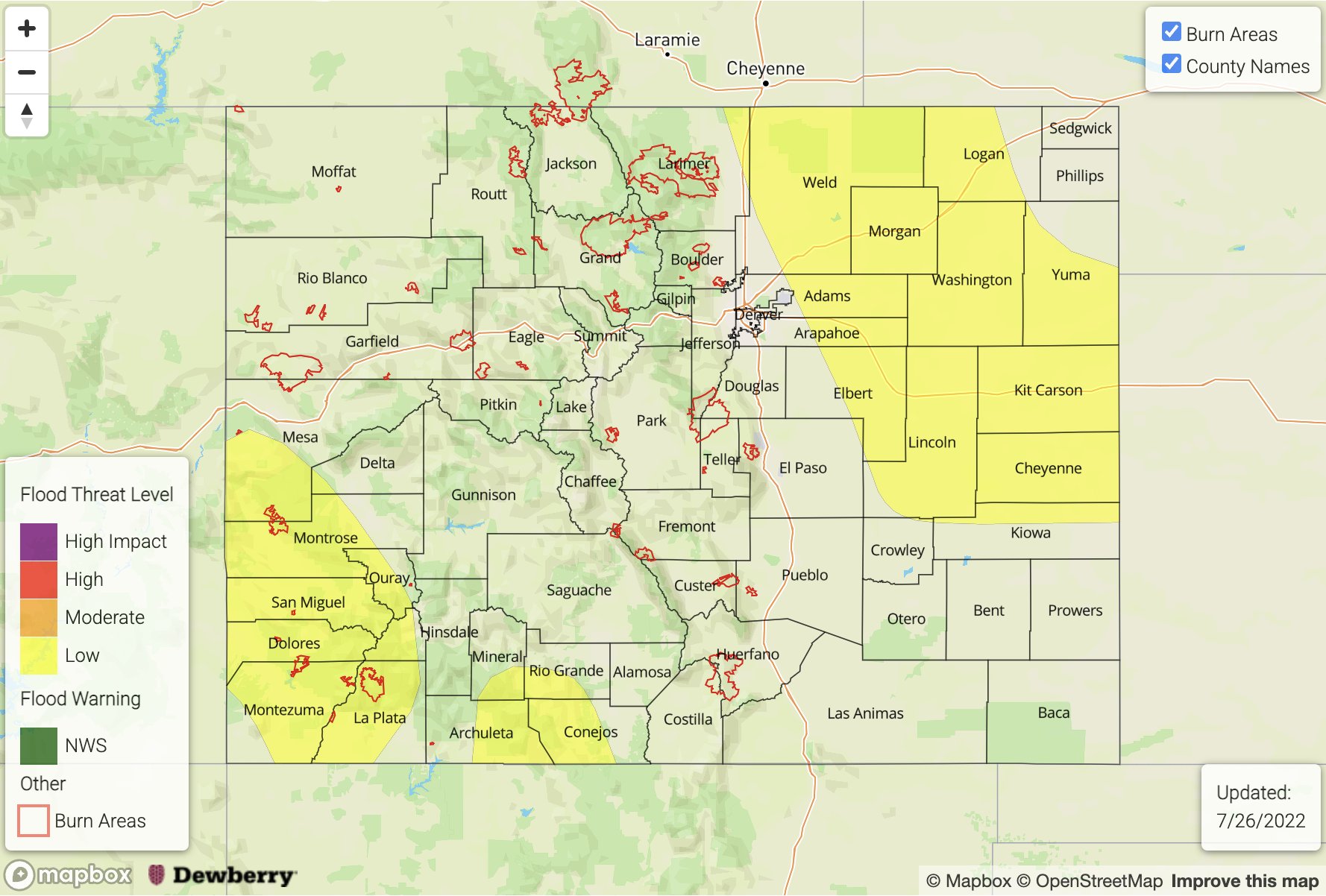
Today’s Flood Threat Map
For more information on today’s flood threat, see the map below. If there is a threat, hover over the threat areas for more details, and click on burn areas to learn more about them. For Zone-Specific forecasts, scroll below the threat map.
Zone-Specific Forecasts:
Southeast Plains, San Juan Mountains, Southwest Slope, Raton Ridge, Palmer Ridge, Central Mountains, Southwest Slope & Southeast Mountains:
Mostly cloudy early then numerous to widespread storms developing early this afternoon and lasting well into the overnight hours across far southern areas. Max 1-hour rainfall up to 3.4 inches over eastern areas and 2.5 inches over western areas. Max 6-hour rainfall up to 6 inches (far eastern areas) and up to 3.8 inches over western areas. A HIGH flood threat has been posted for parts of the region for the risk of flash flooding, debris slides and mud flows. There will also be a high threat of small stream and creek flooding, especially over steeper terrain.
Note that the flood threat will extend well into the overnight hours especially over the San Juan Mountains and Southeast Plains.
Primetime: Noon through 6AM
Front Range, Urban Corridor & Northeast Plains:
Mostly cloudy with scattered to numerous showers and storms developing this afternoon. Max 1-hour rainfall up to 2.8 inches. A MODERATE flood threat has been posted for the higher terrain, with a LOW flood threat over the eastern plains. Isolated flash flooding, debris slides and mud flows will be possible over steeper terrain.
Primetime: Noon through 10PM
Northwest Slope, Northern Mountains & Grand Valley:
Partly cloudy early then widely scattered to scattered showers and storms developing by early afternoon. Max 30-min rainfall up to 1.0 inch possible (especially over the southern higher terrain). A LOW flood threat has been posted for parts of the region for isolated flash flooding, debris slides and mud flows.
Primetime: Noon through 8PM