Issue Date: Friday, September 7th, 2018
Issue Time: 08:35AM MDT
— Flooding is NOT expected today
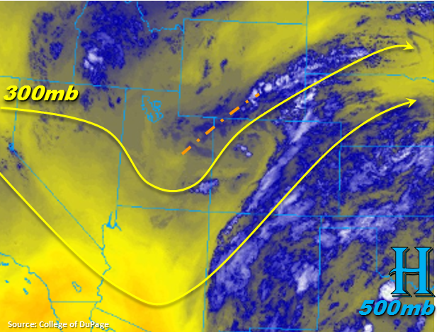
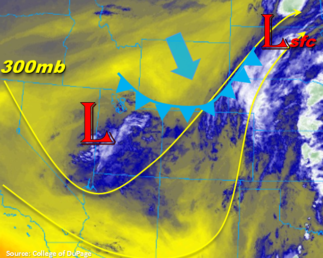
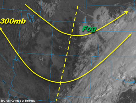
Finally expecting some movement with the upper-level trough. Throughout today and early tomorrow the trough will migrate eastwards across Colorado. Behind the trough, drier, stable air will start to work its way into the state as seen with the clearer skies over western CO and Utah. This morning there is some dense fog over the eastern plains and northern Urban Corridor with added cloud cover over the Southeast Plains. Expecting the fog to last until about 9AM this morning. Cloud cover will also begin to burn off with the sunrise, but between the two, cooler high temperatures and minimal instability is forecast over eastern Colorado today. A few breaks in the clouds near the Palmer Ridge is likely as drier air moves in from the east. This may allow for some instability to build for a few showers and weaker storms this afternoon.
A bit more instability will be able to build over San Juan Mountains, Front Range and Southeast Mountains and mix with some minimal low-level moisture for some isolated afternoon showers. The 12Z sounding at Denver shows quite the dry layer at 700mb, so the threat for heavy rainfall will decrease when compared to the last couple of days. This is especially true as the drier air will start to move into the area today. This also means storms will be much more isolated in nature. Also forecasting stronger steering winds (20mph from the north), so this will keep the storms moving and prevent too much rainfall over one area. Over the Southeast Mountains, moisture will be slower to mix out behind the trough, so the higher rainfall amounts are expected in this area along the CO/NM border. Over western Colorado, PW values have already dropped to 0.66 inches at Grand Junction. This shows the trough has passed through and a drier, more stable air mass is beginning to establish itself. A little better moisture remains over the San Juan Mountains, so some isolated storms will likely form this afternoon. With the drier air mass and decent steering winds, flooding is not likely today even over recent burn areas.
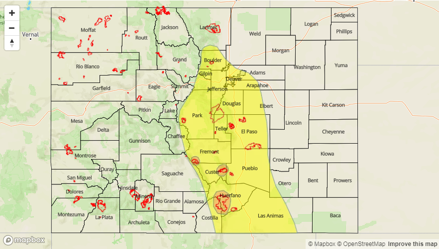
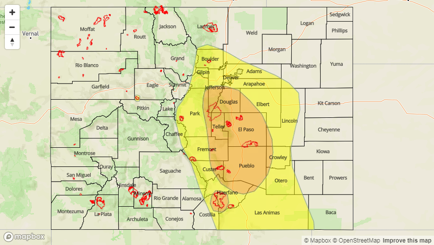
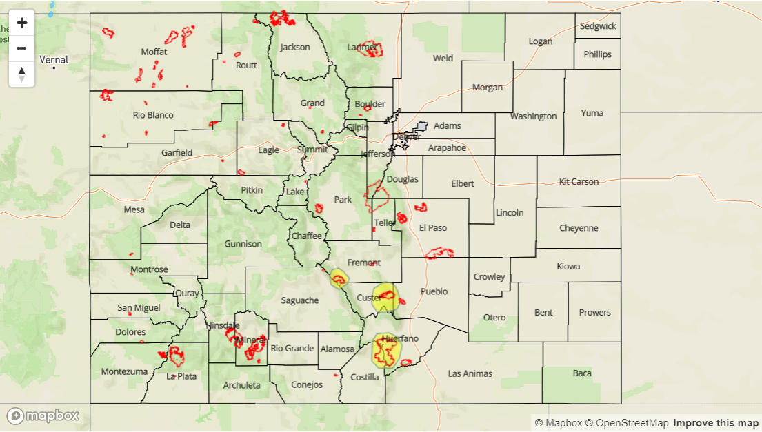
Today’s Flood Threat Map
For more information on today’s flood threat, see the map below. For Zone-Specific forecasts, scroll below the map.
Zone-Specific Forecasts:
Southeast Plains, Raton Ridge, Southeast Mountains, Front Range, Palmer Ridge, Urban Corridor, Northeast Plains:
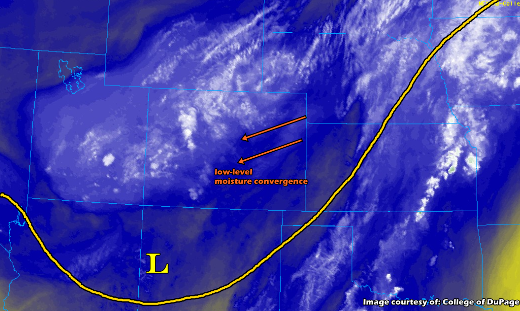
Moisture will start to decrease this afternoon as the trough passes through and a more stable, dry air mass moves into these regions. So not expecting any heavy rainfall today. There is a possibility for some breaks in cloud cover that would allow some instability to build over the Palmer Ridge this afternoon. Low-level convergence may initiate some showers and weak storms over this area. Max 1-hr rain rates up to 0.6 inches are possible. More isolated storms are possible over the Front Range and Southeast Mountains/Raton Ridge. With north to south movement, not expecting storms to track into the adjacent plains. Max 1-hr rain rates up to 0.2 inches (north) and 0.6 inches (south) are possible. Flooding is not expected today.
Primetime: 2PM – 9PM
Grand Valley, Central Mountains, San Juan Mountains, San Luis Valley, Southwest Slope, Northern Mountains, Northwest Slope:
The trough has passed through, which will allow a more stable and dry air mass to fill in behind it. Moisture will be slower to mix out over the San Juan Mountains, so expecting some rainfall, and the highest totals, to be over the southern-most, east-west oriented ridges today. Cloud cover will still increase over the Central and Northern Mountains this afternoon, though measureable rainfall is not likely. Gusty outflow winds are also possible. Swift steering winds and drier air should keep rainfall rates below the flood threat criteria for Friday.
Primetime: 1PM – 8PM