Issue Date: Tuesday, September 4th, 2018
Issue Time: 08:40AM MDT
—A LOW flood threat has been issued for the Spring Creek, Junkins and Hayden Pass burn areas
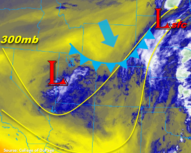
Colorado will again be under the influence of the upper trough today. Similar to yesterday, expecting some shortwave action associated with this feature to help spur better coverage of showers and thunderstorms this afternoon over the higher terrains in tandem with upslope flow. Currently, there is a cold front over WY that will continue to drop south today. Behind the front northerly flow is expected, which will set up a convergence boundary over plains this afternoon. This means that over the far eastern plains, there may be a few thunderstorms that initiate along this line. Though, the main action will be a bit to our east. Deeper moisture is also located east of Colorado today, so the heaviest rainfall will likely be over Kansas. The passage of the front may help return some more low-level moisture over the Front Range and Palmer Ridge as the post-frontal upslope pattern sets up. Therefore, there will likely be an uptick in coverage of storms this afternoon over this area.
Precipitable Water (PW) this morning was measured at 0.67 inches at Denver and 0.69 inches at Grand Junction. While these values may increase slightly today, still forecasting the higher moisture to be over far eastern plains this afternoon. Both soundings show quite a bit of dry air, so thunderstorms may produce some gusty winds this afternoon. As the storms move into the adjacent plains, they will likely dissipate before making it too far east of I-25. Further south, they have a better chance of making their way eastward. Storms over western Colorado will be a rinse and repeat pattern to yesterday with the most abundant action over San Juans and south Central Mountains. Further north, storms will be more isolated in nature and likely produce some gustier outflow winds. Most storms east and west of the Divide will dissipate a couple of hours after the sunset. However, guidance is showing a few storms reforming over the high terrains tonight.
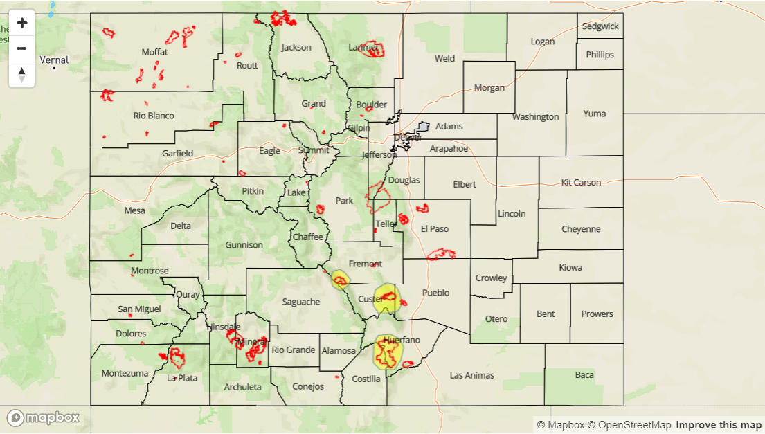
Not expecting widespread flooding over the higher terrains this afternoon. Dry soils (especially north) with moderate max 1-hour rain rates will keep the flood threat minimal. However, with max 1-hour rain rates up to 0.9 inches possible over the Southeast Mountains, recent burn scars will be at risk for flash flooding should a storm track over a scar. A Low flood threat has been issued for the Junkins, Hayden Pass and Spring Creek burn scars.
Today’s Flood Threat Map
For more information on today’s flood threat, see the map below. For Zone-Specific forecasts, scroll below the map.

Zone-Specific Forecasts:
Southeast Plains, Raton Ridge, Southeast Mountains, Front Range, Palmer Ridge, Urban Corridor, Northeast Plains:
Showers and thunderstorms are forecast to return to the Front Range this afternoon with the post-frontal upslope flow. Storms are also expected over the Southeast Mountains. Increased low-level moisture behind the front and slow storm motion mean some pockets of heavier rainfall may be possible. Max 1-hour rain rates up to 0.9 inches are possible with 2-hour totals just over 1 inch. A Low flood threat has been issued for the recent burn scars over the Southeast Mountains. Some stronger storms may set up over the far eastern plains associated with convergence along the front. Max 1-hour rain rates up to 1.25 inches are possible for this area.
Primetime: 1PM – 2AM
Grand Valley, Central Mountains, San Juan Mountains, San Luis Valley, Southwest Slope, Northern Mountains, Northwest Slope:
Similar pattern to the last couple of days. Showers and thunderstorms are expected to increase over the higher terrains this afternoon favoring the San Juan and southern Central Mountains for the higher rainfall totals. Further north, gusty outflow winds are expected with more isolated coverage. Max 1-hour rain rates up to 0.6 inches (south) and 0.15 inches (north) are possible.
Primetime: 12PM – 11PM