FTB 05-11-2019: Cool Front Pushing Through Eastern Colorado

Issue Date: 5/11/2019
Issue Time: 8:53 AM

NO FLOOD THREAT IS FORECAST TODAY.

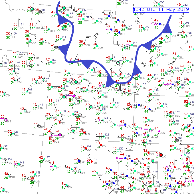
A surface cool front, driven by a disturbance aloft, will shift southward across eastern Colorado today. This front won’t bring a noticeable dip in temperatures, since our temperatures have been cool the last few days. Instead, this front will make its mark by providing gusty northerly winds and sparking isolated-to-scattered thunderstorms along and east of the Continental Divide as it moves southward across the region. A few thunderstorms will be on the strong side of the scale, producing brief periods of moderate-to-heavy rainfall, strong winds, and hail up to 0.5 inches in diameter. Otherwise, temperatures will be a few degrees warmer than yesterday, with plenty of sunshine before and after any showers/storms move overhead.

West of the Continental Divide, a bit of residual moisture from yesterday’s showers will be enough fuel for a few isolated sunshine-driven showers/weak thunderstorms, mainly over the higher terrain. This activity will drift south/southeast with time, bringing a few isolated showers/weak thunderstorms over adjacent lower elevations. This activity will result in mainly light rain, gusty winds, and occasional lightning. For more information on timing, please see the zone-specific forecast discussions below.

Today’s Flood Threat Map

For more information on today’s flood threat, see the map below. For Zone-Specific forecasts, jump below the map.

Zone-Specific Forecasts

Front Range, Southeast Mountains, Urban Corridor, Northeast Plains, Southeast Plains, Palmer Ridge, and Raton Ridge:

Scattered showers/thunderstorms are expected today as a cool front moves southward across the area. Plenty of sunshine will precede the showers/storms and clearing skies will return afterwards. A couple of the storms will be strong, producing winds up to 60 mph, brief periods of moderate-to-heavy rainfall, hail up to 0.5 inches in diameter, and cloud-to-ground lightning. Rain rates will generally be less than 0.2 inches/hour, but stronger storms over the lower elevations will have maximum rain rates of 0.3-0.6 inches/hour.

Timing: 1 PM – 9 PM for the Front Range, Urban Corridor, and Northeast Plains; 2 PM – 11 PM for the Palmer Ridge, Southeast Plains, Southeast Mountains, and Raton Ridge

Northern Mountains, Northwest Slope, San Luis Valley, Central Mountains, San Juan Mountains, Grand Valley, and Southwest Slope:

Mostly sunny and dry for most, with isolated showers/weak thunderstorms dotting the higher terrain during the afternoon and evening hours. Any activity will drift slowly south/southeast with time, bringing a few showers to adjacent lower elevations. With limited moisture available, the main impacts will be gusty winds, light rainfall, and occasional lightning. Rain rates will generally be less than 0.15 inches/hour, but a stronger (relatively speaking) thunderstorm near the CO/NM border could produce rainfall up to 0.4 inches/hour.

Timing: 2 PM – 11 PM

FTB 05-10-2019: Rainfall and Snow Forecast for Southwest Colorado

Issue Date: Friday, May 10th, 2019
Issue Time: 8:30AM MDT

— Flooding is NOT expected today

Multiple shortwaves can be seen in the IR image below. For the most part, they are too far south and west of the state to have much influence on the weather this morning. The southern wave is helping provide some lift for showers (lower elevations) and snow over the southern high terrains of Colorado. The wave over Utah is mostly just causing some cloud cover over the Northwest Slope and Grand Valley (with the help of an eastward moving jet). A drier air mass has worked its way into Colorado, although there is still some residual moisture from the previous systems and current shortwaves to cause some cloud cover.

Today, westerly and southwesterly flow aloft is expected as the vorticity max over Utah starts to get pulled westward into the cut off low over southern California. The shortwaves to the south will also provide a little lift over the southern tier of the state through early this afternoon. Overall, the lack of well-organized dynamics should cause a downtick in coverage of afternoon showers and limit the main action to the higher terrains and southwest corner of the state. By early afternoon, coverage of scattered storms should pick up over the San Juan and Central Mountains. Also forecasting an increase in shower activity over the lower terrains of the Grand Valley and Southwest Slope. However, with lower dew points over the low elevations (north of Montrose County), plenty of showers will produce virga. A very dry air mass will slide south over the northern and northwest portion of the state, so not expecting any rainfall here. Southerly movement of the scattered storms this afternoon into the evening may cause a few storms over the southern Front Range and Southeast Mountains. Rainfall and snow should mostly be confined to the mountains, though some light rainfall may stray into the adjacent plains (west of I-25). Overnight snowfall will likely occur over the Southeast Mountains again, but snow is forecast to end around midnight. Flooding is not expected this Friday.

Today’s Flood Threat Map

For more information on today’s flood threat, see the map below. For Zone-Specific forecasts, scroll below the map.

Zone-Specific Forecasts:

Front Range, Urban Corridor, Southeast Mountains, Palmer Ridge, Raton Ridge, Southeast Plains, Northeast Plains:

Cloud cover across all the regions and a few light snow showers over the Southeast Mountains to start the day. Clouds should start to break up throughout the morning with a drier air mass moving in from the north. A few showers may be possible long the southern Front Range near the Divide late this afternoon and over the Southeast Mountains this evening. Totals over the Southeast Mountains may reach 5-10 inches by morning. Flooding is not forecast.

Primetime: 3:30PM to Midnight

Northwest Slope, Grand Valley, Southwest Slope, Northern Mountains, San Luis Valley, San Juan Mountains, Central Mountains:

Warmer temperatures and sun peeking through broken cloud cover over the Northern Mountains and Northwest Slope today. Further south, lingering moisture and a few shortwaves will provide lift for some afternoon/early evening shower and snow activity. Highest accumulations are expected over the San Juan Mountains where snow totals could reach 10-12 inches by morning over the highest terrains. Over the lower elevations of the Southwest Slope, 24-hr totals up to 0.85 inches will be possible with more general totals between 0.2 and 0.4 inches.

Primetime: Ongoing to Midnight

FTB 05-09-2019: Snow & Rain Mix with Below Average High Temperatures

Issue Date: Thursday, May 9th, 2019
Issue Time: 8:15AM MDT

— Flooding is NOT expected today

Cold temperatures and snow over the mountains and lower elevations in eastern Colorado. Not much sticking along the Urban Corridor, and we should start to the snow turning over to rain with a little daytime heating. Low temperatures are just above freezing south of Colorado Springs, so rain is falling in Pueblo and La Junta. A little bit warmer start to the day over the lower elevations in western Colorado. A drier air mass is currently moving into the area, though it won’t be long until the next shortwave enters from the west. Highs here should reach the mid-50°Fs to 60°F over the lower elevations.

Two systems should affect the weather today. The first is marked over eastern Colorado. This trough will keep light, scattered showers going over the plains through the early afternoon. By then, a little daytime heating and eastward movement of the trough will help break up some of the cloud cover. Still not expecting high temperatures to reach above 50°F. The other system is currently marked with an “X” over the Utah/Arizona/Nevada border. Expecting shower activity to pick up late this afternoon over the Southwest Slope as this wave approaches. Overnight, this should help provide lift for some snow and light showers over the eastern San Juan Mountains, San Luis Valley and Southeast Mountains. Lastly, over the mountains this afternoon, left over mid-level energy, moisture and the diurnal heating pattern should increase showers and snow over the higher terrains. The activity will first start over the Central, Northern and northern San Juan Mountains, then over the Southeast Mountains and Front Range. With the stable atmosphere in the adjacent (eastern) plains, not expecting much precipitation as rain will dissipate away from the lift. There may be a bit more rainfall over the northern Urban Corridor with extra convergence along the Cheyenne Ridge. Flooding is not expected today.

Today’s Flood Threat Map

For more information on today’s flood threat, see the map below. For Zone-Specific forecasts, scroll below the map.

Zone-Specific Forecasts:

Front Range, Urban Corridor, Southeast Mountains, Palmer Ridge, Raton Ridge, Southeast Plains, Northeast Plains:

Snow at elevations higher than 8K ft today. Otherwise, snow turning to rain is forecast over the lower elevations. Rain over the plains is expected to be more stratiform in nature and ending by early afternoon. Totals up to 0.3 inches are possible. To the west, general snow totals in the range of 2-6 inches are possible favoring the northern Front Range. Overnight, a second wave will produce some more snow over the Southeast Mountains. This will likely cause totals up to 12 inches at the highest elevations by morning. Clearing over the plains will cause freezing temperatures overnight, so a Freeze Watch is in place.

Primetime: Ongoing to 6AM

Northwest Slope, Grand Valley, Southwest Slope, Northern Mountains, San Luis Valley, San Juan Mountains, Central Mountains:

Warmer temperatures for the lower elevations this afternoon as there is a break and a bit of dry air between the two systems. Snow showers are expected to pick up over the higher terrains this afternoon with some left over mid-level energy, moisture and minimal instability. Precipitation will generally favor the Central Mountains and should end around sundown. More snow is expected overnight over the eastern San Juan Mountains as the next wave passes through. Snow totals in the range of 5-12 inches are possible by morning.

Primetime: Ongoing to 7AM


FTB 05-08-2019: Snow, Rain, and Rain turning to Snow as Winter Conditions Return through Thursday

Issue Date: Wednesday, May 8th, 2019
Issue Time: 9:10AM MDT

— Flooding is NOT expected today

Much cooler temperatures to start the morning as a cold front moved through the state last night. A secondary, stronger front is expected this afternoon with the surge of cold air beginning around noon over northern Colorado. This surge of northerly, cold wind will knock down high temperatures over the majority of the state today. Forecasting a drastic drop in the freezing level this afternoon into tonight. Snow levels are currently above 10K feet, but are expected to fall to 6K feet by tonight. This means heavy snowfall for the higher elevations and a few inches in the foothills by morning. It is also likely the lower elevations (5-6K ft) will accumulate some light snow on the grass by the morning commute.

The low pressure system that has kept an active pattern in play is currently over eastern Colorado. This is helping produce cloudy, foggy and rainy conditions over the eastern portion of Colorado. A bit of dry air (yellow) has worked its way into central and southern Colorado, so skies have more scattered cloud cover with light snowfall being reported over some mountain stations. However, the next shortwave and associated rainfall has started to move in from the southwest and west, which is producing light rainfall over lower elevations along the Utah/Colorado border. As expected, precipitation at the higher elevations (9-10K+ ft) is falling as snow, which will continue into Thursday. The first front is currently stalled out over western, central Colorado, so expected colder temperatures to the north of this feature with high temperatures a few degrees warmer south this afternoon. This is also the difference between rain and snow. Later this afternoon, the freezing level will begin to drop with the cold front and will be reinforced with evaporate cooling, so about this time, the lower elevations (7-8K ft) rainfall will start to turn to snow.

As the next shortwave navigates eastward across the state, showers and snow are expected to pick up in coverage over the higher terrains by early afternoon. A few of these showers may affect the (eastern) adjacent plains with their slow westerly storm motion. With a stable atmosphere, they should dissipate as the move away from the lift (mountains). Overnight, the main area of precipitation (snow) will be over the eastern San Juan Mountains, Southeast Mountains and Raton Ridge. Even the San Luis Valley is forecast to get in on the action, although totals will be much lower (up to 0.25 inches). With the majority of the precipitation falling as snow overnight, not too worried about flooding over the Spring Creek burn scar. Icy conditions may also be possible over the Palmer Divide (Monument Hill) during the morning commute. Winter conditions are forecast through Thursday, and flooding is not expected.

Today’s Flood Threat Map

For more information on today’s flood threat, see the map below. For Zone-Specific forecasts, scroll below the map.

Zone-Specific Forecasts:

Southeast Plains, Northeast Plains:

The surface winds are forecast to be northerly over eastern Colorado today, so this should keep the atmosphere stable and relatively cold. It also means organized thunderstorm activity this afternoon is not forecast, which should keep the flood threat minimal as rainfall rates in the range of 0.25 inches to 0.5 inches per hour are expected. However, as the trough slowly pulls to the northeast throughout the day, it will provide lift (along with the cold front) for continued light to moderate showers over the eastern plains. Coverage is expected to decrease into the early evening as the mid-level energy moves east. However, the next set of cold showers will arrive by early morning as the next shortwave moves through the area. So another soggy to start tomorrow with 24-hr totals up to 1.4 inches possible.

Primetime: Ongoing with a break in the early evening to midnight

Front Range, Urban Corridor, Southeast Mountains, Palmer Ridge, Raton Ridge:

Fog and low level clouds are being reported once again this morning. Shower coverage is expected to pick up by midday with freezing levels dropping by early evening to 7K ft. By morning, snow will be likely over the Urban Corridor with icy conditions over the Raton Ridge and Palmer Ridge. Max 1-hr rain rates up to 0.2 inches (east) and 0.5 inches (west). Snow totals by morning will be highest over the Southeast Mountains and Raton Ridge.

Snowfall:

8-16 inches are over the Southeast Mountains and Front Range
4-6 inches over the Foothills, Palmer Ridge and Raton Ridge
1-4 inches over the Urban Corridor

Primetime: Noon to 7AM

Northwest Slope, Grand Valley, Southwest Slope, Northern Mountains, San Luis Valley, San Juan Mountains, Central Mountains:

Complicated forecast with rain already starting near the Colorado/Utah border. With the cold front dropping south, snowfall levels are forecast to drop quickly. If the cold front and max lift from the shortwave coincide over the Central Mountains during peak heating, some very heavy snowfall rates can be expected. Snow totals over the Central and Northern Mountains are expected to be between 10 and 20 inches by morning. The eastern San Juan Mountains may get between 10 and 15 inches though these totals are expected to be widespread. Over the lower elevations up to 0.5 inches may fall in the 24-hour period (with general totals closer to 0.2 inches) and greatest coverage is forecast over the Grand Valley and Southwest Slope.

Primetime: Ongoing to 7AM