Issue Date: Tuesday, June 4th, 2019
Issue Time: 8:30AM MDT
–Flooding is NOT expected today
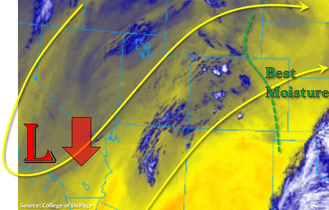
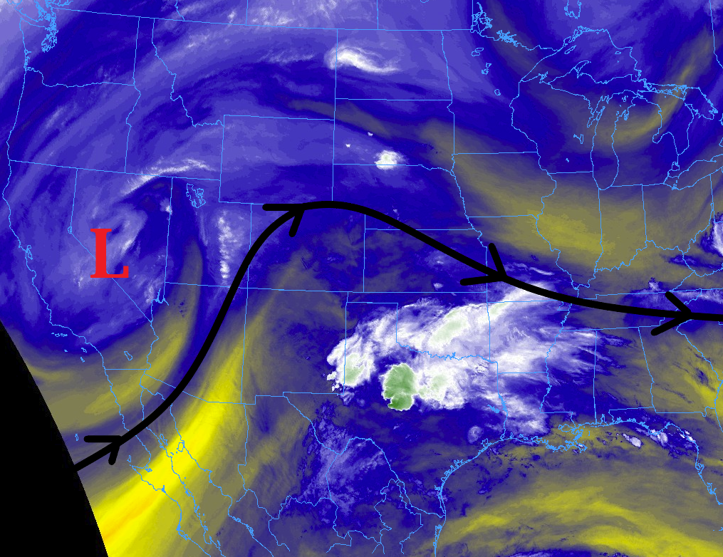
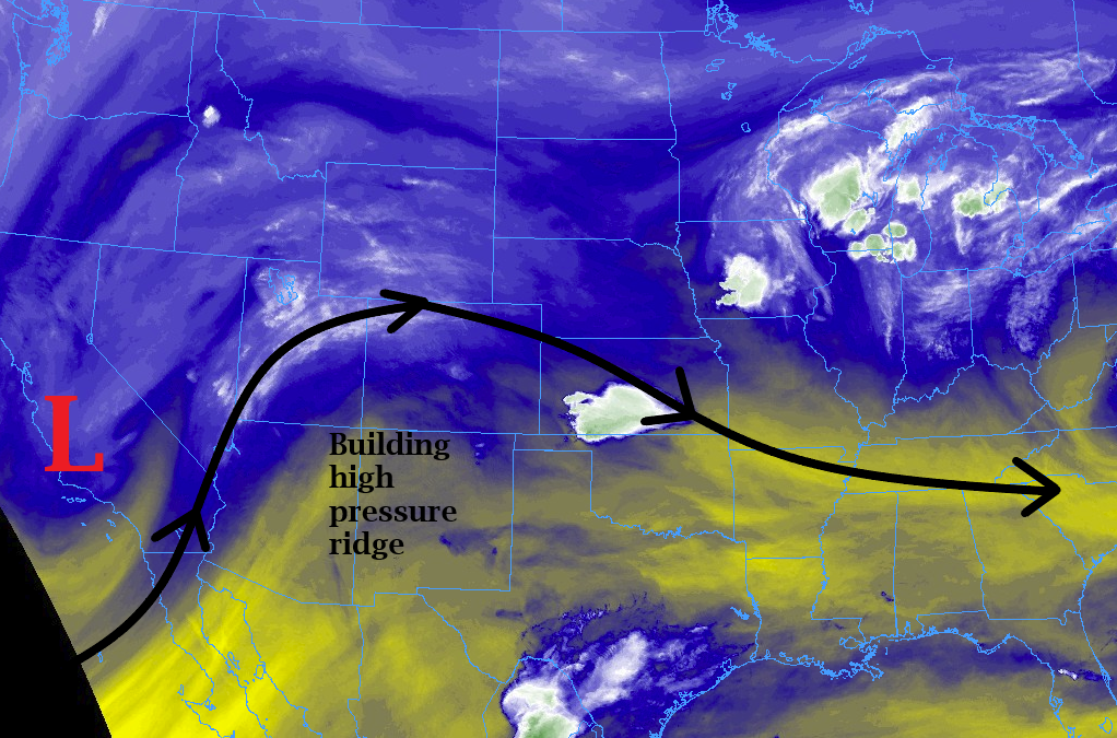
Minus a few high clouds over the San Juan Mountains, which are dispersing quickly, it’s a clear start to the day. Still quite a bit of snowpack over the mountains in the visible image below. This will continue to melt with above average temperatures forecast again today. Expect high temperatures to be on par with high temperatures from yesterday. The upper level low is currently over the Baja CA Peninsula and will move east today, which will center it over south, central Arizona and the Mexico border by this evening. This means upper flow will remain westerly except over the southwest corner where flow will have more of a southwesterly component.

A drier air mass remains over the state, which should limit the heavy rainfall threat once again. PW was measured at 0.43 inches at Denver this morning. There is a slight increase in mid-level energy, so expecting storm coverage to be more widespread over the mountains this afternoon. The weak thunderstorms may produce some small hail, but high-bases will make the main threats today gusty outflow winds and lightning. As storms move into the eastern plains this afternoon, better moisture will reside near Colorado’s eastern border, so expecting storms to become more efficient at producing rainfall in this area. Decent storm motion should only allow for moderate rainfall totals. Overall, similar setup to yesterday, but expecting storms to be more widespread over the southern half of Colorado. Flooding is not forecast.
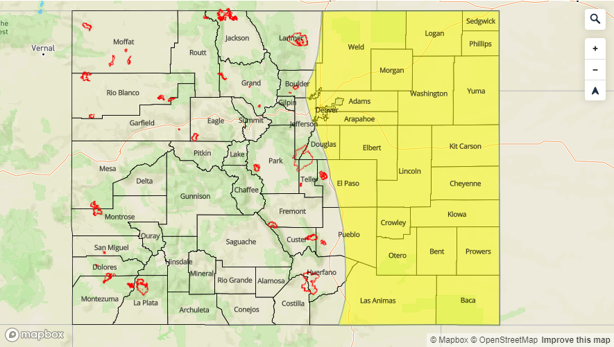
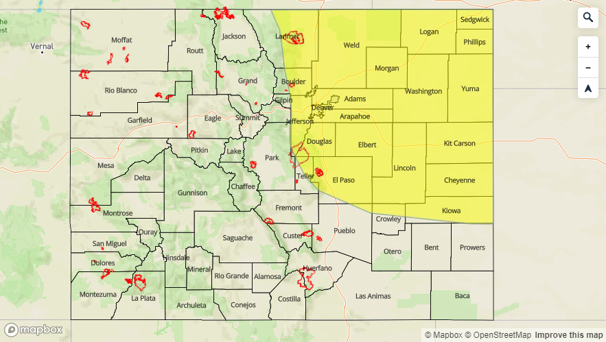
Today’s Flood Threat Map
For more information on today’s flood threat, see the map below. For Zone-Specific forecasts, scroll below the map.

Zone-Specific Forecasts:
Southeast Mountains, San Juan Mountains, Southeast Plains, Raton Ridge, Northeast Plains, Palmer Ridge:
Increased storm activity is forecast across southern Colorado and the eastern Colorado border. Max 1-hr rain rates over the San Juans will be 0.4 inches with more general rain rates in the 0.1 to 0.25 inch/hour range. Thus, stronger thunderstorms that track near the 416 burn area should be monitored closely. Over the Southeast Mountains max 1-hr rain rates will remain below 0.25 inches, so not too worried for recent burn areas here. Over the eastern plains, isolated 1-hr totals up to 1.3 inches are possible though most storms will produce 1-hr rain rates between 0.8 and 1 inch.
Primetime: 11:30AM to 10PM
Front Range, Urban Corridor, Northern Mountains, Central Mountains, Northwest Slope, Grand Valley, Southwest Slope, San Luis Valley:
Similar to yesterday, storms will form over the mountains by early afternoon. A bit drier air is in place over these regions, so storms will be high-based once again. This will translate to the main threats today being lightning and gusty winds. Not totally out of the question for a couple of weak thunderstorms to produce 0.25 inch hail. Max 1-hr rain rates over the mountains are expected to be 0.3 inches (Front Range) and 0.15 inches (west of the Divide). Not expecting totals above trace amounts for the lower elevations in western CO with most storms will only producing cloud cover. A storm might wander into the Urban Corridor again this afternoon, but totals are expected to remain under 0.3 inches. The Conejos and San Antonio Rivers are still under a Flood Warning for high flows and minor flooding of low-lying areas. This is expected to continue for the next few days, but flood stage remains only at Action level today.
Primetime: 12PM to 9PM