Issue Date: 6/16/2019
Issue Time: 8:15 AM
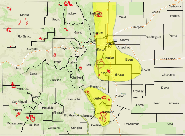
A MODERATE FLOOD THREAT IS FORECAST TODAY FOR THE FOLLOWING AREAS:
Arkansas River at Avondale due to snowmelt
A LOW FLOOD THREAT IS FORECAST TODAY FOR THE FOLLOWING AREAS:
Arkansas River at Canon City due to snowmelt
Rio Grande in the San Luis Valley due to snowmelt
Portions of the Front Range, Urban Corridor, Palmer Ridge, and Northeast Plains
NOTE: Due to snowmelt, many streams/rivers are running fast/high across the state, especially in the High Country.
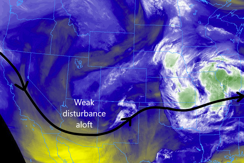
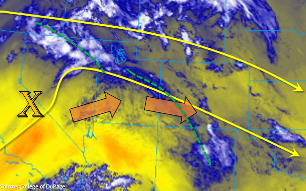
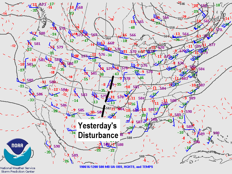
In the wake of a departing upper-level disturbance, Colorado finds itself under the influence of an ever-so-slightly cooler air mass that lacks the upper-level support for thunderstorms that was present the last couple of days. That’s not to say that today will be nothing but blue skies: scattered showers/thunderstorms are expected again today thanks to remnant moisture and sunshine that will provide enough instability for their development. Due to the lack of upper-level support, slightly cooler temperatures, and marginal wind shear, nearly all of the activity will be garden variety, producing mainly gusty winds and periods of light-to-moderate rainfall.
There is one area of concern for a couple stronger storms that will be capable of heavy rainfall, and this is outlined by the low flood threat area below. The presence of a weak surface boundary in the area will provide enough wind shear and surface convergence to force the development of a couple stronger thunderstorms over portions of the Front Range, Urban Corridor, and Northeast Plains. Hail up to 1.5 inches in diameter, strong winds up to 60 mph, and periods of heavy rain will attend these stronger storms. Storm motions *should* be quick enough to avoid flash flooding issues; however, the threat of training/backbuilding storms along the boundary is enough to warrant the low flood threat.
For more details on timing and rain rates, please see the zone-specific forecast discussions below.
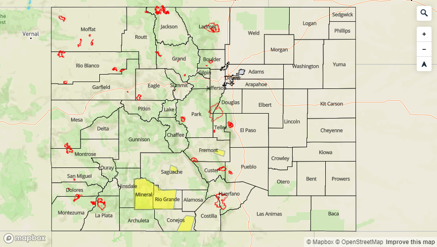
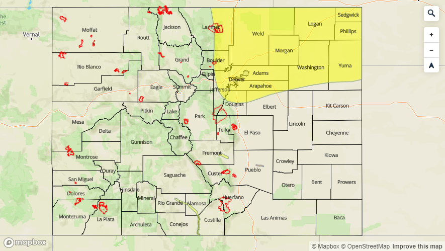
Today’s Flood Threat Map
For more information on today’s flood threat, see the map below. For Zone-Specific forecasts, jump below the map.

Zone-Specific Forecasts
Front Range, Southeast Mountains, Urban Corridor, Northeast Plains, Southeast Plains, Palmer Ridge, and Raton Ridge:
Scattered thunderstorms are expected over the Front Range, Urban Corridor, Palmer Ridge, Southeast Mountains, and Northeast Plains, with more isolated-to-widely scattered coverage over the Raton Ridge and Southeast Plains. Most of the activity will be garden variety, producing periods of light-to-moderate rainfall, gusty winds, and occasional lightning. A few stronger storms are expected in the low flood threat area outlined above, with the potential for hail up to 1.5 inches in diameter, winds up to 60 mph, and periods of heavy rainfall. Maximum rainfall rates are as follows:
Front Range: 0.6-1.0 inches/hour
Urban Corridor and Palmer Ridge: 1.0-1.5 inches/hour
Northeast Plains: 1.5-2.0 inches/hour
Southeast Plains: 0.5-1.0 inches/hour
Southeast Mountains: 0.2-0.4 inches/hour
Raton Ridge: 0.3-0.7 inches/hour
Timing: 11 AM – 11 PM over the Front Range and Southeast Mountains, 1 PM – Midnight over the Urban Corridor and Raton Ridge, and 2 PM – 2 AM over the Northeast Plains and Southeast Plains
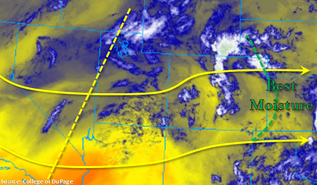
Northern Mountains, Northwest Slope, San Luis Valley, Central Mountains, San Juan Mountains, Grand Valley, and Southwest Slope:
Scattered showers/thunderstorms are expected today, with the best coverage along/near the Continental Divide. Most valleys will likely remain dry, owing to a relative lack of moisture in the lower levels of the atmosphere. Rain rates will generally be less than 0.2 inches/hour, but a stronger thunderstorm may produce rainfall up to 0.4 inches/hour. Storm motions are expected to be quick enough to the east to avoid any flood threat.
Timing: 11 AM – 10 PM, with a few lingering showers into the early morning hours as the next upper-level disturbance approaches.