Issue Date: Tuesday, August 9th, 2022
Issue Time: 10:30 AM MDT
— Flooding is NOT expected today
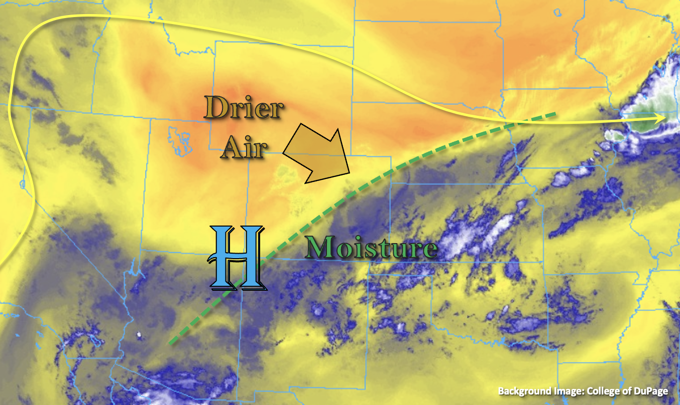
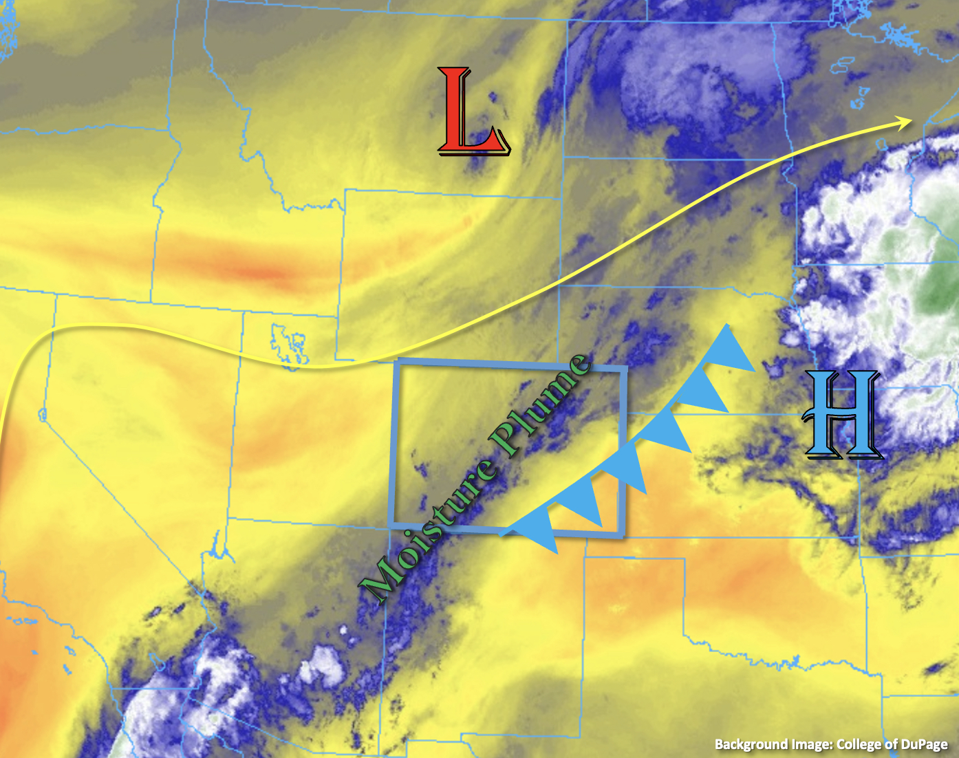
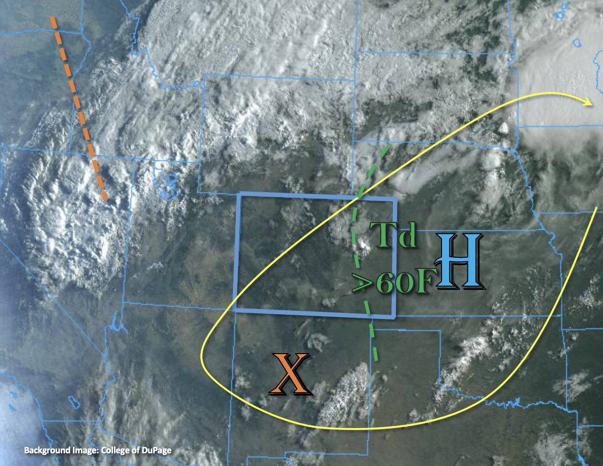
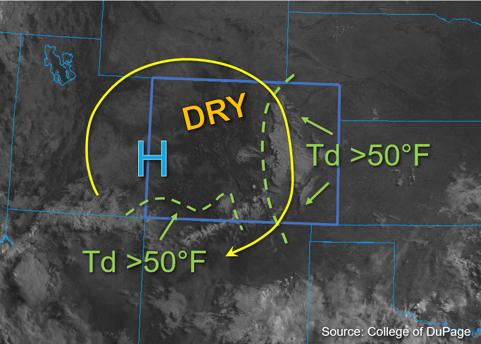
The high-pressure ridge continues to strengthen this morning with the center of the High now located over the Colorado and Utah border, as marked in the visible satellite image below. The ridge is expected to limit the monsoonal moisture return and suppress storm development this afternoon; thus, drier conditions are expected overall. This morning, Grand Junction measured a PW of 0.61 inches and Platteville measured a PW of 0.83 inches, both of which indicate an overall decrease of moisture compared to yesterday. Still, residual surface moisture remains elevated across eastern Colorado as dew points are noted above 50°F. Western Colorado is largely dry at the surface with dew points measured only in the 30s and 40s°F primarily, except for far southwest Colorado where a few dew points in the low 50s°F are noted.
Significant mixing out of surface moisture is forecast this afternoon, particularly across northern and central Colorado. Southern Colorado may be able to cling onto some moisture, especially as upslope flow increases this afternoon to help with moisture return. Additionally, the early morning stratus deck over eastern Colorado has eroded which should allow ample surface heating and moderate instability to build this afternoon. Currently, surface-based instability is forecast to reach values of 500-800 J/kg of CAPE across south-central and southwest Colorado, with values of 1000-1500 J/kg of CAPE possible across far eastern Colorado this afternoon. This should allow isolated to widely scattered storm development over the southern high terrain and Southeastern Plains by this afternoon.
A weak convergence boundary is located over southeast Colorado which should help trigger isolated to a few widely scattered storms over the Southeast Plains. Faster steering speeds up to 25mph are forecast for eastern Colorado, which should limit the flood threat east, although a few briefly heavy downpours and strong winds are possible with stronger storms that develop over the higher elevation ridges or in association with the convergence boundary. Over southwest Colorado, slower steering speeds may allow a few storms to produce heavy downpours over a 30-minute period, but the shorter duration and smaller rainfall cores should limit the flood threat. Flooding is NOT expected today.
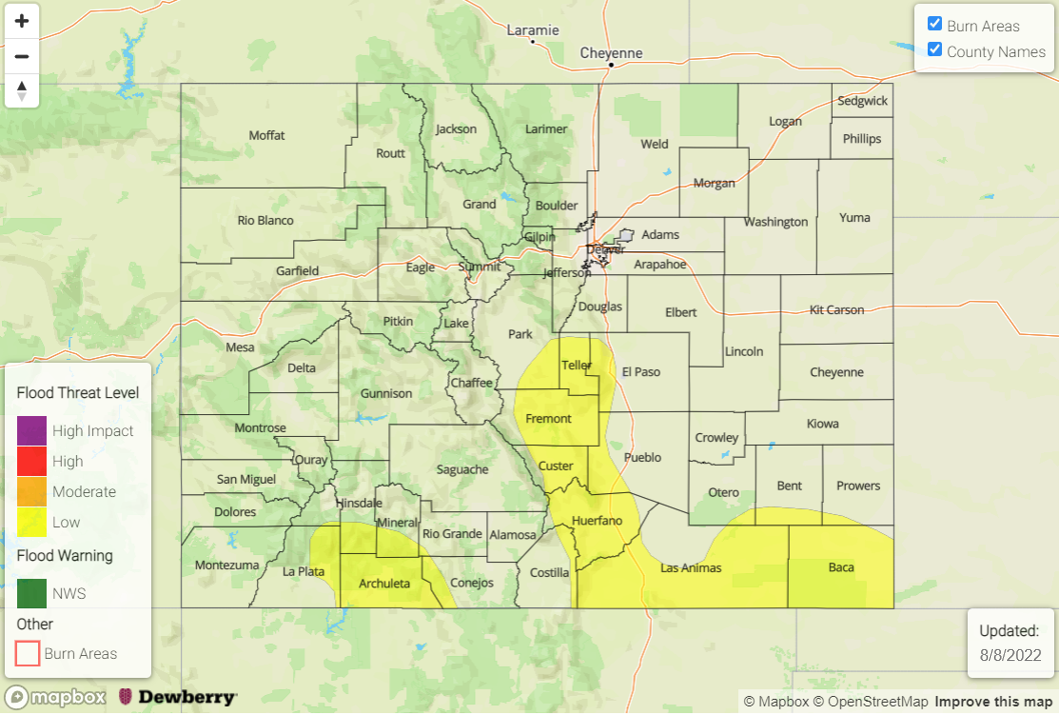
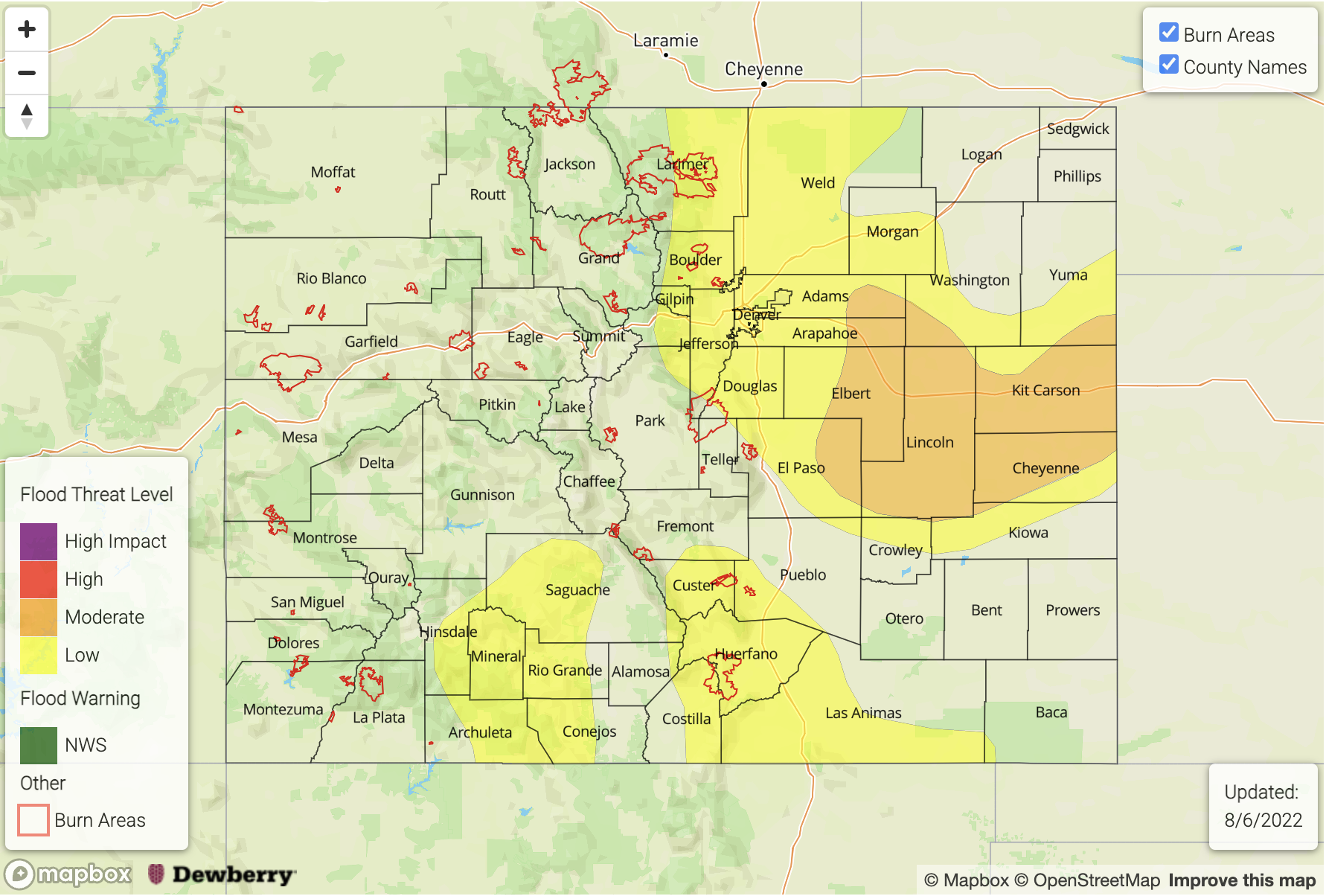
Today’s Flood Threat Map
For more information on today’s flood threat, see the map below. If there is a threat, hover over the threat areas for more details, and click on burn areas to learn more about them. For Zone-Specific forecasts, scroll below the threat map.

Zone-Specific Forecasts:
Southwest Slope, San Juan Mountains, San Luis Valley, Grand Valley, Central Mountains, Northern Mountains, & Northwest Slope:
Some patchy fog was noted in San Luis Valley earlier this morning, but it has cleared out with a little day time heating. This afternoon, a few isolated to widely scattered storms over the high terrain may produce 30-minute rain rates up to 0.8 inches and localized totals just shy of 1 inch over the San Juan Mountains and the eastern Southwest Slope. Although briefly heavy downpours may lead to brief runoff and light ponding, flooding is NOT expected today.
Primetime: 1PM to 11PM
Front Range, Urban Corridor, Northeast Plains, Palmer Ridge, Southeast Mountains, Raton Ridge, & Southeast Plains:
By early afternoon, isolated to widely scattered storm development is expected initially over the southern Front Range and Southeast Mountains and western Palmer Ridge. These storms may produce 30-minute rain rates up to 0.5 inches. Given northeast steering flows, these storms should remain over the high terrain. Isolated storms may also develop over the southern eastern plains along a weak convergence line, and if they break the cap max 1-hour rain rates up to 1 inch would be possible. Briefly heavy downpours and gusty winds are forecast; however, flooding is NOT expected today.
Primetime: 2PM to 9PM