Issue Date: Monday, August 8th, 2022
Issue Time: 10:10AM MDT
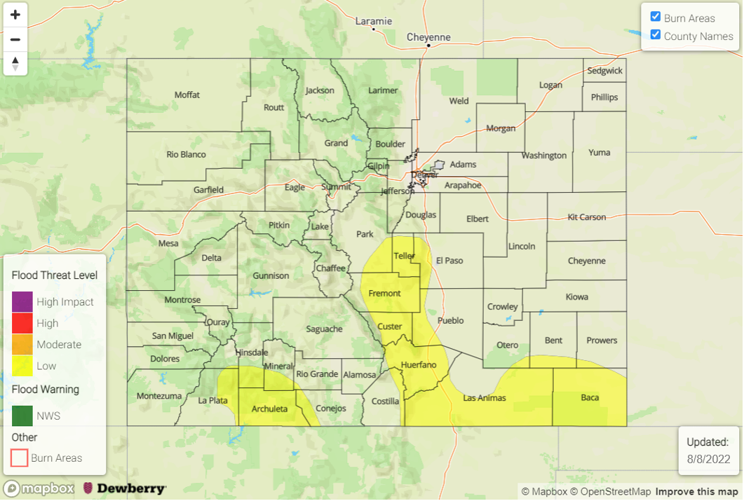
— A LOW flood threat has been issued for the Southeast Mountains, Raton Ridge and portions of the Front Range, Southwest Slope, San Juan Mountains and Southeast Plains
— Fire-Burn Forecast Summary: 1 burn area under MODERATE threat, 1 burn area under LOW threat; click HERE for more info
This morning there are some ongoing showers and cloud cover over southeast Colorado with clear conditions elsewhere. The clear skies are partially due to the drier air mass that is being advected into the state from the northwest (dotted green line marking the transition between the two air masses). As the High moves slightly northwards today, the dry air will continue to rotate clockwise around the High, and it should start to mix out some of the surface moisture over eastern Colorado. PW at Grand Junction has dropped slightly to 0.78 inches, and over North Platte, it has dropped quite a bit to 0.72 inches. Between the decreasing moisture and building High, afternoon and evening thunderstorm activity should be remain isolated to nonexistent over the northern and central high terrain. Some mid-level energy moving through the northwest flow may help to spark an isolated storm or two over the Cheyenne Ridge and Northeast Plains, but with decreasing moisture, flooding is not expected as the storms move southward.
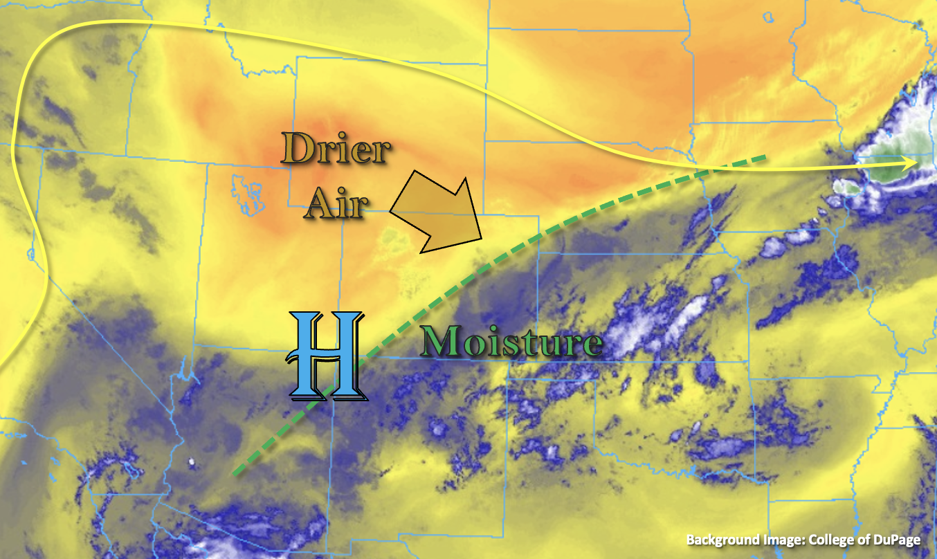
Higher surface moisture will likely be able to hold on across southern Colorado, and where there are clear conditions this morning or breaks in cloud cover after the ongoing morning rainfall, some stronger storms may develop. While moisture should decrease some over the southern Front Range, increased convergence will likely produce another round of late afternoon and early evening storms in this climatologically active region. Isolated heavy rainfall may be possible over these areas with the slow steering flows, enhanced convergence, and dew points remaining in the upper 50°Fs to low 60°Fs, so a LOW flood threat has been issued. There is also an increased flood threat if storms today track over saturated soils, both over eastern and western Colorado.
Today’s Flood Threat Map
For more information on today’s flood threat, see the map below. If there is a threat, hover over the threat areas for more details, and click on burn areas to learn more about them. For Zone-Specific forecasts, scroll below the threat map.
Zone-Specific Forecasts:
Southeast Mountains, Front Range, San Juan Mountains, Southwest Slope, Raton Ridge, Urban Corridor, Palmer Ridge, Northeast Plains & Southeast Plains:
Isolated heavy rainfall will be possible over these southern zones later this afternoon and evening. Max 30-minute rain rates up to 1.4 inches/1.25 inches (east/west) and 1-hour rain rates up to 2 inches (east) will be possible. A LOW flood threat has been issued for isolated mud flows/debris slides over steeper terrains, road flooding and field ponding. Over the northern Front Range, an isolated storm or two may produce totals up to 0.3 inches, and over the eastern plains, a stronger storm could produce 1-hour rain rates up to 1.5 inches along with very strong outflow winds and hail.
Primetime: 1PM to 11PM
Central Mountains, San Luis Valley, Northwest Slope, Northern Mountains & Grand Valley:
These zones should stay mostly dry today with isolated storms most likely to develop over the Central Mountains near the Continental Divide. Storm totals should remain under 0.25 inches. A couple storms may make it into the interior of the SLV with isolated totals up to 0.5 inches possible near the edges. Flooding is NOT expected. Afternoon high temperatures should reach into the 90°Fs for the lower elevations and 70°F/80°Fs for the mountain valleys.
Primetime: 2PM to 10PM