Issue Date: Thursday, July 18th, 2019
Issue Time: 9:10AM MDT
–Flooding is NOT expected today
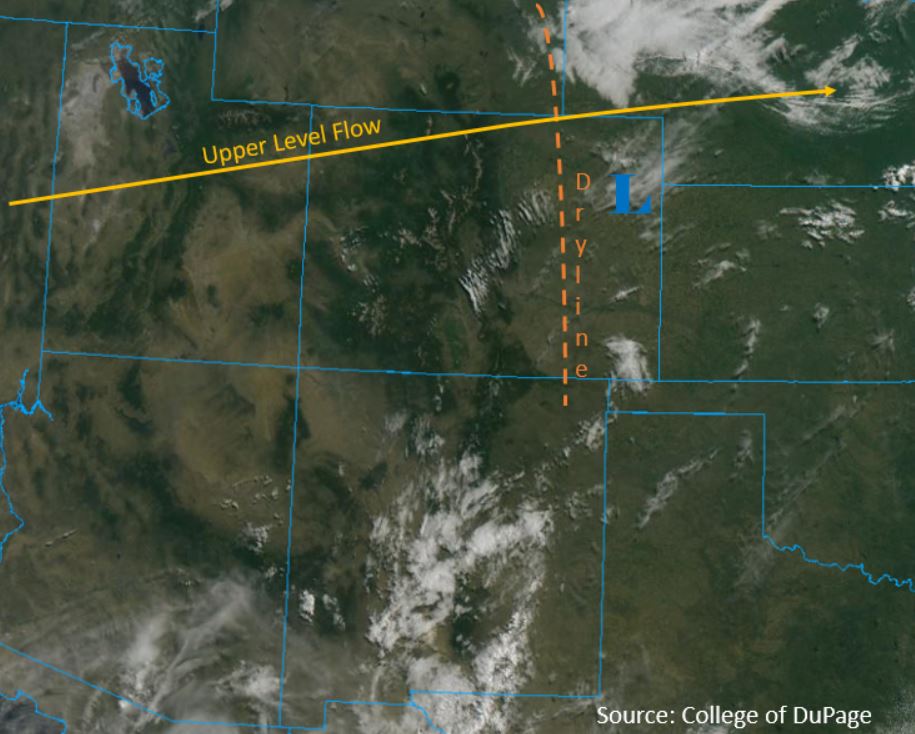
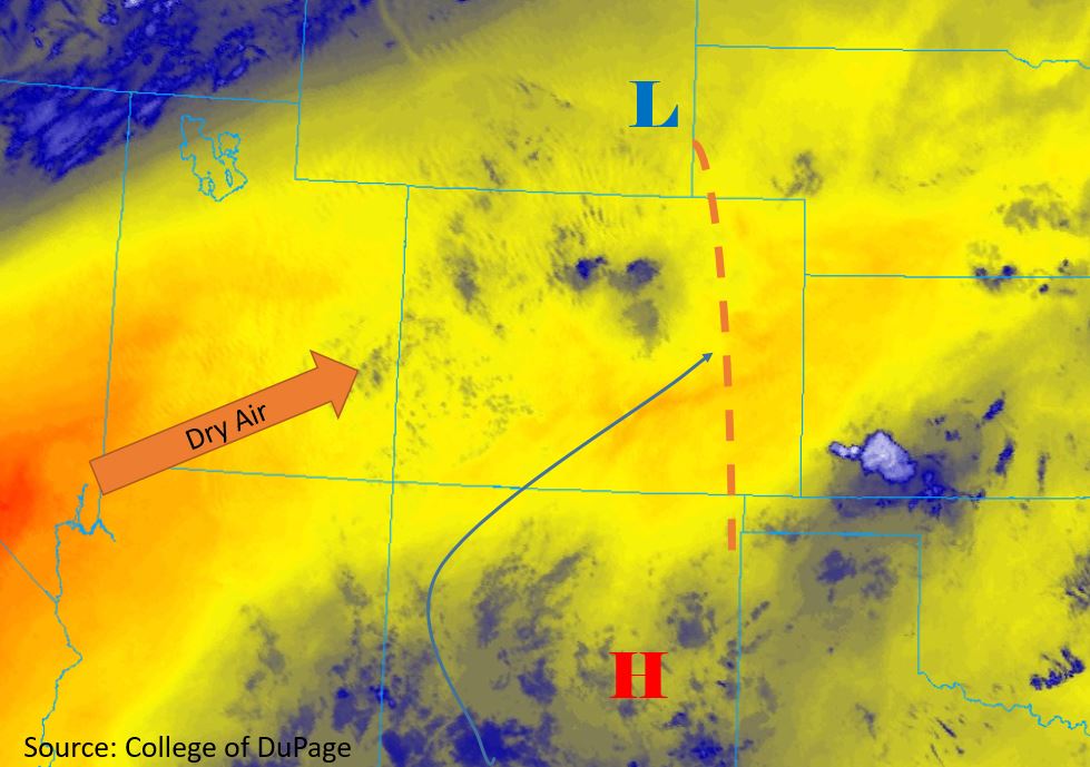
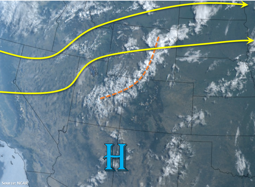
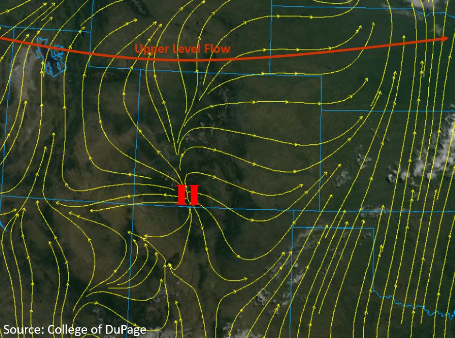
Upper level flow is fully zonal across the continental United States, with the jet stream spanning from Washington to Maine. The upper level high pressure system now sits over Arizona, creating westerly and northwesterly flow over Colorado (Orange Arrow Below). Little to no upper level moisture is expected to enter the state today. PW continues to decrease from yesterday, with 0.3 inches over the Central Mountains and 0.46 inches measured over Denver this morning. At the surface there is currently a high pressure system sitting over the San Juan Mountains (“H” below). Downsloping flow off of the mountains throughout the day (yellow streamlines below) will decrease surface moisture considerably, reducing dewpoints into the 20°Fs over the eastern plains and teens to single digits over the high country and western slope. A Red Flag Warning is in effect for Moffat County and areas of the Front Range, Northern Mountains and Central Mountains between 6000 and 9000 ft. Winds between 10 and 20 mph, with gusts up to 35 mph are forecast over the region.
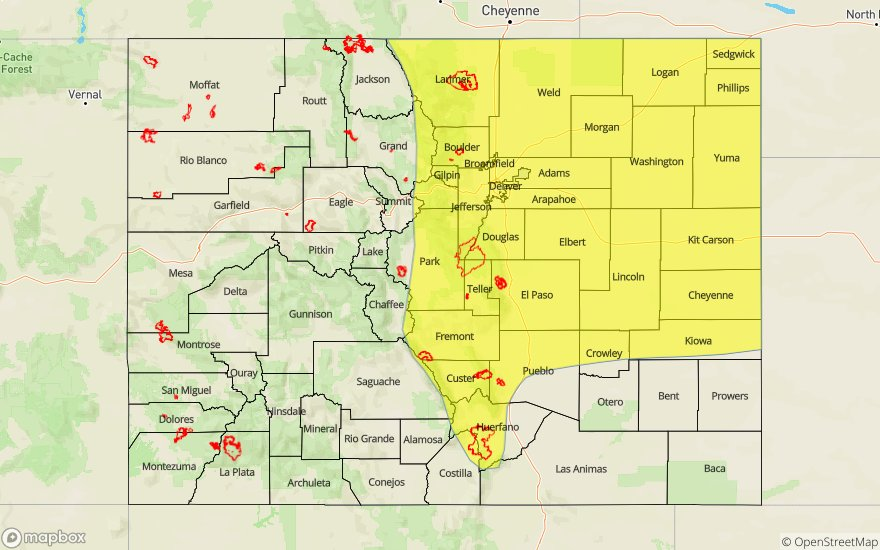
Today’s Flood Threat Map
For more information on today’s flood threat, see the map below. For Zone-Specific forecasts, scroll below the map.

Zone-Specific Forecasts:
Front Range, Urban Corridor, Northeast Plains, Palmer Ridge, Southeast Plains, Southeast Mountains, Raton Ridge:
No precipitation is forecast for today. High temperatures may reach into the 100°Fs once again over the eastern plains. Wind gusts up to 40 mph are expected over the highest elevations of the Front Range. Afternoon cloud cover may provide some shade this afternoon but it’s going to remain hot and dry over most areas.
Northwest Slope, Grand Valley, Northern Mountains, Central Mountains, Southwest Slope, San Juan Mountains, San Luis Valley:
Another hot and dry day is expected again today, with no chances for afternoon precipitation. High temperatures are expected to be similar to yesterday, with highs in the 100°Fs over the Grand Valley. Relative humidity is expected to drop below 30% throughout the day. Flooding is not forecast for today.