Issue Date: Tuesday, July 30th, 2019
Issue Time: 8:45AM MDT
— Flooding is NOT expected today
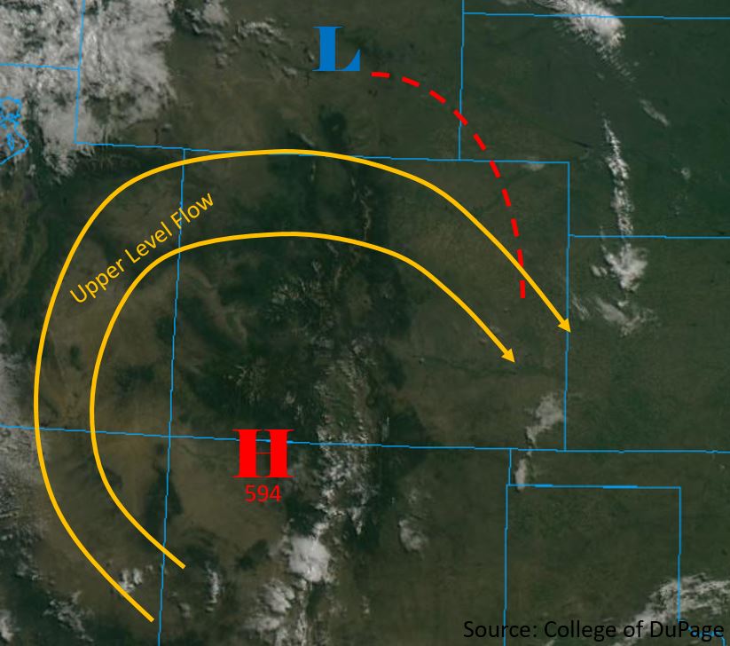
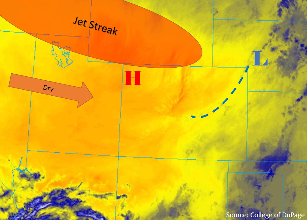
Warm temperatures already to start the day. Mid 60°Fs over the plains with mid-50°Fs and 60°Fs over the adjacent plains and mountain valleys. The subtropical high will once again be anchored over the Colorado/New Mexico border, which should keep the heavy rainfall threat away for another day. This morning soundings at Denver and Grand Junction show slightly higher PW values from yesterday morning, but still well below average for this time of year. Dry upper levels will likely mix out most of this surface and mid-level moisture throughout the day. This is especially true over the northern Front Range and Southeast Mountains due to downsloping winds created by a surface low over the eastern plains. This means the storms that do form will be high-based and produce more virga and wind than accumulating rainfall over the mountains and adjacent eastern plains. Only slightly better moisture holds on over the far northeast corner of the state, so storms that form over the Cheyenne Ridge and move into the state with the northwest steering flow may be capable of producing light to moderate rain rates. However, chances for this occurring are minimal.
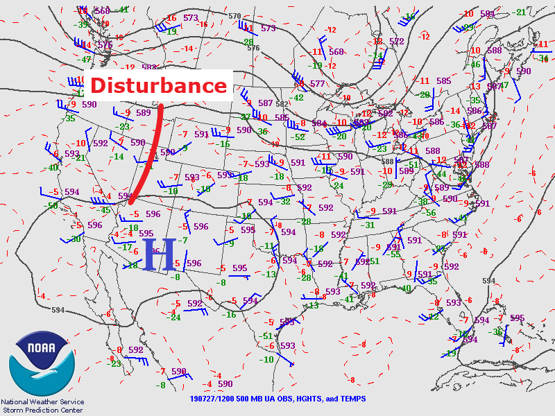
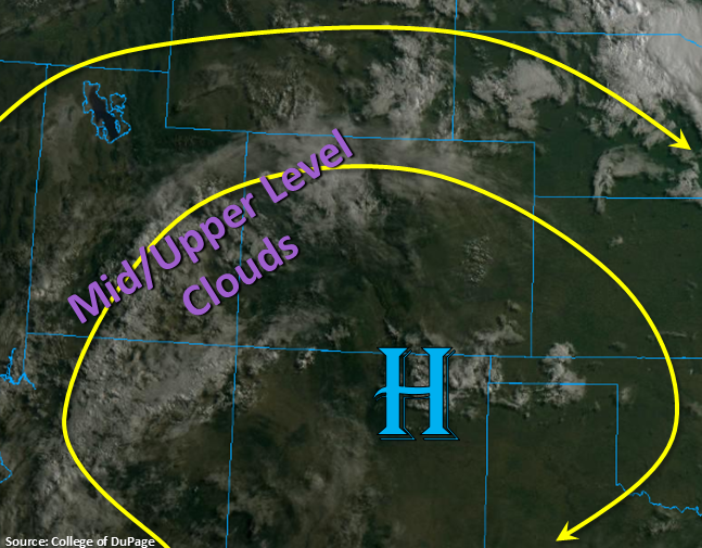
To the west, the best moisture holds on over the southwest corner of the state. Paired with passing shortwaves around the high, expecting weak afternoon thunderstorms and showers over the western high terrains with coverage greatest to the south. The visible satellite imagery below shows some of that remaining moisture with mid and upper level cloud cover associated with the passing disturbances. A couple high-based storms may also be possible over the lower elevations of the Grand Valley and Southwest Slope that move in from Utah. The main threats today will be gusty winds and lightning with lighter rainfall rates. The first round of storms should help make the second round of storms more efficient at producing accumulating rainfall. Storms are expected to weaken a couple hours after sundown, and all activity is forecast to end by 11PM. Flooding is not expected today.
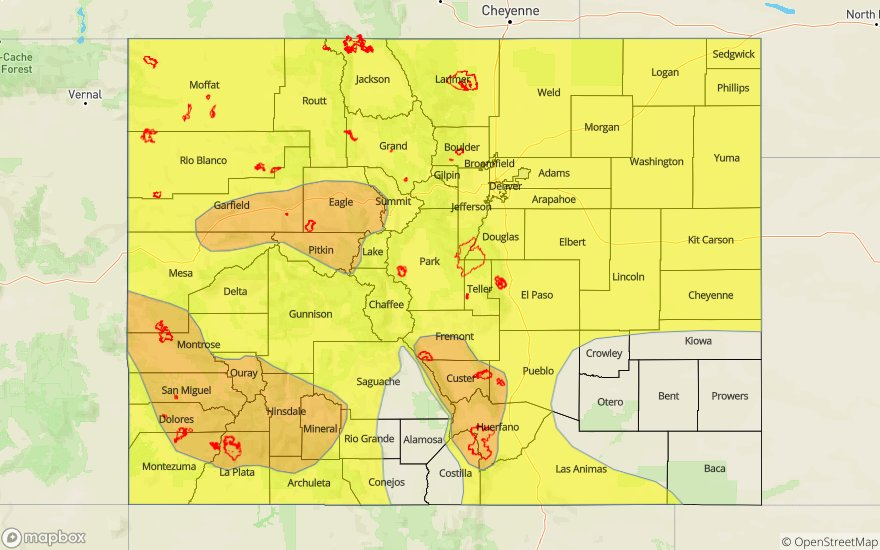
Today’s Flood Threat Map
For more information on today’s flood threat, see the map below. For Zone-Specific forecasts, scroll below the map.
Zone-Specific Forecasts:
Northwest Slope, Grand Valley, Southwest Slope, Northern Mountains, Central Mountains, San Juan Mountains, San Luis Valley:
Isolated max 1-hr rain rates up to 0.5 inches (south/central) and 0.2 inches (north) will be possible over the higher terrains. While a couple of storms may wander into the Grand Valley and Southwest Slope Valleys, max 1-hr rain rates should remain around 0.2 inches. Slow steering winds mean storms will likely sit again today, so very isolated 2-hour totals between 0.6 and 0.75 inches may be possible over the eastern San Juan Mountains and San Juan/Ouray/Hinsdale County area. Rain rates should be low enough that there is no threat for the 416 and Lake Christine burn areas, but as always, caution should be taken if moderate rain is falling over these susceptible scars. The main threats from storms today will be gusty winds and lightning.
Primetime: 1:30PM to 11PM
Front Range, Southeast Mountains, Urban Corridor, Palmer Ridge, Raton Ridge, Northeast Plains, Southeast Plains:
Best chance for accumulating rain today will be over the southern Front Range near the Continental Divide and south over the Raton Ridge. Max 1-hr rain rates up to 0.65 inches will be possible (Front Range/eastern Raton Ridge) with up to 0.3 inches possible over the western edge of the Raton Ridge. An isolated storm may make it into the Northeast Plains, but capping will likely cause the storm to dissipate rather quickly. A quick 0.5 inches may be possible. Storms should end west to east with all activity ending a few hours after sundown.
Primetime: 2:30PM to 10:30PM