Issue Date: Monday, July 29, 2019
Issue Time: 9:40AM MDT
–Flooding is NOT expected today
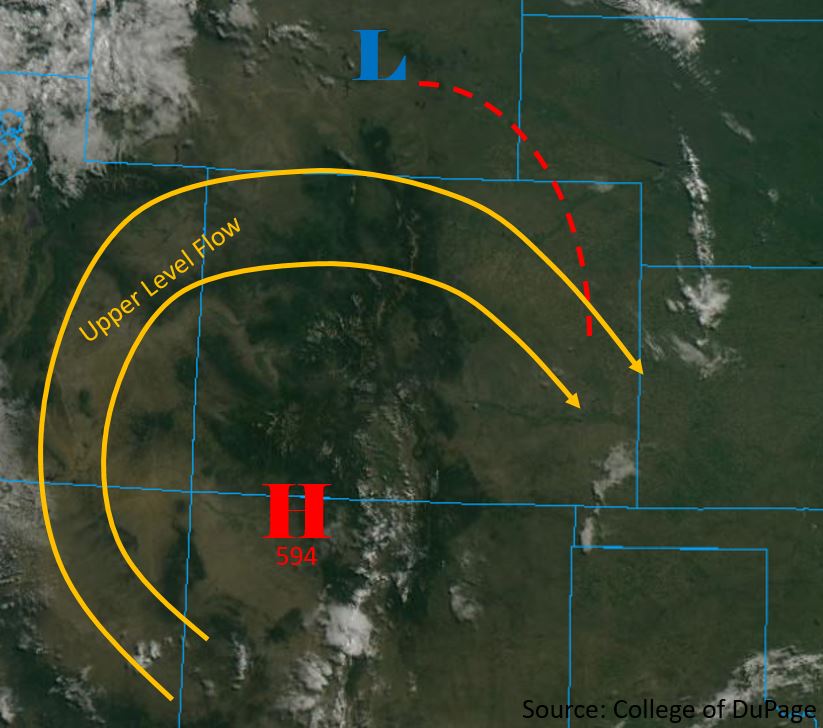
The high pressure ridge over the southwest will continue to move its way slowly to the east and is currently situated over the CO/NM border . Flow aloft will increase today as the ridge builds overhead, with the jet streak remaining to the north of Colorado. The dry air mass that moved over the state yesterday decreased atmospheric moisture significantly, with Denver and Grand Junction measuring 0.6 and 0.41 inches of PW this morning. Counterclockwise flow around the high pressure to the south (marked H below) will slowly increase moisture throughout the state, but it will not be a major factor in today’s weather.
Surface high pressure remains over the high country and will keep most areas west of the Continental Divide dry today. Low pressure is forecast to form over central Colorado and central Wyoming midday and will be the two major drivers for precipitation this afternoon. Afternoon thunderstorms are forecast to begin over the central and southern mountain ranges early this afternoon and move to the southeast throughout the afternoon and into the early evening. Additional storms are forecast to form along a warm front over the Northeast Plains (red line below). Low levels of surface and atmospheric moisture should keep storm bases high, with the primary threat being wind gusts up to 60 mph within the storms vicinity.
Today’s Flood Threat Map
For more information on today’s flood threat, see the map below. For Zone-Specific forecasts, scroll below the map.

Zone-Specific Forecasts:
Front Range, Urban Corridor, Northeast Plains, Palmer Ridge, Southeast Plains, Southeast Mountains, Raton Ridge:
Afternoon thunderstorms are forecast throughout the area this afternoon. Over the mountainous regions and urban corridor, storms are forecast to areas south of the Denver Metro area. Storms will begin from 1 PM (west) to 3 PM (east) and end by 8 PM (north) and 12 AM (south). Max 1 hour rainfall rates of 1.2 inches are forecast over the far eastern edge of the Northeast Plains and 0.6 inches over the Palmer Divide, and southern portions of the Front Range and Urban Corridor. The Spring Creek burn area is not forecast to receive more than 0.25 inches in 1 hour, however storms over the area for 2-3 hours should be monitored closely. Flooding is not forecast over the area today.
Primetime: 1PM to 12AM
Northwest Slope, Northern Mountains, Grand Valley, Central Mountains, Southwest Slope, San Juan Mountains, San Luis Valley:
Storms are forecast over the Central Mountains, eastern San Juan Mountains and San Luis Valley. Dry air over the northwest quadrant of the state will limit precipitation over the area. Storms are forecast to begin by around noon and end early this evening, however weak storms may remain over the San Juan Mountains until 10PM. Max 1-hour rainfall rates of 0.75 inches are forecast over the eastern San Juan Mountains. Storms are forecast to move over the eastern half of the San Luis Valley, but dry air underneath the storm base should limit max 1-hour rainfall rates to 0.6 inches. Flooding is not forecast over the area today.
Primetime: 12PM to 10PM