Issue Date: Saturday, August 3rd, 2019
Issue Time: 10:10AM MDT
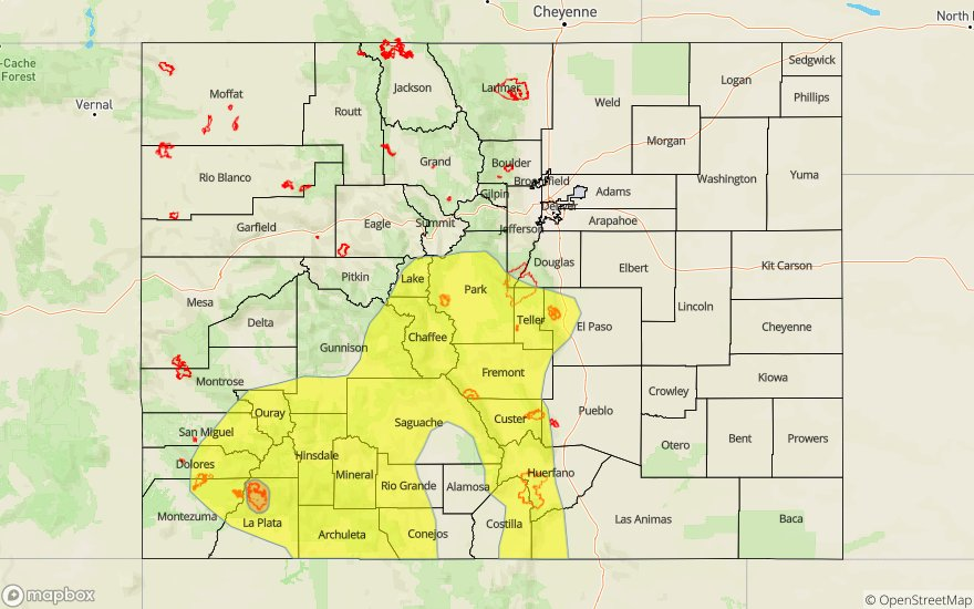
-A MODERATE threat has been issued for the 416 burn area
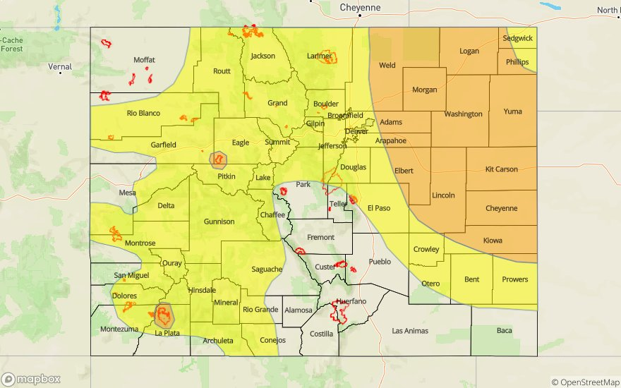
-A LOW flood threat has been issued for portions of the Southwest Slope, San Juan Mountains, Central Mountains, Front Range, Urban Corridor and Southeast Mountains. This threat includes the Junkins, Hayden Pass, and Spring Creek burn areas
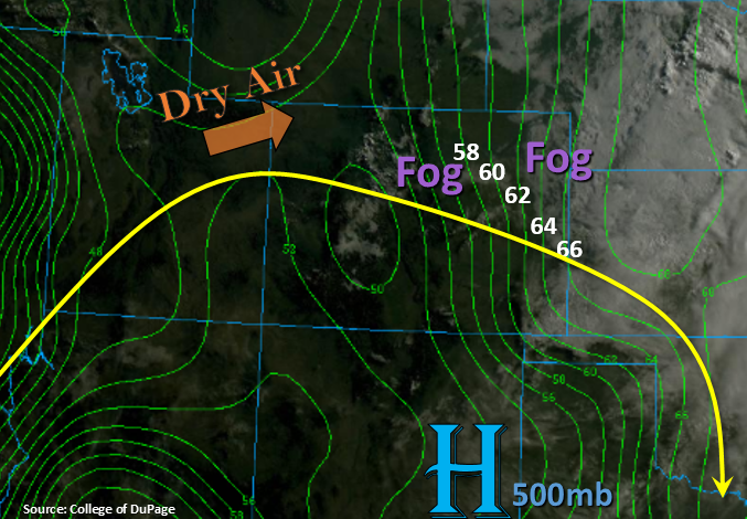
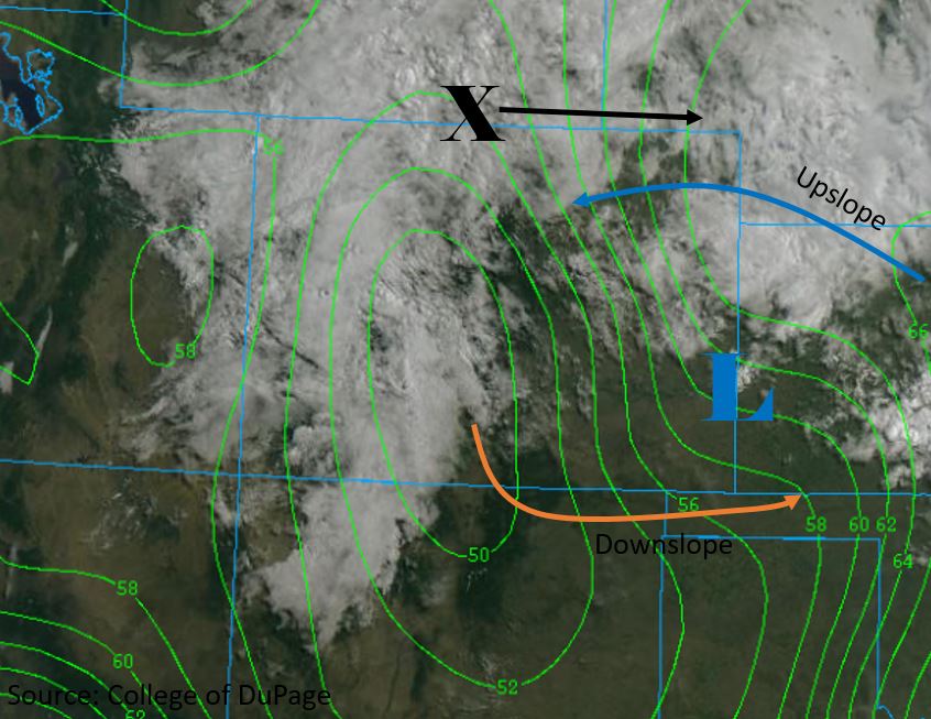
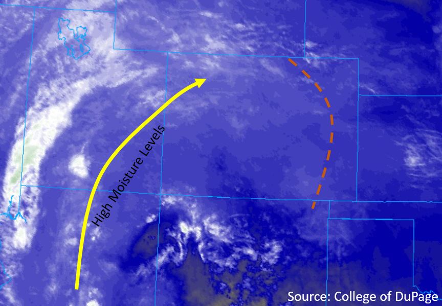
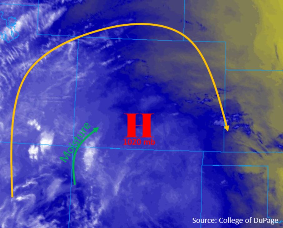
Overall the upper level pattern is similar to yesterday, with the subtropical high now positioned over the Four Corners. As a result, storms are forecast to be confined to the mountains once again today. Clockwise flow, shown in the midlevel water vapor imagery below, will confine moisture to the southern mountain ranges, while northerly flow over the eastern plains should cap most storms over the area. Atmospheric moisture levels are moderate, with PW measuring around 0.75 inches at Denver and Grand Junction this morning. Surface high pressure centered over the Central Mountains will produce downsloping winds this morning and combine with sunny skies to mix out surface moisture throughout the state. A surface dryline over the northwest should prevent storm activity over the area.
There are currently no shortwaves forecast to move over Colorado today, meaning storms will be upslope driven systems over the mountains. Convection is forecast to begin early this afternoon, primarily over the mountain ranges to the south of I-70. Upper level steering flows will be slow to moderate, allowing storms to linger over areas for 1.5-2 hours. Multiple storms passing over the burn areas and steep terrains will create the greatest threat today, so a Moderate flood threat has been issued over the 416 burn area.
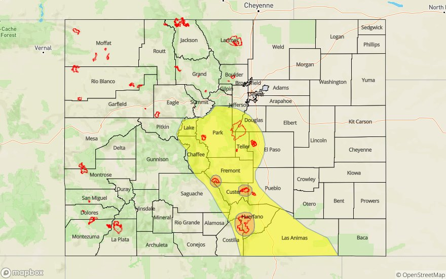
Today’s Flood Threat Map
For more information on today’s flood threat, see the map below. For Zone-Specific forecasts, scroll below the map.

Zone-Specific Forecasts:
Southwest Slope, San Juan Mountains, San Luis Valley, Grand Valley, Northwest Slope, Northern Mountains, Central Mountains:
Storms are forecast to begin early this afternoon, primarily over the regions within the Low flood threat area. Steering flows out of the north-northwest will cause storms to favor the southern facing slopes. Max 3-hour rainfall rates up to 1.25 inches are forecast over the Central Mountains, San Juan Mountains, and Southwest Slope, with isolated max 1-hour rainfall rates up to 0.75 inches. Dry air incoming from the northwest will limit rain over the Grand Valley, Northwest Slope and Northern Mountains to max 1-hour rainfall rates of 0.3 inches. Storms may drift over the San Luis Valley, but accumulations are forecast to be minimal. Threats over and near the 416 burn area include flash flooding, flooding of small streams and rivers, debris slides and mud flows. Storms over most areas will end in the late afternoon to early evening, however the threat over the southwest corner extends into tomorrow morning.
Primetime: 1PM to 5AM
Front Range, Urban Corridor, Southeast Mountains, Raton Ridge, Southeast Plains, Palmer Ridge, Northeast Plains:
Storms today are likely to be confined to the mountains, with chances over the southern Urban Corridor and western Palmer Ridge as well. Steering flows between 15 and 20 mph out of the north-northwest should prevent storms over the eastern plains. Moderate chances for persistent storms over a 2-3 hour period over the Southern Front Range, southern Urban Corridor, and Southeast Mountains has issued a Low Flood Threat over the area. This threat includes the Hayden Pass, Junkins and Spring Creek burn areas. Max 2-3 hour rainfall rates up to 1.25 inches are forecast over the area, with isolated pockets of up to 1.5 inches. Max 1-hour rainfall rates of 0.6 inches are also possible over these areas. The primary threat is over steep terrain and burn areas, with threats of flash flooding, debris flows, and mud slides. Storms are forecast throughout the afternoon and into the early evening, with the threat over the Southeast Mountains ending by 11PM. Storms may move off of the mountains and over the adjacent plains, however max 1-hour rain rates will be limited to 0.3 inches.
Primetime: 1PM to 11PM