Issue Date: Monday, August 19th, 2019
Issue Time: 9:40AM MDT
— Flooding is NOT expected today
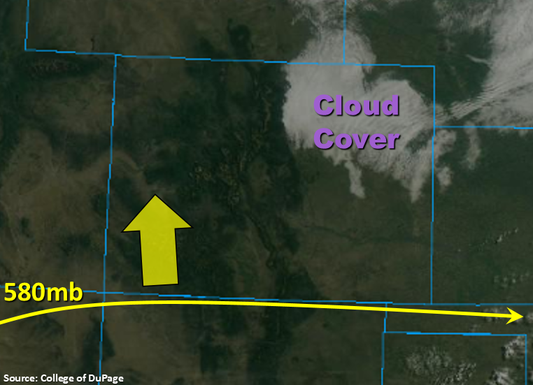
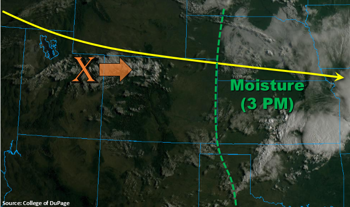
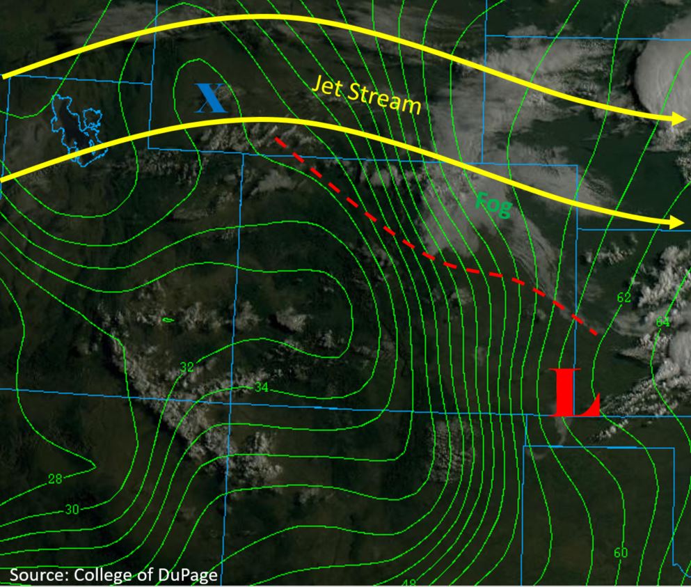
Another day of hot, dry weather is forecast with a dry air mass remaining in place over Colorado. The upper level ridge overhead strengthened throughout the day yesterday providing strong subsidence (sinking motion) over the area. This has resulted in a PW decrease with Denver and Grand Junction measuring 0.52 and 0.41 inches this morning, respectively. A thin layer of moisture is present in the mid-levels producing some cloud cover, which can be seen in the white colors in the water vapor imagery below. This cloud cover will increase over the west again during the afternoon, but rainfall is not forecast. Chances for measurable rainfall will increase over the far eastern plains as a shortwave (“X” below) moves over the state from the southwest and mixes with a little more moisture. At best, there will be some weak afternoon thunderstorms just to the east of the dryline (orange line below). Dew points in the upper 40°Fs to 50°F will keep accumulations well below flood threat criteria and may produce some brief, gusty winds. Flooding is not forecast for today.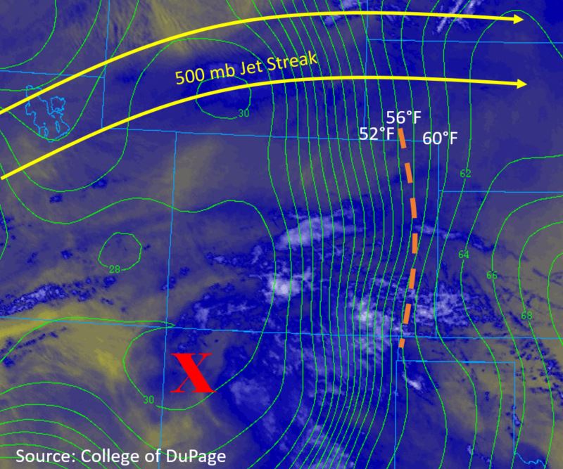
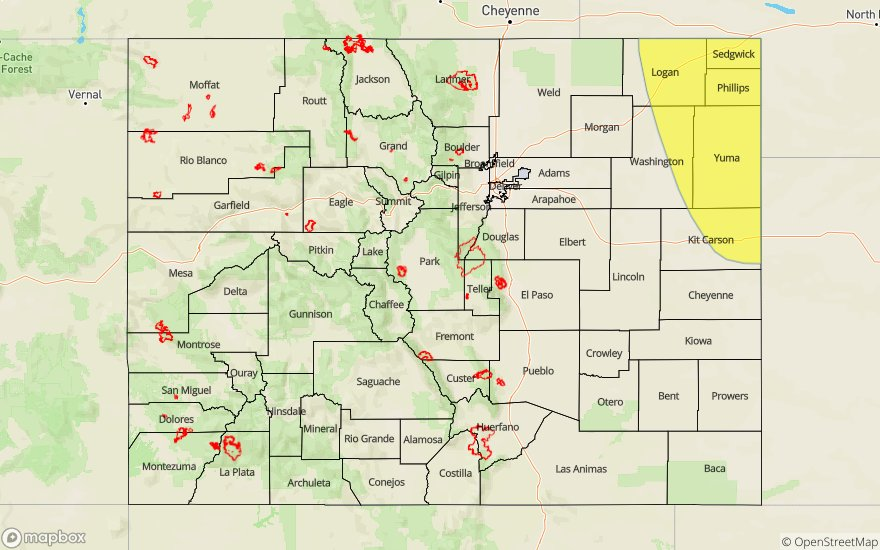
Today’s Flood Threat Map
For more information on today’s flood threat, see the map below. For Zone-Specific forecasts, scroll below the map.

Zone-Specific Forecasts:
Front Range, Urban Corridor, Northeast Plains, Palmer Ridge, Southeast Plains, Southeast Mountains, Raton Ridge:
There is a slight chance for weak thunderstorms over the far eastern plains this afternoon to the east of the dryline. A deep layer of dry air will limit max 1-hour rainfall rates to 0.25 inches. Wind gusts up to 45 mph are possible in the storm’s vicinity. High temperatures are forecast to increase 2-5°F with temperatures nearing or exceeding records in Colorado Springs and Pueblo. Flooding is not forecast over the area.
Primetime: 1PM to 7PM
San Luis Valley, San Juan Mountains, Southwest Slope, Grand Valley, Northwest Slope, Central Mountains, Northern Mountains:
High pressure has set in over the west this morning, which has decreased winds, and thus fire danger, over the area. However, the area will remain very dry so caution is still needed with open flames. Cloud cover is forecast to increase over the area throughout the day when compared to the last couple of days, which should provide some shade from the afternoon sun. There is no precipitation forecast over the area today.