Issue Date: Wednesday, August 17th, 2022
Issue Time: 10:30AM MDT
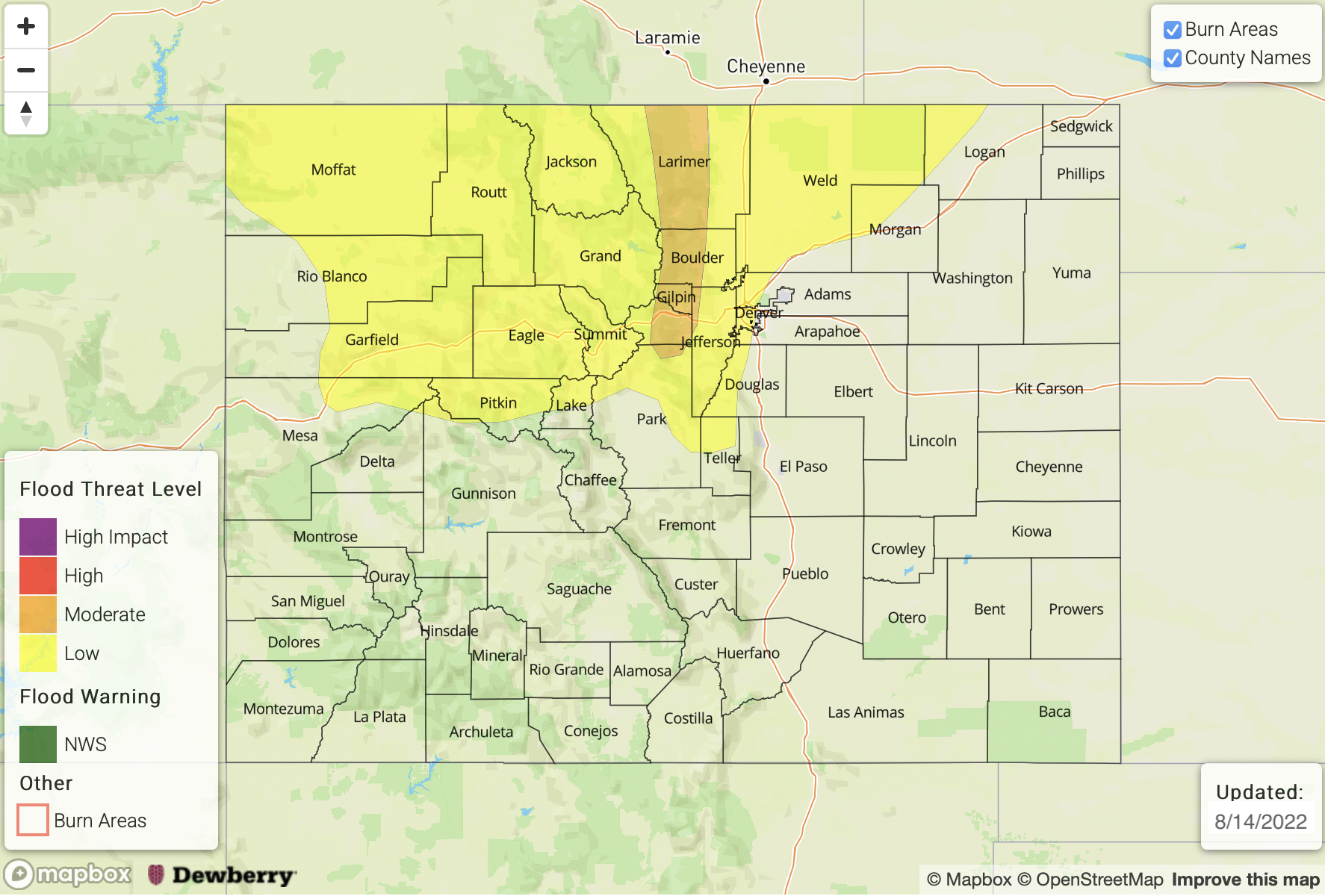
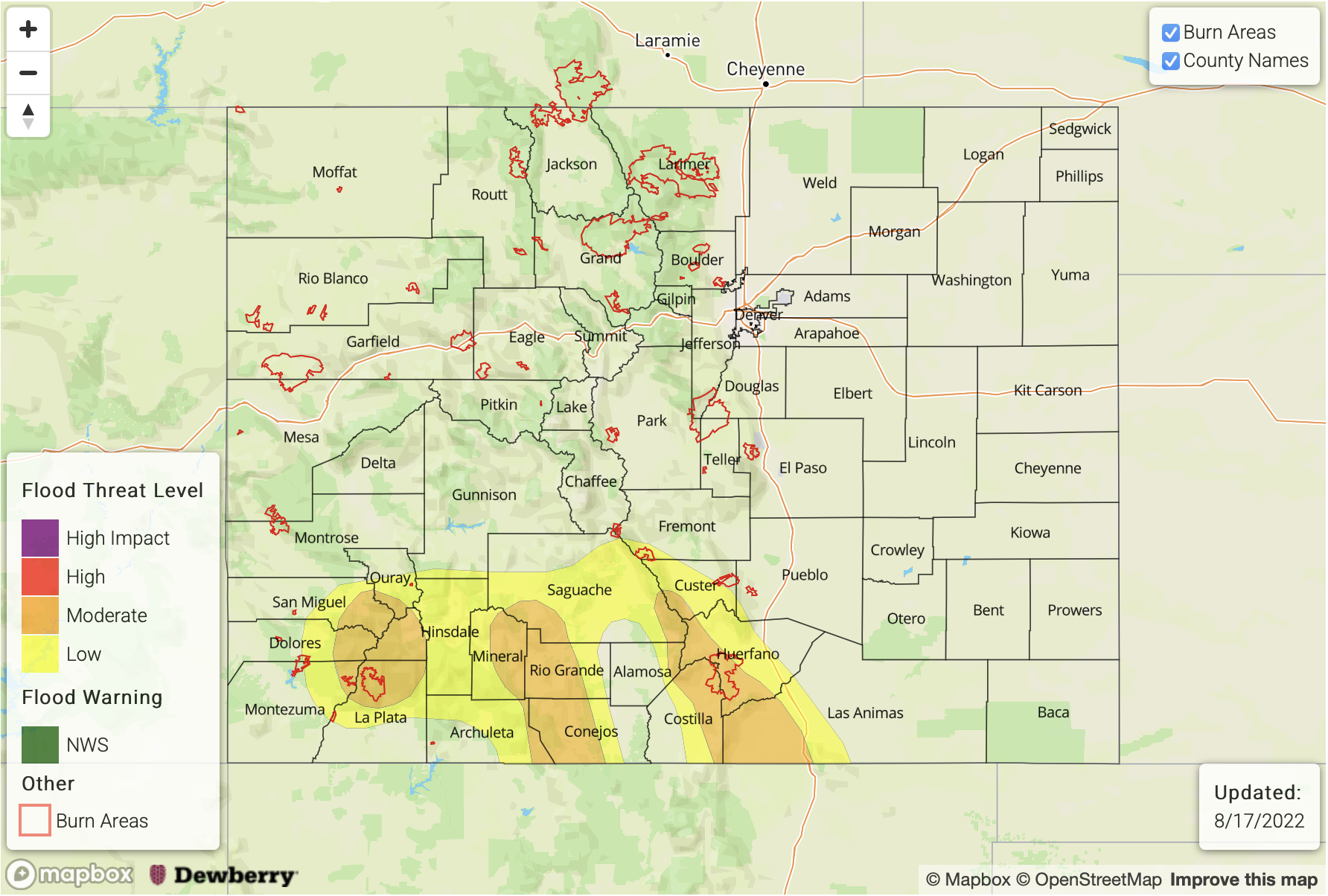
— A MODERATE/LOW flood threat has been issued for portions of the Southwest Slope, San Juan Mountains, Southeast Mountains and Raton Ridge
— Fire-Burn Forecast Summary: 1 burn area under HIGH threat; 1 burn area under LOW threat; click HERE for more info
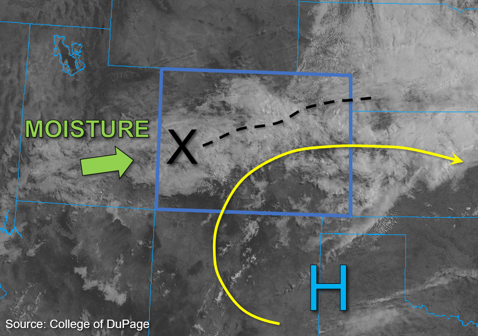
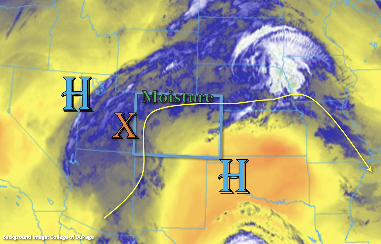
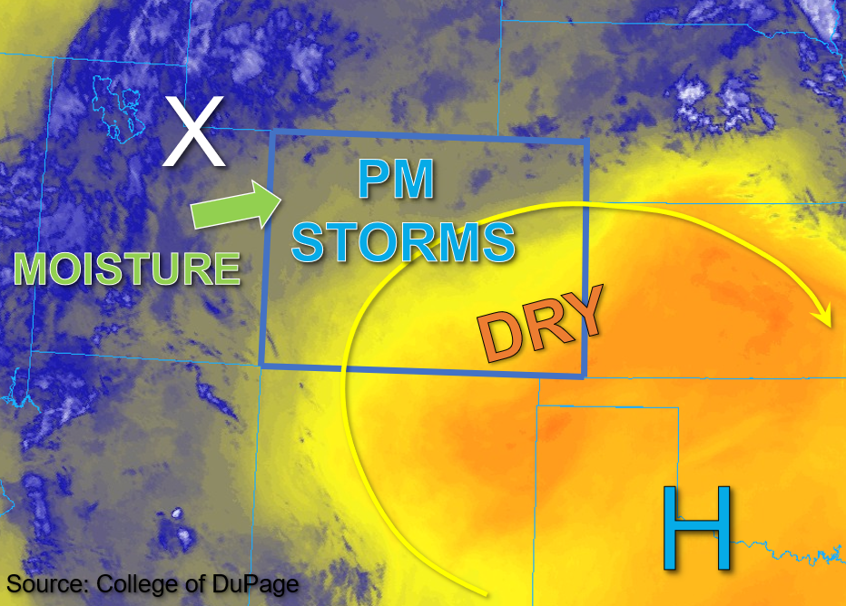
There’s a strong High pressure ridge over the western US with a secondary High near the four corners region this morning. Northwest flow aloft should take over today and help push a drier air mass from north to south, which should limit rainfall chances across the northern tier of Colorado. In North Platte’s morning sounding, PW was measured at 1.01 inches with much drier air noted above 700mb. PW at Platteville has dropped to 0.71 inches, so the drying trend is underway. Currently, there is some ongoing cloud cover, fog and light showers over southern and eastern Colorado associated with a departing shortwave and monsoon moisture. With stable conditions forecast over the eastern plains by this afternoon, rainfall is unlikely to develop behind the current wave of showers. The most welcome news is that high temperatures will continue to run below average for most of the state, and the southeast corner could see temperatures up to 15°F below average.
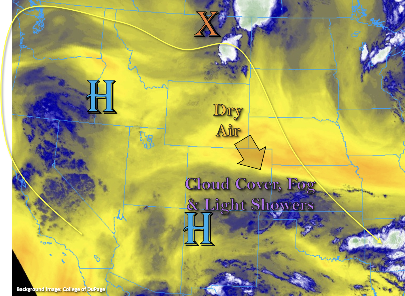
Drier air has also started to work its way into portions of western Colorado with a nice dry pocket noted at 400mb in Grand Junction’s morning sounding. PW is still elevated (1.14 inches) with values estimated near an inch near the southwest border. With mid-level energy, moisture and upslope flow combining again today, another round of scattered to numerous storms are forecast for the central and southern mountains. Storm motion towards the southeast should still be relatively slow and will likely cause some spillover of rain into the San Luis Valley again. The one limiting ingredient to today’s flood threat will be instability with the cooler temperatures, ongoing cloud cover and morning showers. However, with an adequate warm layer depth and some breaks in cloud cover, stronger storms that develop should produce some very efficient rain rates again both in the 1-hour time frame (more isolated) and the longer duration 3-hour time frame. A Moderate/Low flood threat has been issued through this evening with the main flood threats being mud flows and debris slides (mountains), road flooding, excessive runoff and ponding in low-lying areas. These threats increase if storms track over soils that have received a good dose of precipitation over the last couple of days (southern San Juan Mountains, Southeast Mountains and western Raton Ridge).
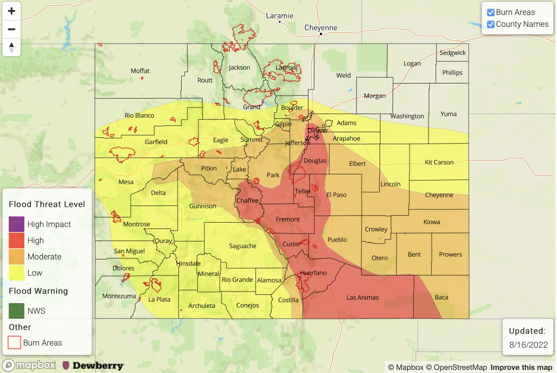
Today’s Flood Threat Map
For more information on today’s flood threat, see the map below. If there is a threat, hover over the threat areas for more details, and click on burn areas to learn more about them. For Zone-Specific forecasts, scroll below the threat map.
Zone-Specific Forecasts:
Southeast Mountains, Raton Ridge, San Juan Mountains, San Luis Valley, Southwest Slope, Central Mountains, Grand Valley & Southeast Plains:
Ongoing rainfall is expected to continue and strengthen with a little daytime heating as they move southeast. Behind this first wave of storms, drier conditions are forecast. Where some higher instability can develop with breaks in the cloud cover, isolated max 1-hour rain rates up to 1.5 inches could be realized. Longer duration rainfall will be the main threat for most areas with max 3-hour rain rates up to 2.5 inches possible. Mud flows, debris slides, road flooding and rises on local streams/creeks could occur, especially if storms track over already saturated soils. A Moderate/Low flood threat has been issued.
Primetime: 11AM to 10PM
Front Range, Urban Corridor, Palmer Ridge, Northeast Plains, Northwest Slope & Northern Mountains:
It should be drier and cooler for these zones today with some isolated precipitation possible over the Palmer Ridge. Isolated storms may also develop over the southern Front Range near the Continental Divide, but storm totals should remain under 0.5 inches. Flooding is NOT expected.
Primetime: 4PM to 9PM