Issue Date: Friday, September 20th, 2019
Issue Time: 9AM MDT
— Flooding is NOT expected today
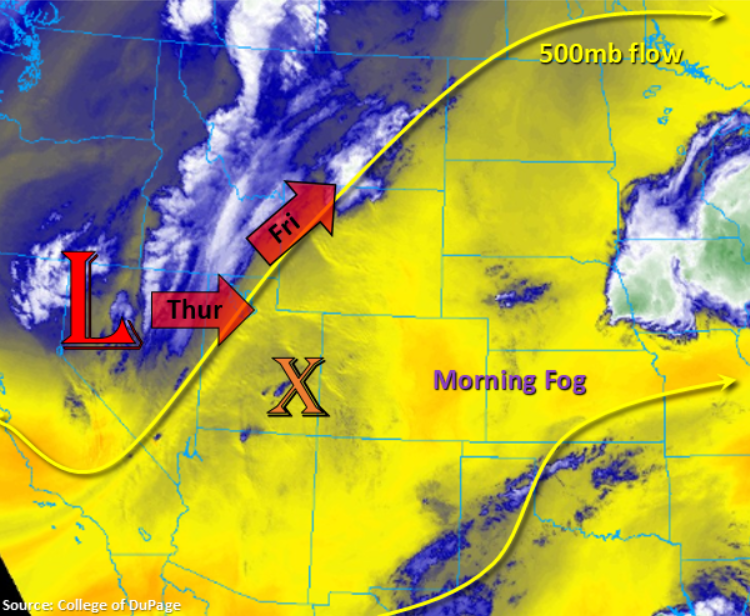
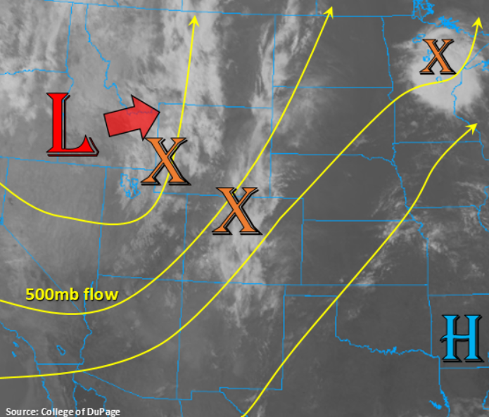
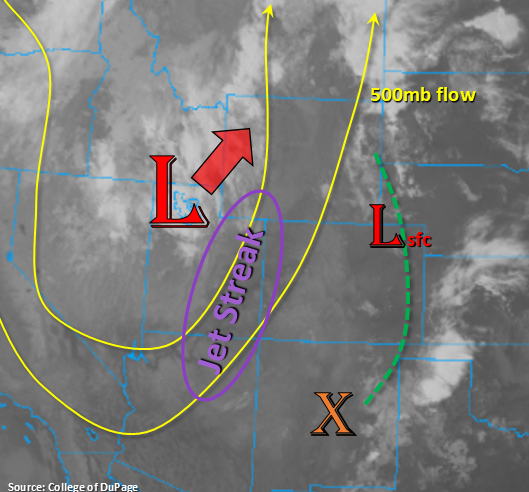
Quite a bit happening this Friday with the upper level trough moving NNE throughout the day. It is currently over northern Utah and is forecast to be over the WY/MT border by this evening. This will put western Colorado under the influence of a jet streak (purple oval below). Thus, strong SW/SSW surface winds are forecast this afternoon (15 to 25 mph) with gusts between 35 and 40 mph anticipated. On top of that, a dry air mass begins to move over the area located at the base of the trough. This will cause elevated and critical fire weather over western Colorado and portions of the mountains. A Red Flag Warning has been issued by the Pueblo NWS WFO (Weather Forecast Office) from noon today until 9PM tonight for the Southwest Slope and Grand Valley. Additionally, very cold overnight temperatures are anticipated for the lower elevations of the Northwest Slope with northwest winds behind the trough, so a Freeze Watch is in place. Not thinking there will be much storm development over the mountains this afternoon with the drier air and strong winds aloft (shear the tops of the storms), but a couple isolated showers may be possible favoring the eastern San Juan Mountains and Central Mountains near and along the Continental Divide. Storms may produce some strong outflow gusts due to the temperature/dew point spread.
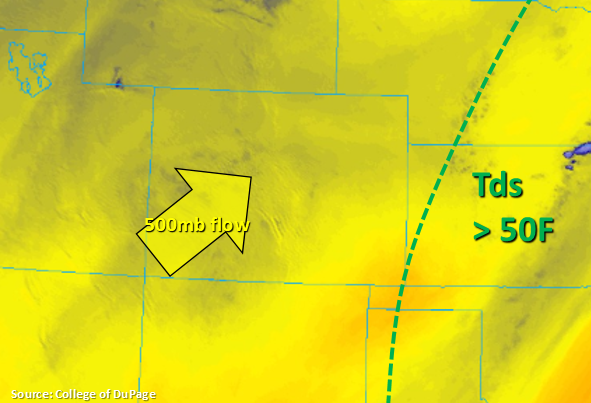
Over eastern Colorado, a surface low develops this afternoon associated with the upper trough. This will help set up a dryline over the eastern plains by noon with higher dew points on the east side of this line (green dashed line below). This will help produce lift for isolated storms, some which may become severe, over the eastern plains favoring the eastern Colorado border once again. With fast storm movement to the NNE, not thinking flooding will be an issue, but large hail (up to 1.75 inches) and strong outflow winds (35-40 mph) are anticipated with the severe storms that do develop. Additionally, the tightening pressure gradient will produce some strong southwest (west) and south (east) surface winds and gusts up to 35 mph, which will create elevated fire danger. This is especially true for the immediate adjacent plains over eastern Colorado where dew points are forecast to be lower. A stronger cold front drops through from the north again this evening in the wake of the trough, so overnight lows will drop into the low 50°Fs behind it with temperatures in the 70°Fs for the lower elevations tomorrow (minus the far southeast corner). Flooding is not forecast.
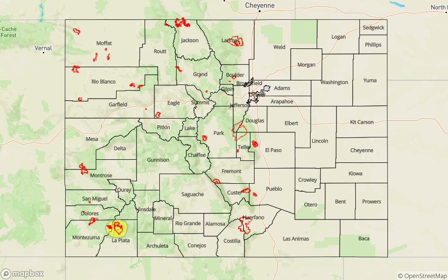
Today’s Flood Threat Map
For more information on today’s flood threat, see the map below. For Zone-Specific forecasts, scroll below the map.
Zone-Specific Forecasts:
Central Mountains, Northern Mountains, San Juan Mountains, Front Range, Southeast Mountains Northwest Slope, Grand Valley, Southwest Slope, San Luis Valley:
Critical and Elevated fire weather are the main concerns this afternoon with the jet in place over western Colorado and the mountains. Not expecting much rainfall with a drier air mass moving in and strong winds aloft. However, a couple of storms may briefly form along the Continental Divide and southern San Juan/Southeast Mountains. Max 1-hour rain rates up to 0.2 inches will be possible (south), but most storms that form will produce under 0.1 inches. Strong outflow winds will be likely with storms that do form with higher winds more easily mixing to the surface. Overnight lows are expected to rapidly drop off once winds shift to the northwest and skies begin to clear. A Freeze Watch is in effect for portions of the Northwest Slope and western Northern Mountains. Flooding is not forecast.
Primetime: 11AM to 10PM
Urban Corridor, Raton Ridge, Palmer Ridge, Southeast Plains, Northeast Plains:
Elevated fire weather is anticipated this afternoon with a tightening surface gradient. This is especially true over the Urban Corridor, western Southeast Plains and Raton Ridge where dew points will drop off more rapidly with the dry air mass arriving sooner. A couple, isolated storms will be possible near the eastern border along a dryline that sets up. The main threats will be large hail and strong outflow gusts for the severe storms that are able to form. Max 1-hour rain rates up to 1 inch will be possible, and with quick movement to the northeast (~20mph), flooding should be avoided. Some light showers may be possible over this same area as the front drops through overnight, but only light accumulations are expected (under 0.05 inches).
Primetime: 2PM to 7PM