Issue Date: Tuesday, May 5th, 2020
Issue Time: 8:25AM MDT
— Flooding is NOT expected today
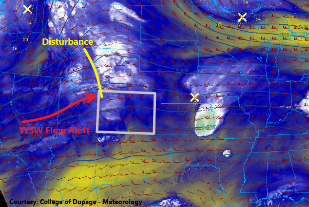
It’s a cooler start to the morning with a Frost Advisory in effect for the northern Front Range and Urban Corridor through 8AM. Currently, there is a disturbance over southern Colorado (orange “X”) that helped produce some overnight rainfall for the area. This is the same boundary that helped initiate the convection over the Palmer Ridge Monday afternoon. Expecting the disturbance to move eastward throughout the morning and clearing skies to fill in behind it.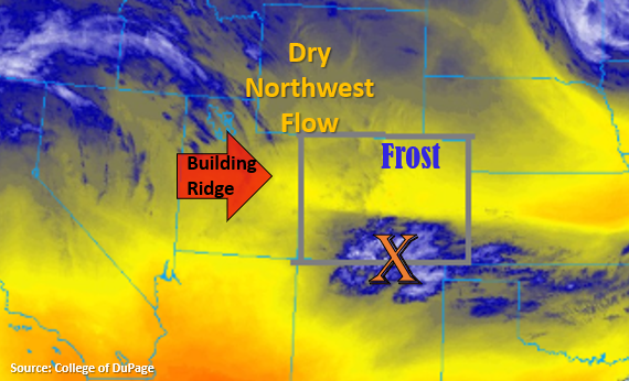
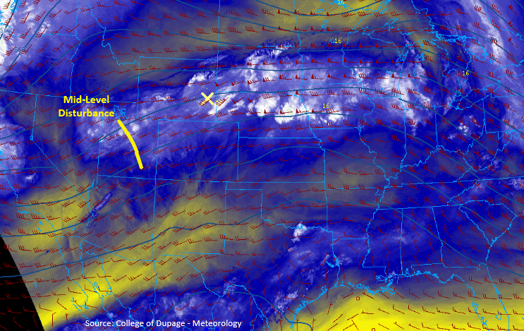
Mild weather day ahead of us as the ridge begins to build over the state from the west and dry northwesterly flow drives the upper levels. A minor disturbance within the flow will likely help produce some cloud cover over the Southeast Mountains and Front Range, which will then be pushed into the adjacent plains for some afternoon and evening cloud cover. The only moisture available for storms is marginal, and is located over southern Colorado where the current disturbance is located. Over this area there may be some light rainfall later this afternoon into the evening along a convergence boundary. Gusty winds will likely accompany any storms that do form due to the storms being outflow driven. Once again, flooding is not anticipated.
Today’s Flood Threat Map
For more information on today’s flood threat, see the map below. If there is a threat, hover over the threat areas for more details, and click on burn areas to learn more about them. For Zone-Specific forecasts, scroll below the threat map.
Zone-Specific Forecasts:
Northern Mountains, Front Range, Palmer Ridge, Urban Corridor, Northeast Plains, Raton Ridge, Southeast Mountains, Southeast Plains & Central Mountains:
Temperatures are back on the rise again today with highs in the 70Fs for the lower elevations and 50Fs for the mountain valleys. Best chance for rainfall this afternoon is over the southern border along the Raton Ridge and Southeast Plains. Storm totals up to 0.20 inches are possible with a lot of storms producing only very light rainfall. The main threats will be downburst winds as they will be outflow driven due to the large temperature and dew point spread. Elsewhere cloud cover will increase throughout the day with a sprinkle or two possible under the bases.
Primetime: 3PM to Midnight
Grand Valley, Northwest Slope, Southwest Slope, San Luis Valley & San Juan Mountains:
With the ridge building north and decreasing surface winds, there will be a break (for a day) in critical fire weather. Some breezy conditions may be possible over the south, central mountains and San Luis Valley, so there is still some elevated fire danger in these parts. Temperatures will be increasing with highs in the 70Fs for the valleys and 50Fs for the mountain valleys.