Issue Date: Wednesday, May 13th, 2020
Issue Time: 8:25AM MDT
— Flooding is NOT expected today
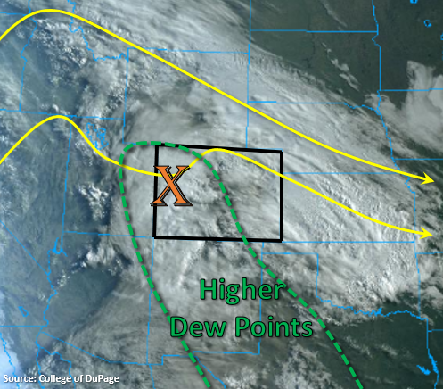
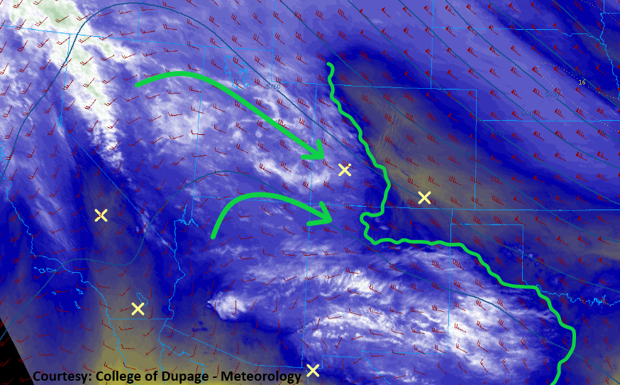
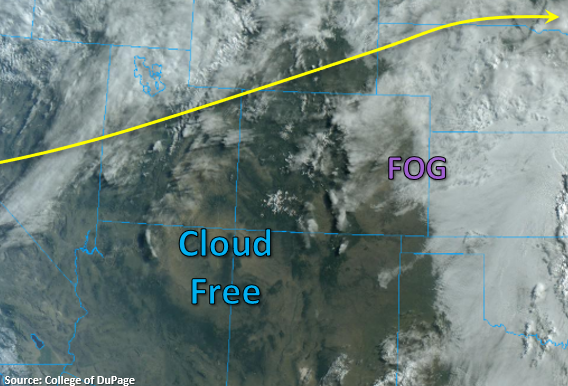
WSW flow aloft continues to pull in a very dry air mass as indicated by PW measurements in Grand Junction and Denver – 0.26 inches. Visually, this dry air can be seen by the cloud free conditions in the satellite image below. There is cloud cover east of the Continental Divide and some dense fog being reported over the far eastern plains, but this is expected to mix out rather quickly. Westerly flow aloft will produce a surface low over eastern Colorado, which will help increase surface speeds and produce Red Flag conditions across southern Colorado. Outside of scattered, light rainfall over the northwestern Colorado border late this afternoon (passing shortwave to our north), rainfall is not forecast today. A weak cold front drops through the state overnight, and will increase moisture behind it. That should set the stage for storms to return tomorrow afternoon over northwestern and eastern Colorado.
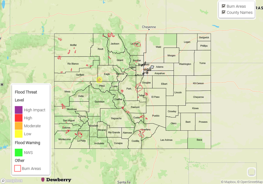
Today’s Flood Threat Map
For more information on today’s flood threat, see the map below. If there is a threat, hover over the threat areas for more details, and click on burn areas to learn more about them. For Zone-Specific forecasts, scroll below the threat map.
Zone-Specific Forecasts:
Northwest Slope, Northern Mountains, & Central Mountains:
Temperatures will reach around 70F for the lower elevations of the Northwest Slope and 60F over the mountain towns. A passing shortwave to the north of the state may produce some light showers over the northern border. Best chance for accumulation will be the Northern Mountains (Routt and Jackson County) where very isolated totals up to 0.20 inches may be possible. Expect lower amounts and some wind over Moffat County. Flooding is not forecast.
Primetime: 2:30PM to 9PM
Front Range, Southeast Mountains, San Juan Mountains, Southeast Plains, Raton Ridge, Grand Valley, Southwest Slope, & San Luis Valley:
A Red Flag Warning has been issued through this evening for most of the regions mentioned above. The only exception is the San Juan Mountains where surface winds won’t quite meet warning criteria. Over western Colorado, southwest surface winds are forecast to reach 15 to 25 mph with gusts up to 35 mph. Forecasting similar winds for southeast Colorado, but lower relative humidity values (single digits); thus, increased danger. With temperatures in the 80Fs and plenty of dry fuels, fires will be able to spread quickly. Please use caution with anything that can cause a spark, and tune into your local NWS office for more information.
Urban Corridor, Northeast Plains, & Palmer Ridge:
Starting to heat up once again with highs in the 80Fs forecast. Broken cloud cover this afternoon should help provide a little respite from the heat. With a dry air mass in place and downsloping winds, rainfall is not forecast.