Issue Date: 5/17/2020
Issue Time: 7:45 AM
— Flooding is NOT expected today
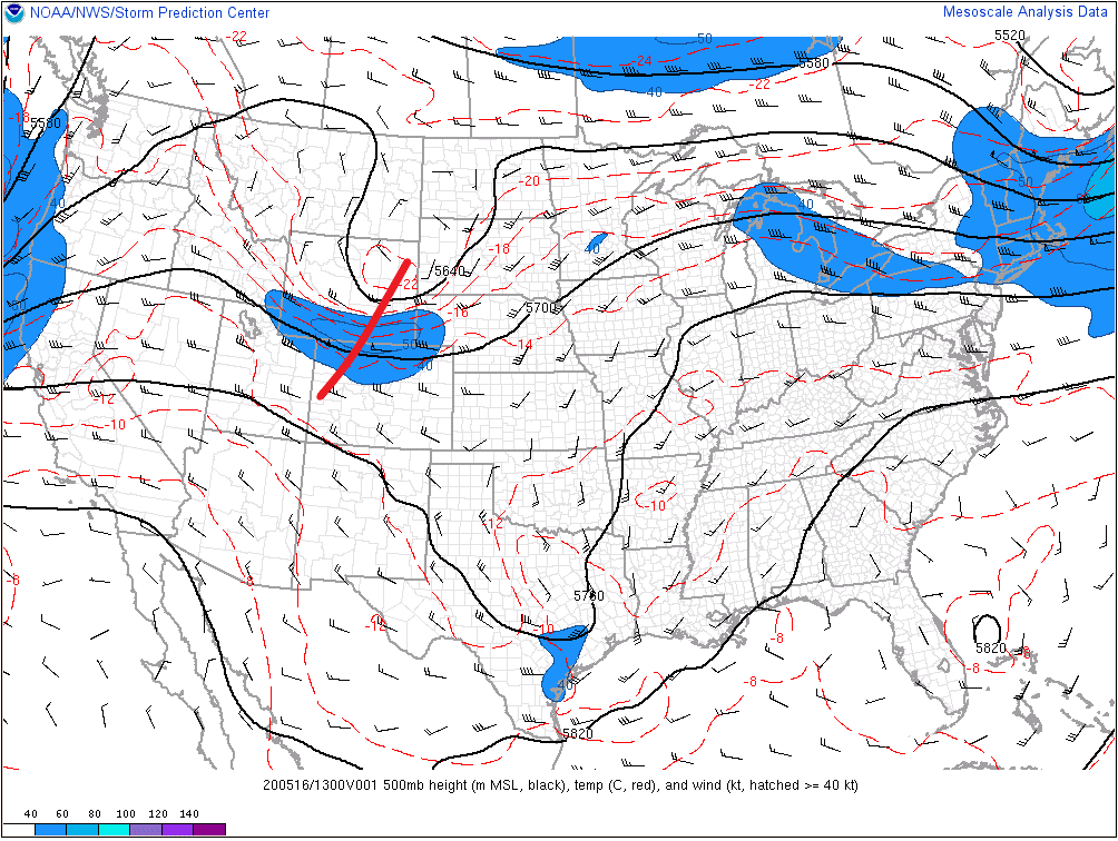
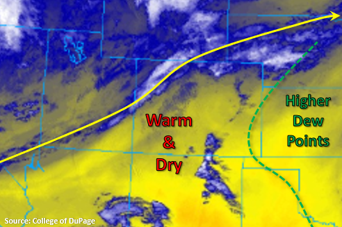
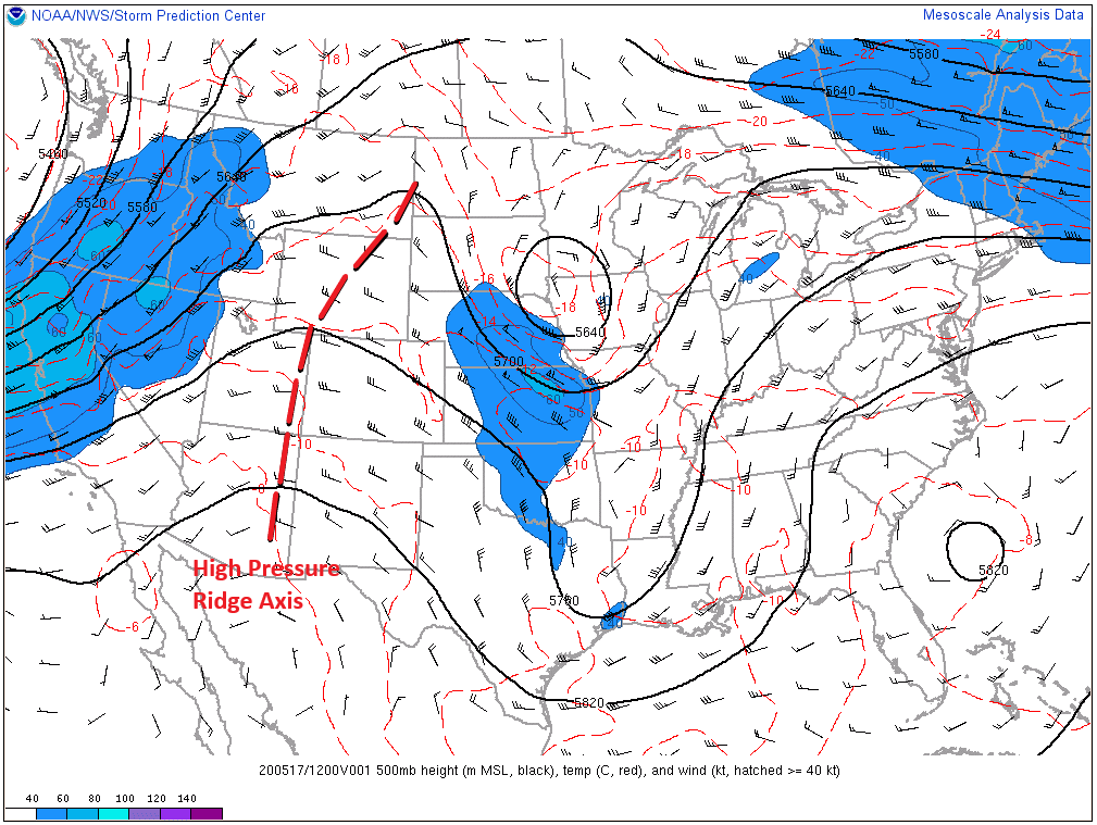
A quick glance at the image below will be enough to find the major controlling factor of today’s forecast: the ridge of high pressure that is building over the mountain west. The axis of that ridge will shift slightly eastward today, centering itself over Colorado, and bringing warmer and drier conditions to the state. Over much of the High Country, the dry and warm conditions will be attended by gusty winds, leading to elevated fire danger. Red Flag Warnings have been issued, so please check with your local National Weather Service office for more information.
There remains a chance for a couple isolated thunderstorms over the Southeast Mountains and southern Front Range, eventually rumbling eastward over the adjacent Southeast Plains, southern Urban Corridor, Raton Ridge, and Palmer Ridge. Moisture is on the marginal side, so gusty winds and brief periods of light-to-moderate rainfall will be the main impacts. One or two may become strong-to-severe, producing hail up to 1 inch in diameter and strong winds.
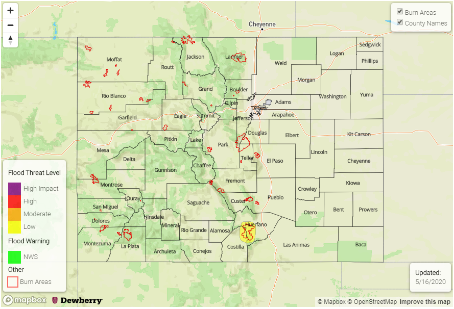
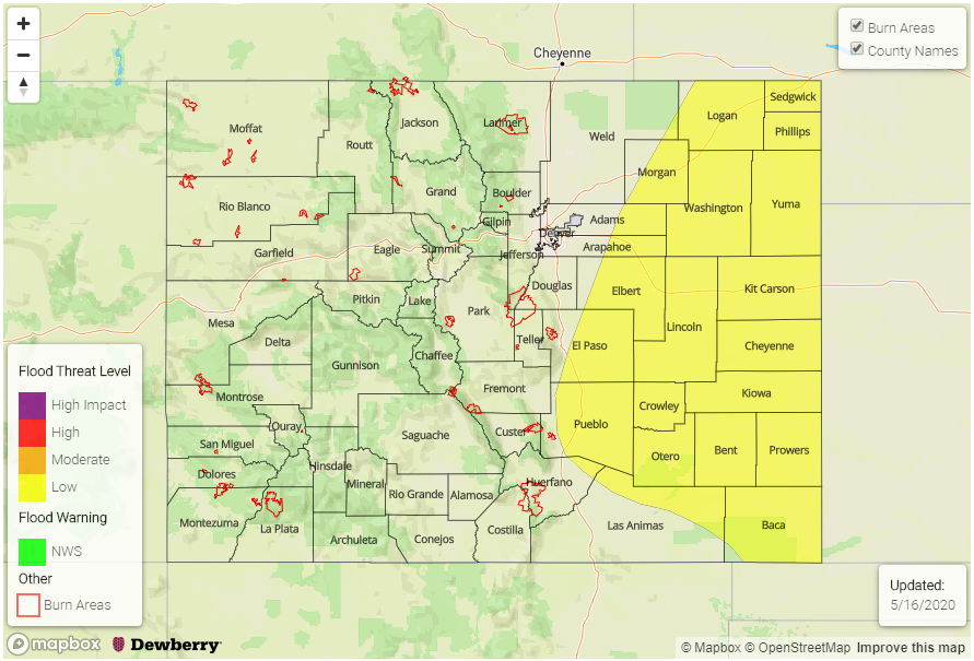
Today’s Flood Threat Map
For more information on today’s flood threat, see the map below. Hover over the threat areas for more details and click on burn areas to learn more about them. For Zone-Specific forecasts, scroll below the threat map.

Zone-Specific Forecasts
Front Range, Southeast Mountains, Urban Corridor, Palmer Ridge, Northeast Plains, Southeast Plains, and Raton Ridge:
Mainly dry and warmer, with only a few isolated thunderstorms expected over the Southeast Mountains and southern Front Range, eventually rumbling eastward over adjacent areas. Any storm activity will begin between 1 and 3 PM, maximizing in coverage around 6-8 PM, and then diminishing quickly after that. A few light remnant showers will dissipate over the Southeast Plains early tomorrow morning. Rain rates will generally be less than 0.2 inches/hour, but stronger thunderstorms over the Southeast Plains may produce rainfall up to 0.5 inches/hour.
Northwest Slope, Northern Mountains, Grand Valley, Central Mountains, Southwest Slope, San Juan Mountains, and San Luis Valley:
Warmer and drier, with gusty winds and elevated fire danger being the main concern. This will likely be the warmest day of the year so far for many locations. Red Flag Warnings have been issued for much of the area, so please check with your local National Weather Service office for more information.