Issue Date: Thursday, May 14th, 2020
Issue Time: 8:30AM MDT
— Flooding is NOT expected today
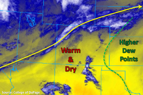
Moisture has begun to return to the state behind a cold front that moved through overnight as evidenced by late night storms over the northern Urban Corridor. PW was measured at 0.60 inches and 0.48 inches for Denver and Grand Junction, respectively. That’s quite the increase from this time yesterday. With low-level moisture available and weak shortwaves moving through the WSW flow, afternoon and overnight storms will return to the forecast. There isn’t quite as much moisture over western Colorado, so the high-based storms will be restricted to the northern border and favor the Northern Mountains for accumulation.
East of the Continental Divide, upslope flow will start to develop storms over the Front Range and northern Southeast Mountains around noon. Expecting these storms to move into the adjacent plains with ESE storm motion. Best coverage should be over the Northeast Plains and Palmer Ridge, and as storms make it into better moisture over the plains, convection will likely increase in area. This could mean a couple rounds of storms over one location, which would help increase accumulations. With dew points still in the upper 40Fs, and relatively fast storm motion, flooding is not forecast. The central, eastern border counties may see some overnight thunderstorms and rainfall, but it should clear out by morning.
Today’s Flood Threat Map
For more information on today’s flood threat, see the map below. If there is a threat, hover over the threat areas for more details, and click on burn areas to learn more about them. For Zone-Specific forecasts, scroll below the threat map.
Zone-Specific Forecasts:
Front Range, Southeast Mountains, Urban Corridor, Northeast Plains, Palmer Ridge, Southeast Plains, & Raton Ridge:
While the southern Southeast Mountains and Raton Ridge will stay dry, all other regions should see some rainfall and thunderstorms this afternoon. A severe storm or two may be possible for the plains with the main threats being gusty outflow winds and hail around 1 inch in diameter. All storms will be high-based so outflow may produce brief gusts. Max 1-hour rain rates up to 0.50 inches (west) and 1 inch (east) will be possible. Reminder that the central, eastern border counties will likely see some overnight thunderstorms, but it should clear out by morning as the system moves into Kansas. Isolated storm totals by morning could reach up to 1.50 inches. There is no flood threat forecast.
Primetime: 12PM to 5AM
Northwest Slope & Northern Mountains:
A little better moisture in this area before the front stalled out moving south. Storms once again are expected be high-based and produce strong wind gusts in lieu of rainfall. The best chance for accumulation will be over the Northern Mountains where isolated totals up 0.20 inches will be possible by morning. A weak cold front moves through again overnight, which may cause another round of evening storms. Flooding is not forecast.
Primetime: 12PM to 11PM
San Juan Mountains, Central Mountains, Grand Valley, Southwest Slope, & San Luis Valley:
These areas will remain dry today with afternoon temperatures in the low to upper 70Fs in the valleys and mid 50Fs to 60F over the mountains. Due to the jet pulling north into Wyoming, surface winds will decrease. This will eliminate Red Flag Warning conditions for the next couple of days.