Issue Date: Wednesday, June 10th, 2020
Issue Time: 8:50AM MDT
— Flooding is NOT expected today
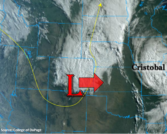
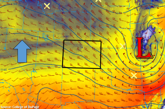
The vigorous system that brought high winds, rain, and snowfall to the state is now well to our east as seen in the image below. That means there will finally be a break in severe surface winds, which have caused so much damage the last couple of days. Behind the Low, northwesterly flow has taken over, which has pulled in a drier air mass to the state. PW at Denver and Grand Junction was measured at 0.36 inches, which is a significant drop off from the last few days. Today, the ridge is forecast to build northward to our west, which means the rebound in high temperatures will begin. Expecting afternoon highs to be 10-15F warmer than yesterday. As for rainfall, there might be a couple high-based showers that develop along the Continental Divide and over the Front Range near the Palmer Ridge with the upslope flow. However, limited low-level moisture will mean that virga and broken cloud cover will be more likely that measurable rainfall.
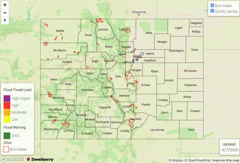
Today’s Flood Threat Map
For more information on today’s flood threat, see the map below. If there is a threat, hover over the threat areas for more details, and click on burn areas to learn more about them. For Zone-Specific forecasts, scroll below the threat map.

Zone-Specific Forecasts:
Northwest Slope, Grand Valley, Central Mountains, San Juan Mountains, Northern Mountains, & Southwest Slope:
Highs this afternoon over the valleys will be in the 70Fs with a few places further south nearing that 80F mark. Surface winds look to increase to about 15 – 20 mph this afternoon over the Central and San Juan Mountain valleys, but other than that, a pleasant day is in store. A couple weak showers may develop over the mountains near the Divide further south, but only a few sprinkles are forecast.
Front Range, Southeast Mountains, San Luis Valley, Raton Ridge, Palmer Ridge, Urban Corridor, Southeast Plains, & Northeast Plains:
Severe winds over the eastern plains are not forecast today with the relaxing pressure gradient. However, surface winds over the San Luis Valley and Northeast Plains may still increase to around 15-20 mph this afternoon. This may bring spotty critical fire weather, but a Red Flag Warning will likely not be issued. Highs are forecast to rebound around 10F with some lower elevations seeing as much as a 15F increase. As far as rainfall, the best chance will be along the Divide and southern Front Range/Palmer Ridge intersect, but only a sprinkle or two are forecast. So overall, a pleasant day is in store.