Issue Date: 6/7/2020
Issue Time: 8:35 AM
— A NWS Flood Advisory is in effected for the Los Pinos River near Bayfield affecting La Plata County due to reservoir releases. Minor flooding of lowlands adjacent to the river is expected downstream from the dam.
— Otherwise, Flooding is NOT expected today
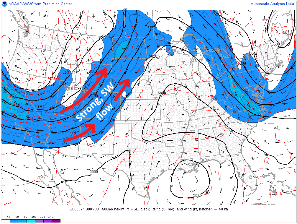
Strong southwesterly flow aloft will help to dry out Colorado today, all-but-eliminating rain chances and increasing fire danger. Expansive Red Flag Warnings have been issued as the dry conditions will be concurrent with strong winds. As far as rain chances for today are concerned, only a couple isolated showers/thunderstorms are expected over the Northwest Slope, western portions of the Northern Mountains, and far northern portions of the Grand Valley regions.
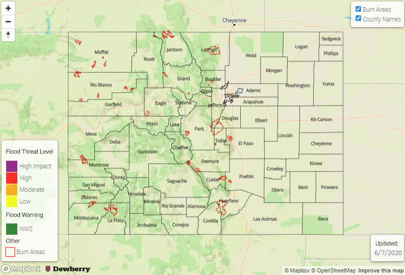
Today’s Flood Threat Map
For more information on today’s flood threat, see the map below. Hover over the threat areas for more details and click on burn areas to learn more about them. For Zone-Specific forecasts, scroll below the threat map.
Zone-Specific Forecasts
Urban Corridor, Palmer Ridge, Northeast Plains, Southeast Plains, and Raton Ridge:
Hot and dry conditions will rule the day, with strong winds elevating fire danger to critical levels. Red Flag Warnings have been issued for much of the area. Please visit your local National Weather Service office website for more details.
Northwest Slope, Northern Mountains, and Grand Valley:
Available moisture from previous days’ showers/thunderstorms will combine with *just enough* support from the low pressure system over the Pacific Northwest and result in the development of a few showers/thunderstorms this afternoon and evening. Gusty winds, lightning, and brief periods of moderate rainfall will attend the strongest storms, relatively speaking. Rain rates are expected to generally be less than 0.2 inches/hour, up to 0.25 inches/hour underneath thunderstorms.
Otherwise, portions of Grand Valley are included in the Red Flag warning area.
Timing: 11 AM – 8 PM
Front Range, Southeast Mountains, Central Mountains, Southwest Slope, San Juan Mountains, and San Luis Valley:
Unseasonably hot and dry conditions, combined with gusty winds, will result in elevated fire danger for much of the area. Red Flag Warnings are currently in effect for portions of the Front Range, Southeast Mountains, Central Mountains, Southwest Slope, and San Luis Valley regions. Please visit your local National Weather Service office website for more details.