Issue Date: Sunday, June 14th, 2020
Issue Time: 8:55AM MDT
— Flooding is NOT expected today
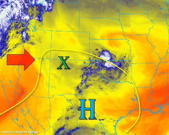
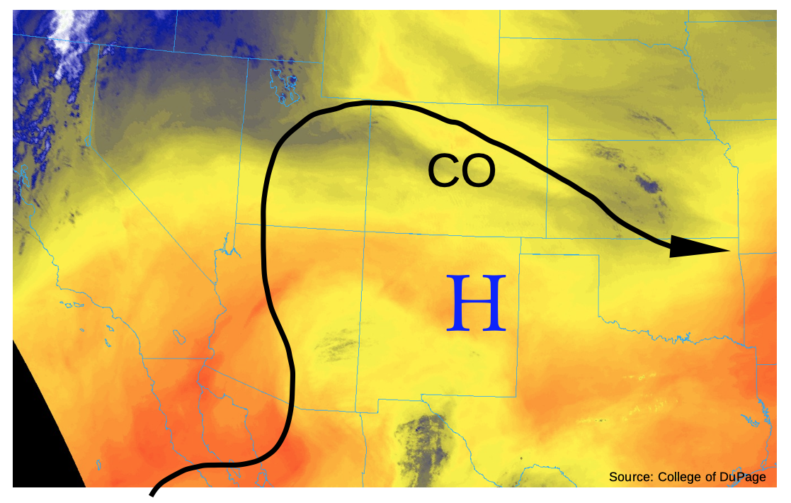
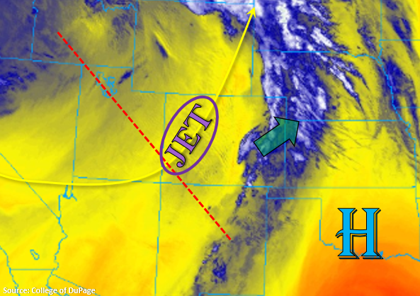
Sunny, hot, windy, and mostly dry conditions are expected over Colorado today. The majority of the state has already moved into the dry slot portion of the current system, which can be seen by the yellow shade over the state in the water vapor imagery below. There is still a bit of moisture and lift over eastern Colorado, so it’s pretty cloudy over the border counties this morning. High surface winds are expected today, which means high fire danger when paired with the dry mass across the state. This increase in wind is due both to the upper level jet over western/central Colorado and a developing lee trough over the northeast plains. Therefore, a majority of the moisture over the eastern plains is expected mix out east (green arrow) by early afternoon with the dry southwesterly flow. One or two weak thunderstorms or quick rain showers may develop over the eastern plains with the minimal residual moisture as some mid-level vorticity (lift) passes overhead this afternoon. However, storms are expected to be high-based and produce little rainfall, so flooding is not forecast. The main threat from the few storms that are able to develop will be very strong outflow winds (45 to 55 mph).
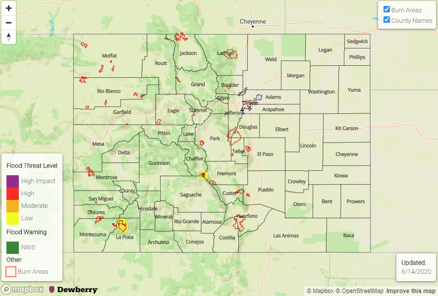
Today’s Flood Threat Map
For more information on today’s flood threat, see the map below. If there is a threat, hover over the threat areas for more details, and click on burn areas to learn more about them. For Zone-Specific forecasts, scroll below the threat map.

Zone-Specific Forecasts:
Southeast Mountains, Raton Ridge, Southeast Plains, & Northeast Plains:
One or two dry thunderstorms will be possible this afternoon over the Southeast Mountains and western Raton Ridge. However, chances won’t be great for storm development with the fast winds and low moisture environment. Best chance for a storm or two will be over the far eastern plains where temperatures will near 100F. The best chance for any rainfall will be over the Southeast Plains. Max 1-hour rain rates up to 0.15 inches (south) and 0.10 inches (north) will be possible, but most storms will produce only virga. Strong outflow winds will likely develop with any thunderstorm that can form, so 45 to 55 mph gusts will be possible over the eastern plains. A Red Flag Warning has been issued for the Southeast Plains and portions of the Northeast Plains and northern Southeast Mountains. Tune into your NWS office for the latest on today’s fire danger.
Primetime: 2PM to 10PM
Front Range, Central Mountains, San Juan Mountains, Northern Mountains, Northwest Slope, Grand Valley, San Luis Valley, Southwest Slope, Urban Corridor, & Palmer Ridge:
Dry, hot, and windy conditions are expected by midday for these regions. Highs will reach the upper 80Fs to low 90Fs over the lower elevations and valleys, and highs over the mountain valleys will be in the mid-70Fs. A large portion of these regions are placed under a Red Flag Warning due to increasing southwesterly surface winds that are forecast today. Surface winds are forecast to be in the 15 to 25 mph range with gusts up to 40 to 50 mph possible. Be sure to tune into your NWS office for the latest on the fire weather front. Decoupling with the upper atmosphere will occur around sundown, so that’s about the time the surface winds will relax.