Issue Date: Thursday, June 11, 2020
Issue Time: 9:15AM MDT
— Flooding is NOT expected today
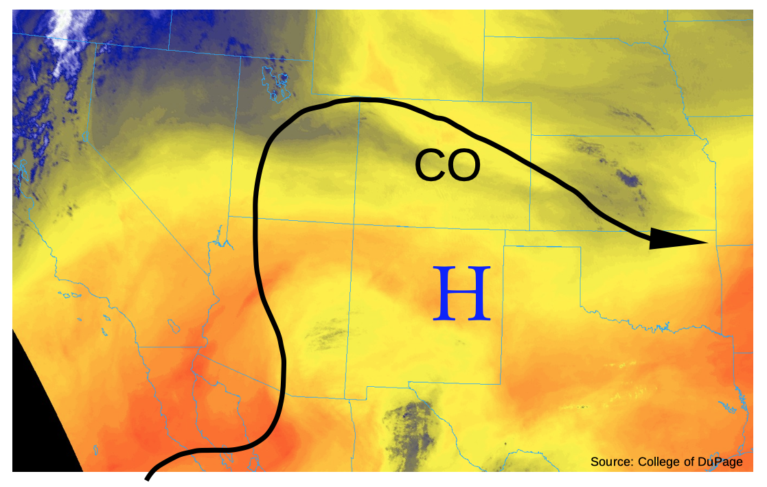
Folks across the state awoke to a cloud-free morning on this Thursday, a preview for the rest of the day. As shown in the water vapor image, below, a ridge axis is in place over the Four Corners region. This ridge will intensify notably today, with 500-mb heights rising by roughly 60 meters over the next 12-18 hours. As such, mid-level subsidence will occur statewide. In combination with low moisture, this implies a mostly sunny day for almost everyone. The only exception will be in the far southeast corner of the state, where slightly higher moisture content could result in an isolated storm. With dewpoint depressions approaching 60 degrees F (!), anyone who sees even a drop of rain should consider themselves lucky. More likely would be gusty downdraft winds, as downdraft CAPE is expected to exceed 1,000 J/kg should a storm hang around long enough.
Elsewhere, the very low humidity levels will combine with gusty afternoon winds to elevate the wildfire threat yet again over the San Luis Valley, Southeast Mountains and Raton Ridge.
Today’s Flood Threat Map
For more information on today’s flood threat, see the map below. If there is a threat, hover over the threat areas for more details, and click on burn areas to learn more about them. For Zone-Specific forecasts, scroll below the threat map.

Zone-Specific Forecasts:
Northeast Plains, Front Range, Palmer Ridge, Urban Corridor, Central Mountains, Northwest Slope, Grand Valley, Northwest Slope, Southwest Slope, San Juan Mountains:
Sunny and warmer today with temperatures near seasonal normal. Flooding is NOT expected today.
San Luis Valley, Southeast Mountains, Raton Ridge, Southeast Plains:
Sunny and warmer today with temperatures slightly above seasonal normal. An isolated thunderstorm is possible over far southeast areas, towards the Kansas and Oklahoma borders. Max 1-hr rainfall up to 0.20 inches along with gusty winds possible. Gusty winds are also expected to develop over the higher terrain this afternoon, which will cause an elevated fire threat. Flooding is NOT expected today.