Issue Date: Thursday, August 25th, 2022
Issue Time: 10:50AM MDT
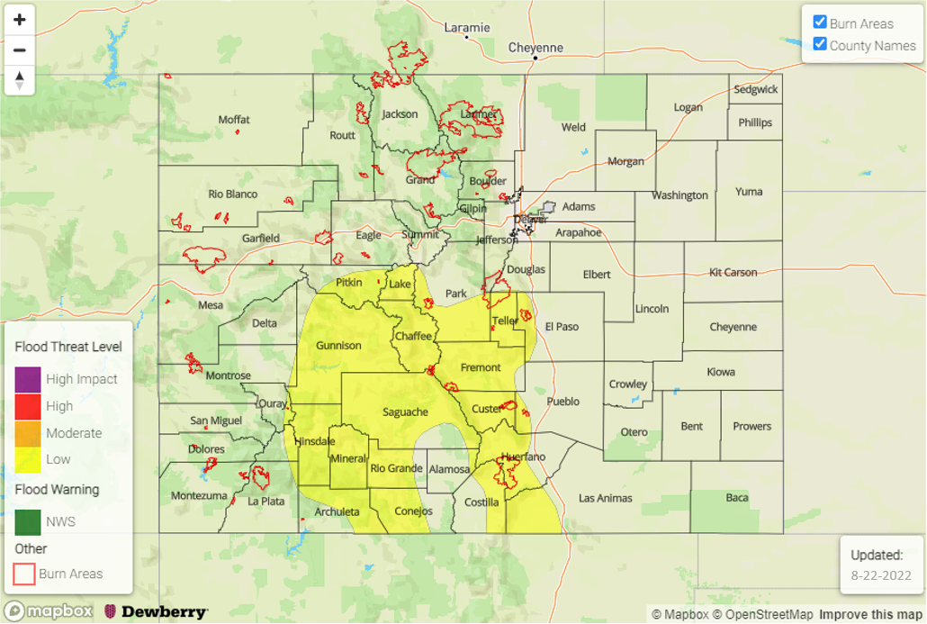
— A LOW flood threat has been posted for parts of the Front Range, Northern Mountains, Central Mountains, Grand Valley, San Juan Mountains and Southeast Mountains
— Fire-Burn Forecast Summary: 5 burn areas under MODERATE threat; 3 areas under LOW threat; click HERE for more info
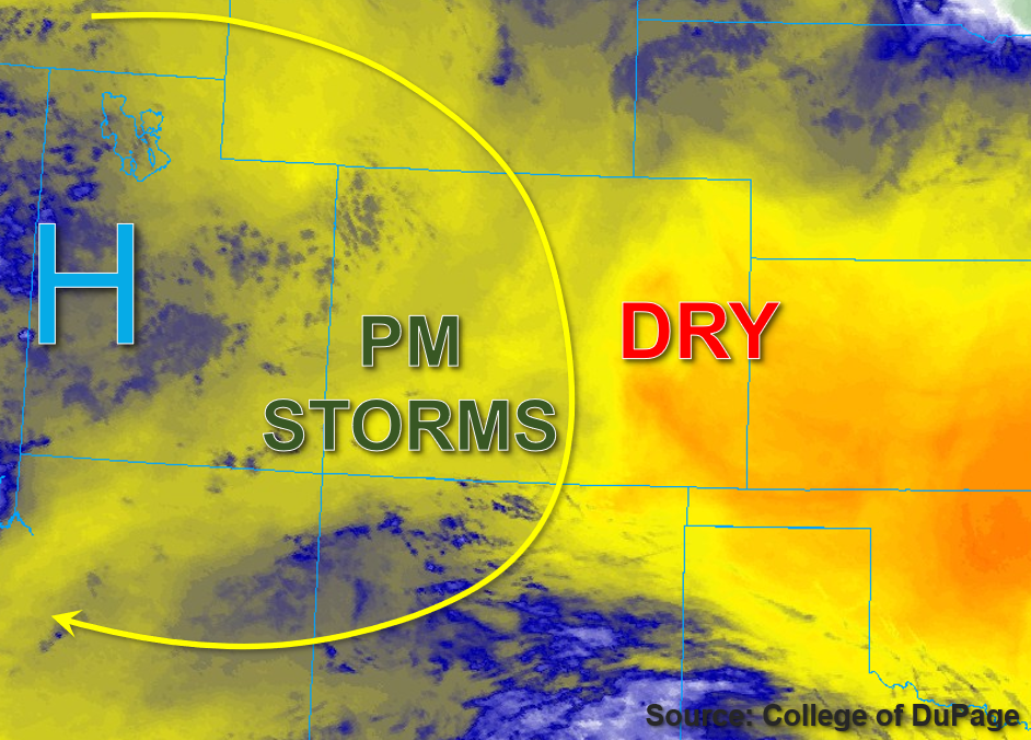
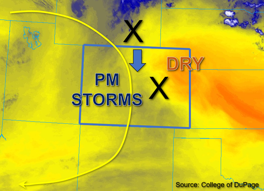
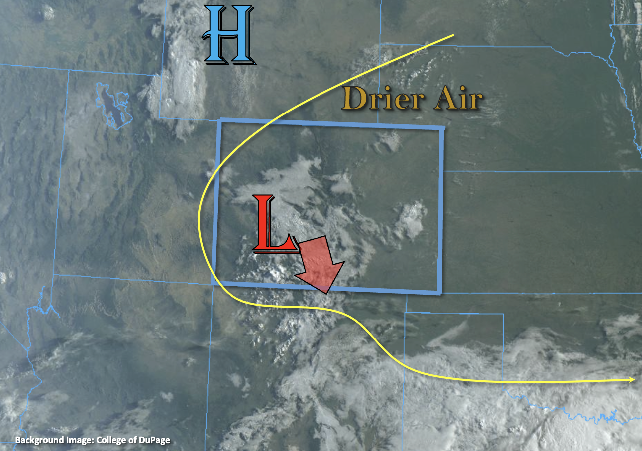
This morning’s visible satellite imagery, below, shows that a couple of features will bring a notable uptick in heavy rainfall chances mainly over our higher terrain. First, a strong but small disturbance over Wyoming will provide synoptic-scale lift to our Central and Northern Mountain zones, resulting in scattered to numerous showers and storms. Further south and west, Grand Junction’s PW has increased from 0.77 to 0.89 inches, with values likely approaching 1 inch over the southwest part of the state. Although synoptic-scale lift will be weaker over southwest Colorado, the diurnal upslope circulation combined with an increase in monsoonal moisture will be enough to cause scattered to numerous showers and storms here as well. The flood threat today will be primarily earlier in the afternoon as plenty of sunshine should generated CAPE of up to 900 J/kg. This will support the threat of heavy rainfall at predominantly the 30-60 minute duration. Thus, a LOW flood threat has been posted for a large part of our higher terrain today. Later in the evening, upscale growth of storms should transition rainfall intensity into the (mighty welcome) light to moderate variety.
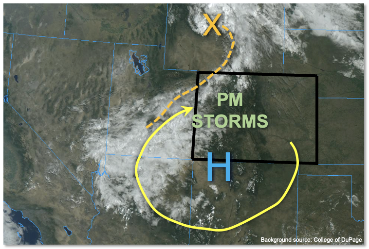
Further east, the Platteville morning PW of 0.62 inches is down further from yesterday morning’s 0.71 inches. Boundary layer moisture looks less favorable for heavy rainfall potential. Nonetheless, with the strong forcing described above, a few storms will likely make it off the higher terrain, especially from the Palmer Ridge northward. However, they are expected to pose more of a gusty wind threat along with brief moderate rainfall potential. Thus, flooding is not expected here.
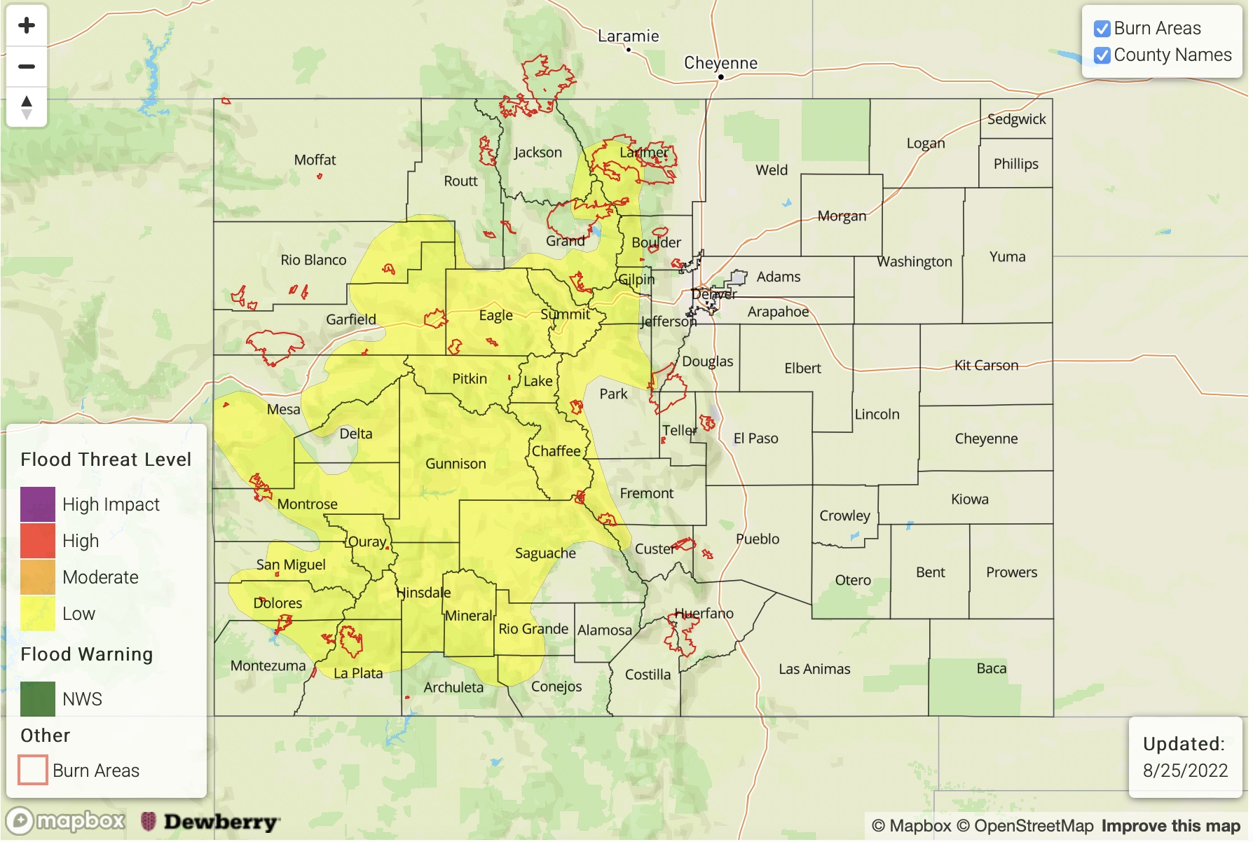
Today’s Flood Threat Map
For more information on today’s flood threat, see the map below. If there is a threat, hover over the threat areas for more details, and click on burn areas to learn more about them. For Zone-Specific forecasts, scroll below the threat map.
Zone-Specific Forecasts:
Northern Mountains, Central Mountains, Front Range, Grand Valley, San Juan Mountains, Southeast Mountains, Southwest Slope, San Luis Valley & Northwest Slope:
Becoming mostly cloudy with scattered to numerous showers and storms developing by early afternoon. Max 30-min/60-min rain rates up to 0.9/1.3 inches, respectively, warrant a LOW flood threat for most of the higher terrain. Primary hazards will be flash flooding along with debris slides and mud flows over steeper terrain. Light to moderate rainfall should continue into the late evening hours and lucky locations could receive up to 2.0 inches of total rainfall by Friday morning.
Primetime: 1PM to 9PM
Northeast Plains, Southeast Plains, Urban Corridor, Palmer Ridge & Raton Ridge:
Mostly sunny and seasonably hot through early afternoon, then partly cloudy with isolated to widely scattered showers and storms. Best coverage will be closer to the foothills, especially from Colorado Springs northward to the WY border. Max 30-min rain rates up to 0.6 inches are possible, but flooding is NOT expected today. However, gusty winds up to 50mph could accompany the strongest storm cores.
Primetime: 3PM to 9PM