Issue Date: Monday, August 22nd, 2022
Issue Time: 9:30AM MDT
— A LOW flood threat has been issued for the Central Mountains, San Juan Mountains, Southeast Mountains and portions of the Front Range and Raton Ridge
— Fire-Burn Forecast Summary: 2 burn areas under MODERATE threat; click HERE for more info
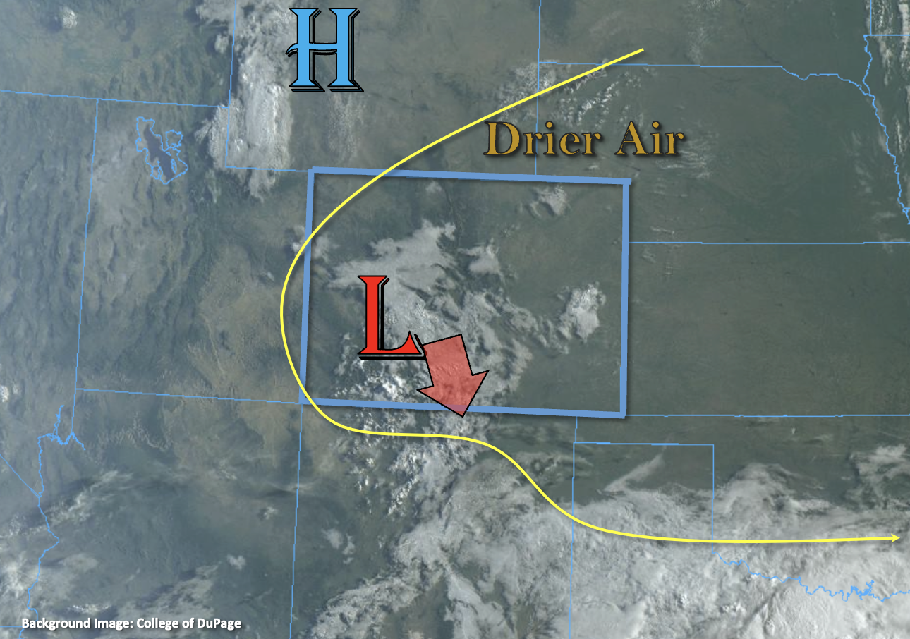
There is some fog, cloud cover and morning showers over the state this morning associated with the upper-level Low that is helping to generate lift in a moisture rich environment. The Low will continue to slowly track southward throughout the day with building High pressure filling in behind it. As it does so, it should promote enhanced lift out in front of it over the high terrain. Monsoon moisture is still in place over the state with PW at Grand Junction measured at 0.98 inches. There is some drier air has begun to work its way in from the north, and PW at Platteville has dropped to 0.83 inches. This drier air in tandem with building high pressure, should help to keep that area mostly dry today with only isolated mountain storms expected. Better moisture and lift are forecast south of I-70, which will be the focal point for another round of scattered to numerous mountain storms this afternoon and evening.
Similar to the last couple of days, where there are breaks in cloud cover behind this first round of showers and associated cloud cover, isolated, stronger storms are likely to develop. With cooler temperatures forecast (limited instability), the more intense rainfall from these thunderstorms should occur in the first 30 minutes to hour. Slow steering flows to the southeast will also promote higher accumulations under the small storm cores, so a LOW flood threat has been issued.
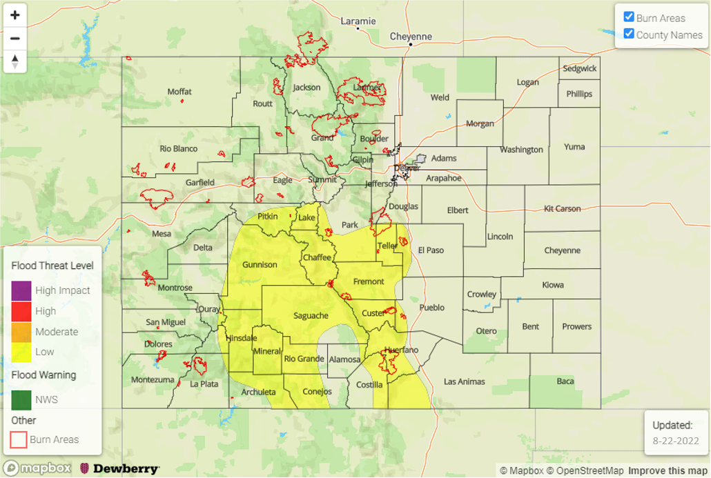
Today’s Flood Threat Map
For more information on today’s flood threat, see the map below. If there is a threat, hover over the threat areas for more details, and click on burn areas to learn more about them. For Zone-Specific forecasts, scroll below the threat map.
Zone-Specific Forecasts:
Front Range, Central Mountains, Southeast Mountains, Raton Ridge, San Juan Mountains & San Luis Valley:
Scattered to numerous afternoon and evening storms are forecast today with more intense thunderstorms likely to develop in areas with breaks in cloud cover. Max 30-minute/1-hour rain rates up to 1.1/1.75 inches will be possible, but since stronger storm cores should be relatively small and isolated, only a LOW flood threat has been issued. Storms should mostly stick to the high terrain with some spillover possible into the western Raton Ridge and San Luis Valley. In addition to local, heavy rainfall, thunderstorms may produce small hail and strong outflow winds. Flood threats include mud flows, debris slides, road flooding and ponding in low-lying areas. The flood threat should end early this evening with some light rainfall likely lingering through midnight over the southern mountains.
Primetime: 1:30PM to Midnight
Urban Corridor, Palmer Ridge, Southwest Slope, Southeast Plains, Northwest Slope, Northern Mountains, Grand Valley & Northeast Plains:
Afternoon high temperatures should still be below a couple of degrees below average today, although it will be warmer when compared to yesterday. Isolated storms may develop over high terrain with residual moisture, but totals should remain under 0.2 inches. Other areas should see plenty of sunshine and dry conditions. Flooding is NOT expected.
Primetime: 1:30PM to 9PM