Issue Date: Wednesday, August 24th, 2022
Issue Time: 10:10 AM MDT
— Flooding is NOT expected today
— Fire-Burn Forecast Summary: 3 burn areas under LOW threat, click HERE for more info
The upper High continues to build over western Utah this morning and advect dry air into the state today from the north. Column moisture has decreased slightly across western Colorado from yesterday, with Grand Junction measuring a PW value of 0.77 inches this morning. Surface dew points in the low to mid-40s°F this morning further indicate drying of the boundary layer air as well. Still, weak energy circling around the high is expected to move through western Colorado and trigger isolated to widely scattered storm development along and west of the Continental Divide beginning early afternoon.
Given the forecast drying of both surface and column moisture today, storms are expected to remain confined to the higher elevations similarly to prior days. Slightly higher surface moisture may remain in place over the far southwest where dewpoints are currently in the low 50s°F, and it is here that the highest likelihood for heavy rainfall is expected this afternoon. But with limited instability forecast to reach between 800-1200 J/kg of CAPE over the southwest, along with decreasing column moisture, storm cores are expected to be small and produce only light to moderate rain rates. Flooding is NOT expected today.
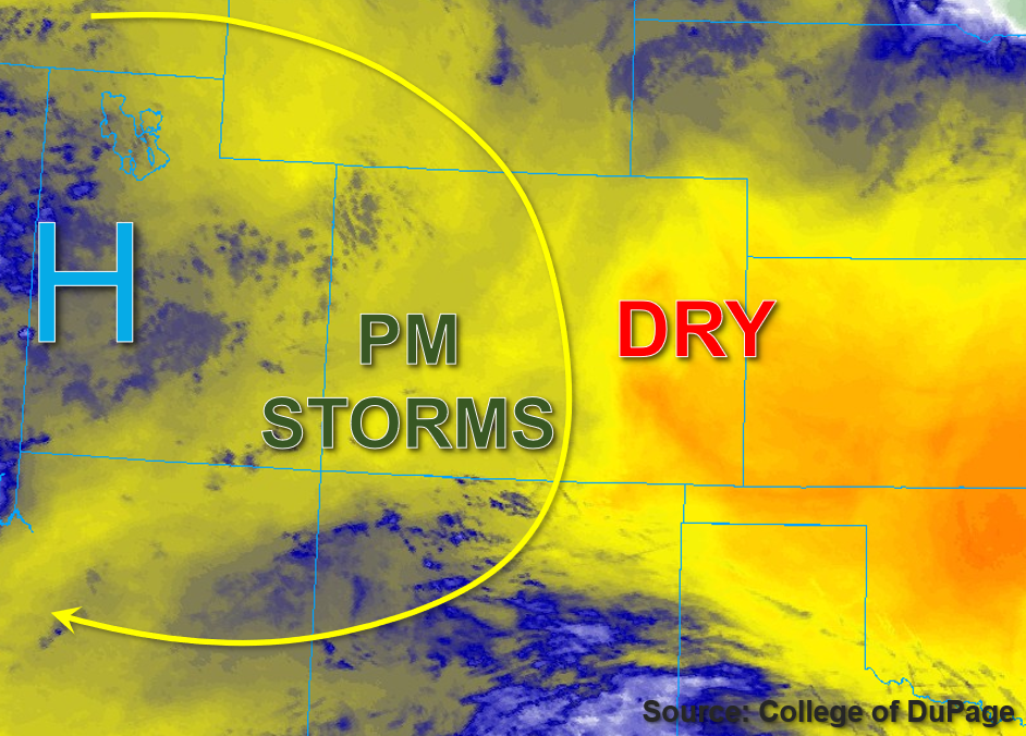
Further east, a there has been a slight moistening in Platteville compared to yesterday with a PW value of 0.71 inches measured this morning. However, continued mixing out of boundary layer moisture is expected, and with no instability forecast, eastern Colorado is expected to remain dry and NO flooding is expected today.
Today’s Flood Threat Map
For more information on today’s flood threat, see the map below. If there is a threat, hover over the threat areas for more details, and click on burn areas to learn more about them. For Zone-Specific forecasts, scroll below the threat map.

Zone-Specific Forecasts:
Southwest Slope, San Juan Mountains, San Luis Valley, Grand Valley, Northwest Slope, Central Mountains & Northern Mountains:
Stray high clouds are noted across the Northwest Slope this morning, otherwise skies are mostly clear across western Colorado. As the weak impulse approaches this afternoon, isolated to widely scattered southward-moving storms are anticipated across mainly higher elevations. Over the Northern and Central Mountains, an isolated storm or two may produce 30-minute rain rates up to 0.4 inches. Over the San Juan Mountains and eastern Southwest Slope, isolated 30 to 45-minute rain rates up to 0.8 inches are possible. Storms should remain confined to the higher elevations and although some runoff may occur, flooding is NOT expected today.
Primetime: 1PM to 10PM
Front Range, Urban Corridor, Northeast Plains, Palmer Ridge, Southeast Plains, Southeast Mountains, & Raton Ridge:
Clear skies and warmer temperatures (relative to the last few days) are forecast for eastern Colorado today. Storms are expected to remain confined to the higher elevations west of the Continental Divide, while eastern Colorado is expected to remain dry. Therefore flooding is NOT expected today.