Issue Date: Saturday, September 3rd, 2022
Issue Time: 11:10 AM MDT
Summary:
Friday morning started calmly across Colorado, with diurnal cumulus buildup along the high terrain of the Front Range, Central, and Southeast Mountains eventually beginning in the mid-afternoon. Limited moisture prevented all but isolated showers, and instead there was mainly gusty winds and lightning. Along the Palmer Ridge, convergence allowed for afternoon shower and thunderstorm development for the Eastern Plains along and south of the I-70 corridor. By evening, a weak cold-frontal boundary pushed in from the northeast, bringing thunderstorms to the Front Range, Urban Corridor, and Palmer Ridge, and late evening and overnight showers and thunderstorms for the Plains. The long-duration nature of the rainfall thankfully limited the flood threat, even with some more intense localized precipitation at times. Storms lasted well into the overnight hours, with lingering showers and thunderstorms associated with the boundary still occurring this morning for the Southeast Mountains and Raton Ridge.
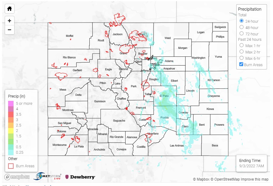
A lone severe thunderstorm warning was issued for northeastern Denver County and southwestern Adams County, including DIA. The airport officially saw 0.50 inches from the severe thunderstorm in just about an hour after 9:00 pm. Between 0.28-1.25 inches were reported across the western portion of the Denver Metro Area. The Fort Collins area saw up to 0.70 inches of rain yesterday; and between 0.10-0.25 was reported across Colorado Springs, though areas just east in El Paso County saw higher totals, including up to 0.91 in Peyton and 0.90 in Fountain.
While a 0.31 inch total in Pueblo isn’t particularly impressive compared to some of the rainfall seen yesterday on the Eastern Plains, it still amounts to nearly half of the normal precipitation in September! See the tweet below from Pueblo WFO for a bit more information.
Overnight, Pueblo received 0.31 inches of rain! 🌧️
The monthly average rainfall total for Pueblo in September is 0.65 inches.
That means 47.6% of the monthly average rainfall fell in one night.
Every drop matters, as a drier pattern is expected the next several days. #cowx pic.twitter.com/HhUxxA0tKc
— NWS Pueblo (@NWSPueblo) September 3, 2022
Western Colorado remained hot and dry yesterday. Grand Junction broke their record high yesterday, reaching 99 degrees. The previous record of 98 degrees was set in 1995 and tied in 2019.
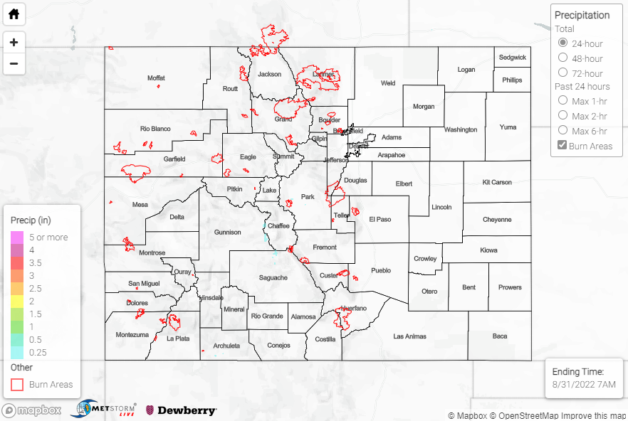
No flooding was reported yesterday. For precipitation estimates in our area, check out the map below. Remember, if you observe flooding in your area, you can use the “Report a Flood” page to make a flood report when you can safely do so.
Click Here For Map Overview