Issue Date: Thursday, September 1st, 2022
Issue Time: 11:50 AM MDT
Summary:
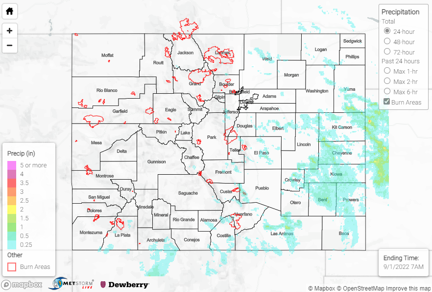
Wednesday featured more active weather across the state thanks to a shortwave trough moving into the region from Montana. Increased moisture over the eastern foothills and plains led to numerous showers and storms mainly along and east of the I-25 corridor, although isolated convection also impacted the southern San Juans. Rainfall amounts over this eastern half of the state were generally 0.50-1.00”, although locally higher amounts approaching and exceeding 1.5” are suggested by QPE data under the most intense storms. The heaviest widespread rain appears to have fallen along and south of the Palmer Ridge over the Southeast Plains; however, in the southern San Juans, an isolated total of 1.39” was recorded by a rain gauge just west of Durango.
Notable rainfall totals over the Southeast Plains include:
• 0.82” near Two Buttes
• 0.71” near Lamar
• 0.60” near Arapahoe
Farther west in the high terrain along the southern I-25 corridor, notable rainfall totals include:
• 0.98” near Beulah
• 0.75” near Trinidad
• 0.70” near Rye
In terms of severe weather, a Severe Thunderstorm Warning was issued just east of Colorado Springs, while 1” hail was reported near Seibert and a 53-mph thunderstorm wind gust was measured near Kit Carson. Right on the Colorado-Kansas border, local law enforcement reported a landspout tornado approximately 15 miles WSW of Saint Francis, KS.
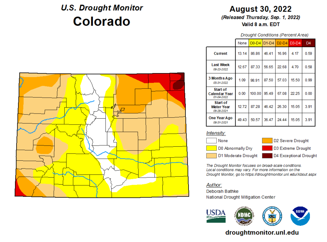
Looking at the updated U.S. Drought Monitor released this morning, conditions are in better shape compared to one and especially three months ago. We’ve seen a complete elimination of drought conditions for central portions of the state, while extreme/exceptional drought conditions have been pushed and confined to the far southwestern and northeastern tips of the state
 .
.
No flooding was reported yesterday. For precipitation estimates in our area, check out the map below. Remember, if you observe flooding in your area you can use the “Report a Flood” page to make a flood report, when you can safely do so.
Click Here For Map Overview