Issue Date: Thursday, August 19th, 2021
Issue Time: 9:35 AM MDT
Summary:
As forecasted, a plume of monsoonal moisture rotating around a low-pressure to the west entered the western half of Colorado yesterday, bringing widespread, heavy, long-duration rain to the Northwest and Southwest Slopes, Grand Valley, and even western portions of the Northern and Central Mountains. Afternoon thunderstorms produced an initial surge of heavy rainfall and even small hail, followed by waves of showers lasting overnight and well into the early morning. This prompted flood advisories and ultimately flood warnings for the Pine Gulch and Grizzly Creek burn scars, as well as a portion of the Cameron Peak scar.
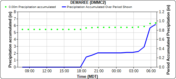
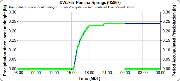
Due to the rural nature of the Pine Gulch burn area, there are limited observations. However, a total of 1.04 inches was recorded from a MesoWest gage in Demaree, just west of the burn scar. The time series plot below shows rain beginning around 6:00 pm and continuing until 6:00 am this morning. To the south, observations in Grand Junction range from 0.49-0.78 inches from CoCoRaHS observers across town – similarly, rainfall totals are from afternoon storms and continuing showers overnight into morning.
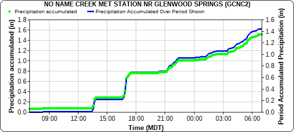
Observers in Glenwood Springs reported just about 0.5 inches of rain yesterday, however nearby Glenwood Canyon and the Grizzly Creek burn scar received over an inch and half of rain yesterday and overnight. The plot below of No Name Creek shows an accumulation of 1.44 inches, with continuous rainfall starting in the early afternoon and continuing through this morning.
The flash flood warning issued for Glenwood Canyon prompted a safety closure of I-70 (after just reopening partially within the week). CDOT shared the following information on twitter describing their approach to I-70 closures based on flood watches and warnings.
What happens during a Flash Flood Warning? CDOT crews at the 2 closure points will close I-70. The @CSP_News will sweep the area to ensure there are no motorists or members of the public in the area. Crews will continue to monitor the mudslide area.
— Colorado Department of Transportation (CDOT) (@ColoradoDOT) August 18, 2021
Unrelated to any burn scars, but due to heavy rain – an early morning debris flow occurred north of Craig, closing CO-13 in the Northwest Slope. Between 0.34-0.37 inches were reported in Craig from CoCoRaHS and COOP observers, though there are very little observations along Highway 13 where the debris flow occurred. However, a personal weather station north of Craig and east of CO-13 recorded 0.25 inches of rain yesterday, and already an additional 0.30 this morning from rain beginning before 7:00 pm last night and continuing through morning. CO-13 remains closed with no estimated time for reopening, according to the following tweet from CDOT.
#CO13 northbound/southbound: Road closed between County Road 73 and County Road 38. Closed during ongoing slide cleanup MP 111-115. No est. reopen time. https://t.co/WIJBWjWZNI
— Colorado Department of Transportation (CDOT) (@ColoradoDOT) August 19, 2021
Other notable precipitation totals from CoCoRaHS observers in Western Colorado yesterday include:
- 1.59 inches in Dove Creek, right on the Utah Border
- 0.76 inches in Dolores
- 0.74 inches in Rockwood
- 0.71 inches in Cortez
- 0.56 inches in Montrose
- 0.39 inches in Ridgeway
- 0.34 inches in Durango
- 0.32 inches in Pagosa Springs
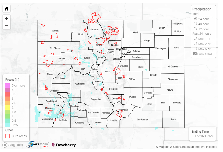
Elsewhere, an evening thunderstorm produced modest rainfall in Greeley and along the I-76 corridor, but the most of Eastern Colorado stayed dry. For rainfall estimates in your area, check out the State Precipitation Map below.
Click Here For Map Overview

