STP 06-19-2015: Temperatures Heated Up, Isolated Thunderstorms Rumbled

Issue Date: Friday, June 19th, 2015
Issue Time: 9:00 AM MDT

Summary:

The main story of yesterday’s weather was the sunshine and warm temperatures, which was a nice change over previous weeks’ weather stories. Isolated thunderstorms still rumbled, mainly from the Front Range/Southeast Mountains and eastward, producing mainly gusty winds, some hail, and lightning. Locally moderate-to-heavy rain fell from the strongest storms, but no flash flooding has been reported at this time.

As far as severe storm reports are concerned, hail 1.0-1.25 inches in diameter was reported in the following locations: Louisville (Boulder County), WSW of Lafayette (Boulder County), and 1 mile NW of Superior (Boulder County).

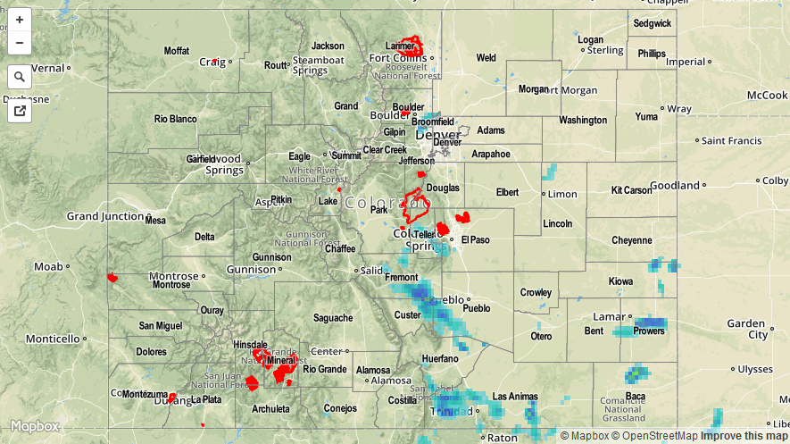
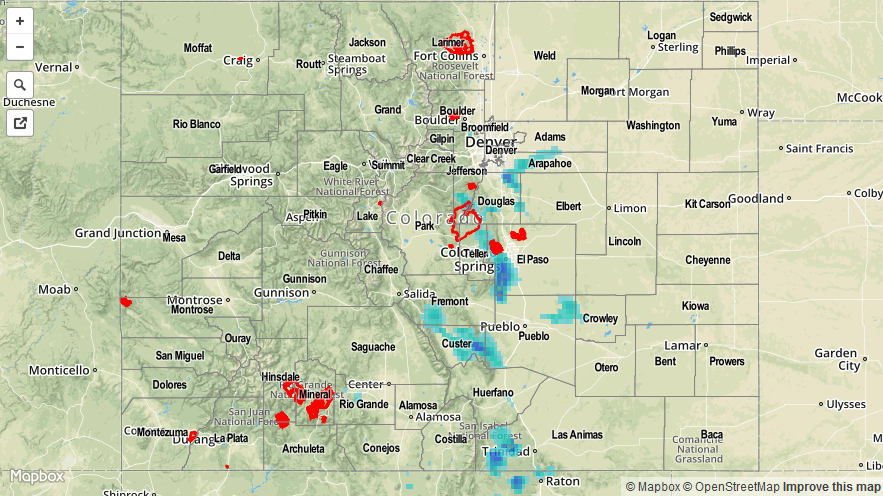
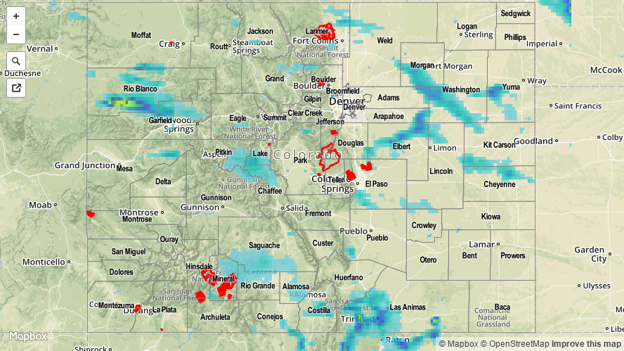
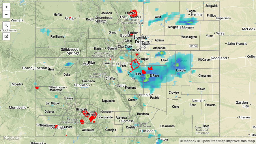
As of 7 AM, CoCoRaHS observers reported that most rainfall totals were less than 0.1 inches, with a few locations receiving 0.15-0.25 inches. For a look at statewide precipitation totals, be sure and check out the radar-derived Storm Total Precipitation Map below.

06192015_STPImage
Storm Total Precip Legend

STP 06-18-2015: Sunshine and Warmth Were Prevalent as Storms Were More Isolated

Issue Date: Thursday, June 18th, 2015
Issue Time: 9:00 AM MDT

Summary:

FLOOD WARNINGS/ADVISORIES CONTINUE FOR PORTIONS OF THE CACHE LA POUDRE RIVER, SOUTH PLATTE RIVER, ARKANSAS RIVER, AND VARIOUS STREAMS AND RIVERS ACROSS WESTERN COLORADO DUE TO SNOWMELT AND RAINFALL RUNOFF.

As weak, upper-level ridging built over the state, showers and thunderstorms became less numerous compared to previous days and mostly sunny skies prevailed. Temperatures were some of the highest readings of the year, so far, and served as a reminder that summer is ready to get into full swing. Isolated showers and thunderstorms still fired off, as they so often do in Colorado, with storms over the higher terrain producing mainly light rain and blustery winds. As storms moved off of the Front Range, however, they tapped into better moisture and instability, producing locally heavy rainfall and a few reports of severe hail:

11 miles SE of Aurora (Arapahoe County): 1.5 inch hail
3 miles NW of Parker (Douglas County): 1.0 inch hail
12 miles NNE of Penrose (Fremont County): Heavy rain, 1.25 inches fell in 20 minutes

For a look at statewide precipitation totals, be sure to check out the radar-derived Storm Total Precipitation map.

06182015_STPImage
Storm Total Precip Legend

STP 06-17-2015: Downturn in the Overall Number of Storms, Heavy Rain Still Present

Issue Date: Wednesday, June 17th, 2015
Issue Time: 9:00 AM MDT

Summary:

FLOOD WARNINGS/ADVISORIES CONTINUE FOR PORTIONS OF THE CACHE LA POUDRE RIVER, SOUTH PLATTE RIVER, ARKANSAS RIVER, SOUTH BOULDER CREEK AND VARIOUS STREAMS AND RIVERS ACROSS WESTERN COLORADO DUE TO SNOWMELT AND RAINFALL RUNOFF.

A shortwave trough was the main player in yesterday’s weather, providing the energy for scattered showers and thunderstorms to fire across Eastern Colorado while working against activity over Western Colorado. The result was fewer storms overall, but with ample moisture still available, heavy rain was still a threat as they moved to the east-southeast. Relatively quick storm motions helped to limit the flash flood threat. A flood advisory was issued for northeastern El Paso County yesterday evening, but no flash flooding has been reported.

As far as rainfall totals are concerned, take a look at the “big winners” according to CoCoRaHS observers (as of 7 AM):

Grand County: 0.78 inches
Washington County: 0.50 inches
El Paso County: 0.50 inches

A few severe storm reports were given to the National Weather Service Office in Boulder:

58 mph wind gust: 2 miles NE of Wiggins (Morgan County)
1.0 inch hail: 6 miles ESE of Fort Collins (Larimer County), 4 miles S of Fort Collins (Larimer County)

Be sure to check out the Storm Total Precipitation map below for a look at statewide rainfall totals.

20150617_STPImage
Storm Total Precip Legend

STP 06-16-2015: Heavy Rain and Flash Flooding the Main Story

Issue Date: Tuesday, June 16th, 2015
Issue Time: 9:00 AM MDT

Summary:

The active weather pattern continued yesterday, as scattered showers and thunderstorms developed during the late morning/early afternoon, and have continued well into the morning hours. A cool front dropped south across Eastern Colorado during the day, providing upslope flow which reinforced low-level moisture. As surface dewpoints remained in the 50s, and precipitable water climbed into the 90th percentile, thunderstorms were efficient rainfall producers, and heavy rain caused flash flooding/flooding in various locations across the state.
There were urban water rescues ongoing in Colorado Springs last night as a strong thunderstorm, producing very heavy rain, moved across the city during the late evening hours. Additionally, flash flooding, which stranded cars, was reported approximately 4 miles S of Colorado Springs near Star Ranch Road and Highway 115. Heavy rain reports were aplenty in El Paso County, and the following reports come from the NWS Local Storm Reports:

3.05 inches of rain in approximately 3 hours: 4 miles S of Colorado Springs
1.30 inches of rain in 70 minutes: 4 miles NNE of Colorado Springs
1.39 inches of rain in 1 hour: 2 miles WNW of Colorado Springs
1 inch of rain in 20 minutes: 4 miles NNE of Colorado Springs
0.80 inches of rain in 15 minutes: 3 miles WSW of Colorado Springs

The Elbert County Sheriff reported that heavy rain caused flash flooding in northeastern Elbert County last night, which resulted in washed out/closed roads. Portions of Kiowa Bennett were temporarily closed, and County Road 178 was closed between County Road 53 and Wolf Creek Drive.

Levee Breach: At 7 am yesterday, railroad officials noted a levee breach along the South Platte River in Washington County. Emergency evacuations were ordered for 15 homes and approximately 20 residents in the Messex community.

For a statewide look at radar-derived precipitation, please check out the Storm Total Precipitation map below.

20150616_STPImage
Storm Total Precip Legend