Issue Date: Wednesday, June 17th, 2015
Issue Time: 9:00 AM MDT
Summary:
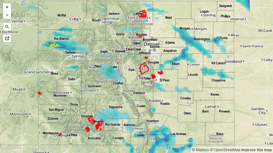
FLOOD WARNINGS/ADVISORIES CONTINUE FOR PORTIONS OF THE CACHE LA POUDRE RIVER, SOUTH PLATTE RIVER, ARKANSAS RIVER, SOUTH BOULDER CREEK AND VARIOUS STREAMS AND RIVERS ACROSS WESTERN COLORADO DUE TO SNOWMELT AND RAINFALL RUNOFF.
A shortwave trough was the main player in yesterday’s weather, providing the energy for scattered showers and thunderstorms to fire across Eastern Colorado while working against activity over Western Colorado. The result was fewer storms overall, but with ample moisture still available, heavy rain was still a threat as they moved to the east-southeast. Relatively quick storm motions helped to limit the flash flood threat. A flood advisory was issued for northeastern El Paso County yesterday evening, but no flash flooding has been reported.
As far as rainfall totals are concerned, take a look at the “big winners” according to CoCoRaHS observers (as of 7 AM):
Grand County: 0.78 inches
Washington County: 0.50 inches
El Paso County: 0.50 inches
A few severe storm reports were given to the National Weather Service Office in Boulder:
58 mph wind gust: 2 miles NE of Wiggins (Morgan County)
1.0 inch hail: 6 miles ESE of Fort Collins (Larimer County), 4 miles S of Fort Collins (Larimer County)
Be sure to check out the Storm Total Precipitation map below for a look at statewide rainfall totals.