Issue Date: Tuesday, June 16th, 2015
Issue Time: 9:00 AM MDT
Summary:
The active weather pattern continued yesterday, as scattered showers and thunderstorms developed during the late morning/early afternoon, and have continued well into the morning hours. A cool front dropped south across Eastern Colorado during the day, providing upslope flow which reinforced low-level moisture. As surface dewpoints remained in the 50s, and precipitable water climbed into the 90th percentile, thunderstorms were efficient rainfall producers, and heavy rain caused flash flooding/flooding in various locations across the state.
There were urban water rescues ongoing in Colorado Springs last night as a strong thunderstorm, producing very heavy rain, moved across the city during the late evening hours. Additionally, flash flooding, which stranded cars, was reported approximately 4 miles S of Colorado Springs near Star Ranch Road and Highway 115. Heavy rain reports were aplenty in El Paso County, and the following reports come from the NWS Local Storm Reports:
3.05 inches of rain in approximately 3 hours: 4 miles S of Colorado Springs
1.30 inches of rain in 70 minutes: 4 miles NNE of Colorado Springs
1.39 inches of rain in 1 hour: 2 miles WNW of Colorado Springs
1 inch of rain in 20 minutes: 4 miles NNE of Colorado Springs
0.80 inches of rain in 15 minutes: 3 miles WSW of Colorado Springs
The Elbert County Sheriff reported that heavy rain caused flash flooding in northeastern Elbert County last night, which resulted in washed out/closed roads. Portions of Kiowa Bennett were temporarily closed, and County Road 178 was closed between County Road 53 and Wolf Creek Drive.
Levee Breach: At 7 am yesterday, railroad officials noted a levee breach along the South Platte River in Washington County. Emergency evacuations were ordered for 15 homes and approximately 20 residents in the Messex community.
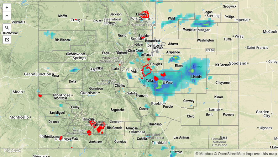
For a statewide look at radar-derived precipitation, please check out the Storm Total Precipitation map below.