STP 07-09-2015: Scattered Heavy Downpours Statewide, But Limited Flooding

Issue Date: 7/9/2015
Issue Time: 9:00AM

Summary:

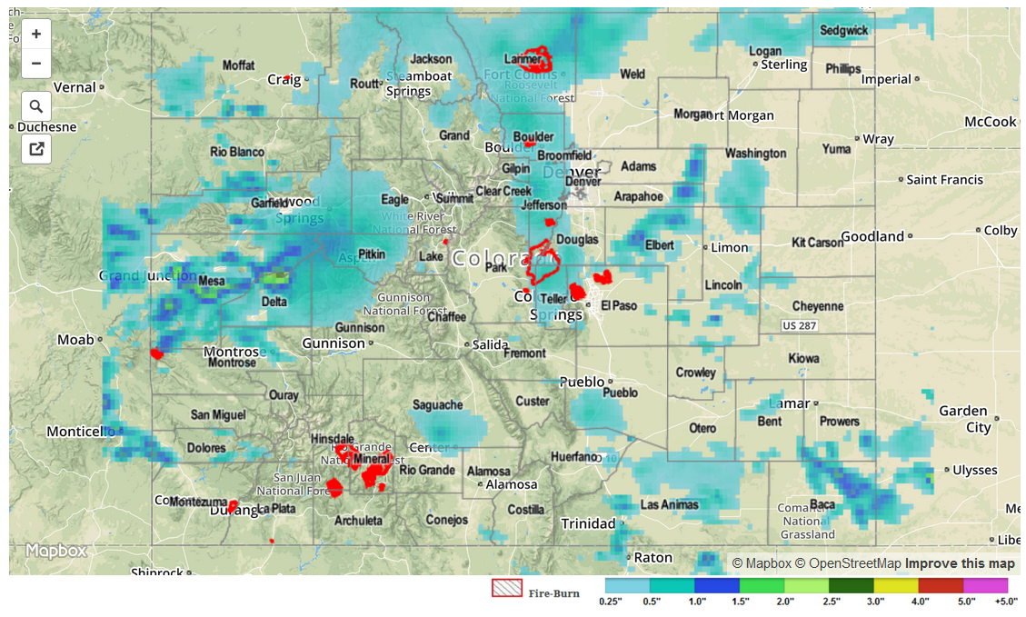
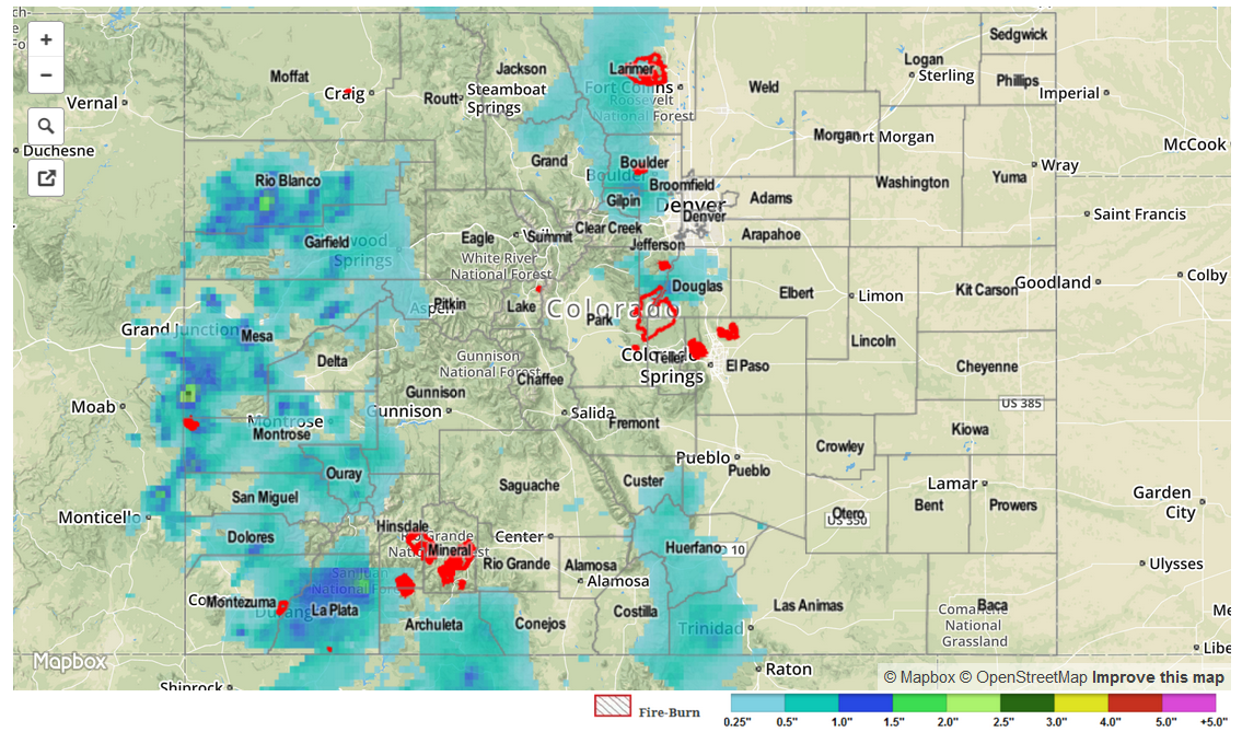
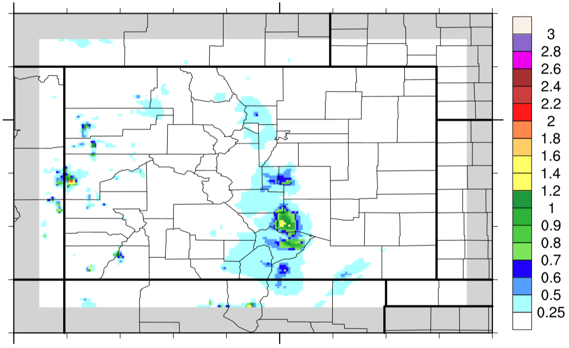
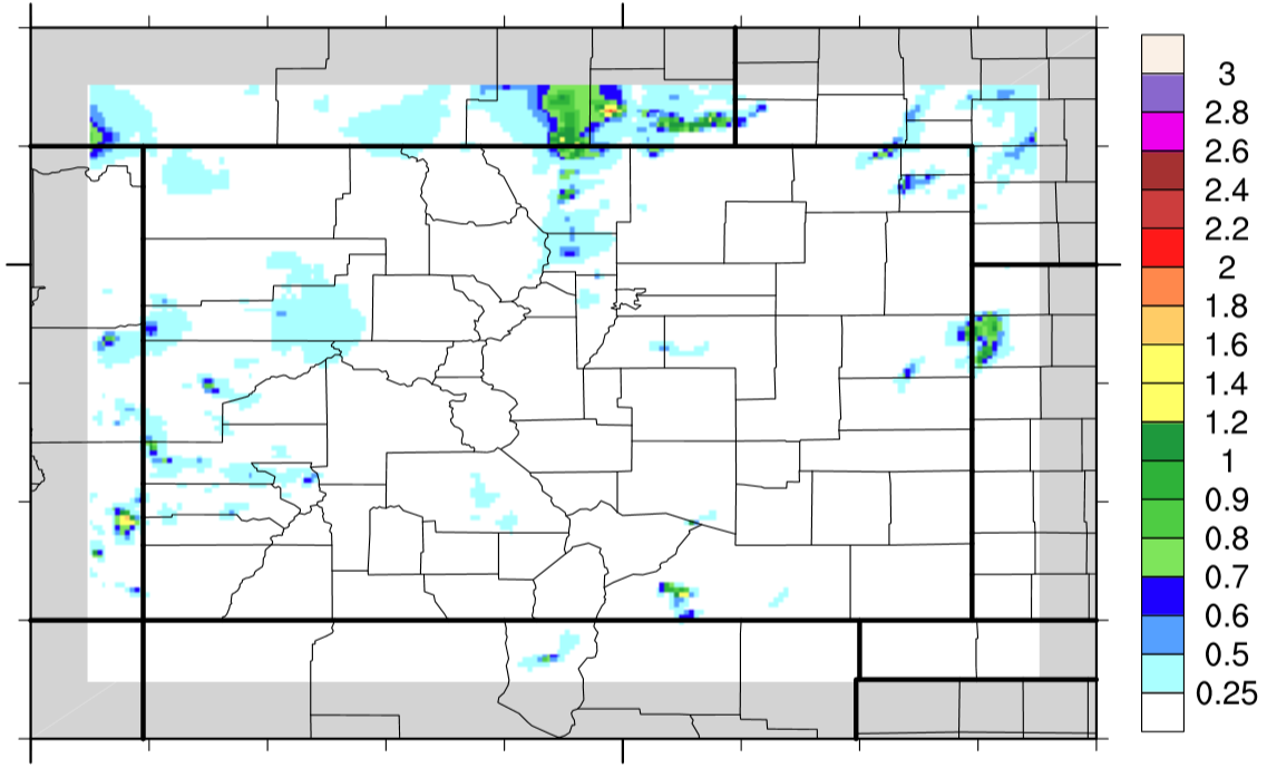
Storms did not wait long to develop on Wednesday with activity beginning before noon west of the Divide and around noon to the east. As with the past few days, individual storms only lasted about 30 minutes or so, which helped to limit rainfall in any one area. The highest observed 24-hr total was 1.32 inches in Clear Creek County. About a dozen official reports over 1 inch were received from Elbert, Boulder, Jefferson and Larimer counties. Meanwhile, quite a few areas, both east and west of the Divide, received from 0.75 to 1 inch.

In the Grand Junction area, a few thunderstorms were able to maintain enough strength to develop hail. Many reports of pea-size hail were received, and even one report of 1 inch hail right in the vicinity of Grand Junction itself.

For 24-hour rainfall amounts in your area, be sure to check out our radar estimated rainfall map below.

STP_snapshot_20150709

STP 07-08-2015: A Two-Story Tale

Issue Date: 7/8/2015
Issue Time: 9:00AM

Summary:

While a stable airmass prevented thunderstorm activity over the Plains east of the Divide, the higher terrain and western slope saw quite a different story. Numerous thunderstorms made their way across western Colorado, being fueled by abundant moisture and favorable atmospheric dynamics. Fortunately, almost all individual thunderstorms only lasted 30-45 minutes, minimizing the rainfall at any given locale. However, some areas saw two or three thunderstorms that piled on the rain totals. The highest observed 24-hr total came from Archuleta County where Pagosa Springs measured 1.51 inches of rain. Several other storms in the San Juans produced pea-size hail. All in all, it was an active day with 13 different Flood Advisories issued by the Grand Junction National Weather Service office between noon and midnight. A mud flow was reported in Mesa County, causing a momentary closure of eastbound I-70.

As storms made their way off the Continental Divide, they quickly collapsed as they hit a very stable airmass. Rainfall amounts up to 0.5 inches were noted in the Denver metro area.

For 24-hour rainfall amounts in your area, be sure to check out our radar estimated rainfall map below.

STP_snapshot_20150708

STP 07-07-2015: Streak Of Heavy Rain Days Continued

Issue Date: 7/7/2015
Issue Time: 9:10AM

Summary:

Plentiful moisture and favorable upper-level dynamics conspired to form many thunderstorms across Colorado on Monday. With precipitable water values exceeding an inch over many areas (and up to 1.4 inches at Pueblo!), some thunderstorms produced very heavy rainfall. The most intense storms, by far, were located in the Southeast Mountains and Southeast Plains. Several observers in Pueblo, Huerfano and Fremont counties recorded over 2 inches of rainfall, with the highest 24-hour rainfall amount of 2.96 inches coming from the vicinity of Rye.

As in previous days, rainfall was not just confined to east of the Divide. Numerous “popcorn” type thunderstorms were also seen across the higher elevations and western slope with 24-hr totals up to 1 inch noted. Two debris slides were reported in Mesa County on Highway 141 after the passage of a thunderstorm.

Meanwhile, many areas in the Northeast Plains stayed cool and quiet as low clouds blocked the July sun and kept temperatures as much as 25F below normal.

For 24-hour rainfall amounts in your area, be sure to check out our radar estimated rainfall map below.

STP_snapshot_20150707

STP 07-06-2015: Scattered Showers and Thunderstorms Dotted the State, Widespread Over the High Country

Issue Date: Monday, July 6th, 2015
Issue Time: 9:00 AM MDT

Summary:

Plenty of deep, subtropical moisture was available to thunderstorms yesterday as precipitable water values climbed above an inch at all four normal reporting stations (Boulder, Grand Junction, Pueblo, and Shriever AFB). In fact, as of 6 AM this morning, Pueblo’s precipitable water is above 1.4 inches.

07062015_IPW

This moisture allowed for showers and thunderstorms to be efficient rainfall producers; luckily, no flash flooding/mudslide issues were reported as storm motions helped to mitigate the risk. A couple of strong/marginally severe storms were able to develop across the far eastern plains, as well.

Be sure and check out the radar-derived Storm Total Precipitation map below for a statewide overview of yesterday’s rainfall.

STP_snapshot_20150706