Issue Date: 7/7/2015
Issue Time: 9:10AM
Summary:
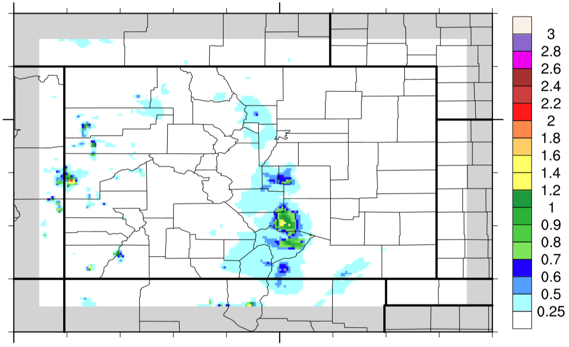
Plentiful moisture and favorable upper-level dynamics conspired to form many thunderstorms across Colorado on Monday. With precipitable water values exceeding an inch over many areas (and up to 1.4 inches at Pueblo!), some thunderstorms produced very heavy rainfall. The most intense storms, by far, were located in the Southeast Mountains and Southeast Plains. Several observers in Pueblo, Huerfano and Fremont counties recorded over 2 inches of rainfall, with the highest 24-hour rainfall amount of 2.96 inches coming from the vicinity of Rye.
As in previous days, rainfall was not just confined to east of the Divide. Numerous “popcorn” type thunderstorms were also seen across the higher elevations and western slope with 24-hr totals up to 1 inch noted. Two debris slides were reported in Mesa County on Highway 141 after the passage of a thunderstorm.
Meanwhile, many areas in the Northeast Plains stayed cool and quiet as low clouds blocked the July sun and kept temperatures as much as 25F below normal.
For 24-hour rainfall amounts in your area, be sure to check out our radar estimated rainfall map below.