Issue Date: 7/8/2015
Issue Time: 9:00AM
Summary:
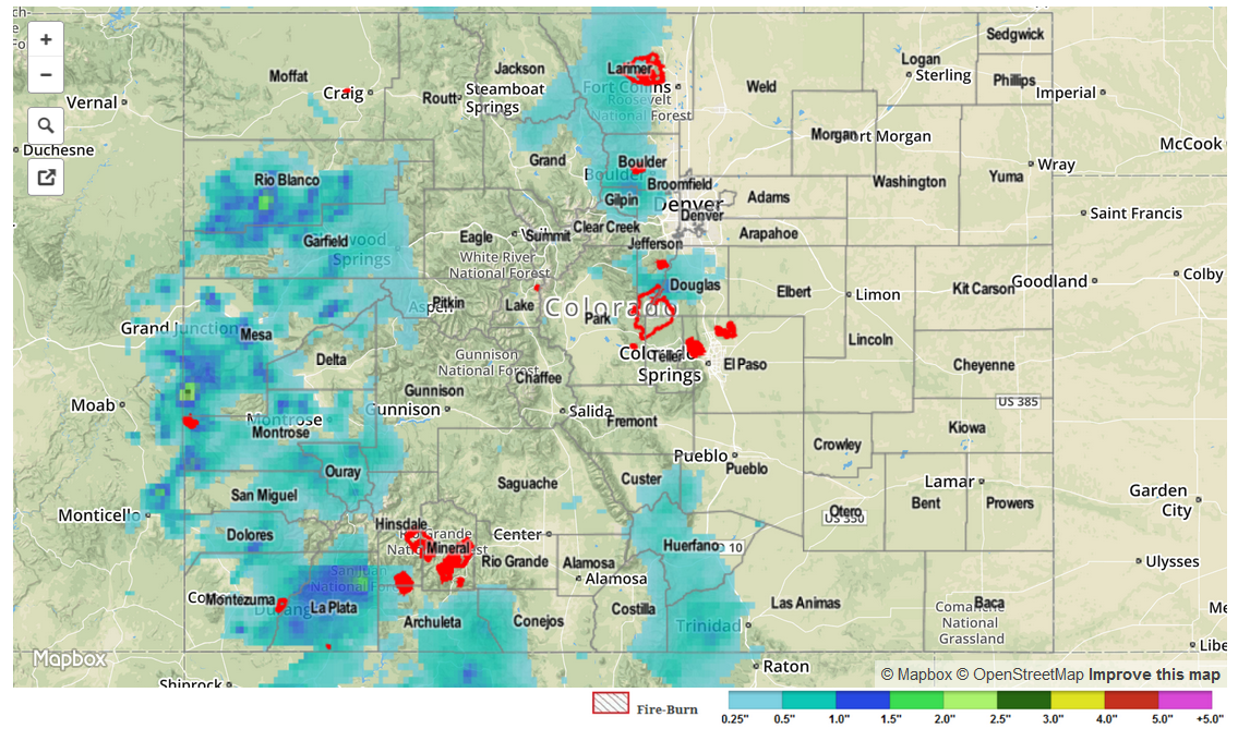
While a stable airmass prevented thunderstorm activity over the Plains east of the Divide, the higher terrain and western slope saw quite a different story. Numerous thunderstorms made their way across western Colorado, being fueled by abundant moisture and favorable atmospheric dynamics. Fortunately, almost all individual thunderstorms only lasted 30-45 minutes, minimizing the rainfall at any given locale. However, some areas saw two or three thunderstorms that piled on the rain totals. The highest observed 24-hr total came from Archuleta County where Pagosa Springs measured 1.51 inches of rain. Several other storms in the San Juans produced pea-size hail. All in all, it was an active day with 13 different Flood Advisories issued by the Grand Junction National Weather Service office between noon and midnight. A mud flow was reported in Mesa County, causing a momentary closure of eastbound I-70.
As storms made their way off the Continental Divide, they quickly collapsed as they hit a very stable airmass. Rainfall amounts up to 0.5 inches were noted in the Denver metro area.
For 24-hour rainfall amounts in your area, be sure to check out our radar estimated rainfall map below.