Issue Date: Monday, July 6th, 2015
Issue Time: 9:00 AM MDT
Summary:
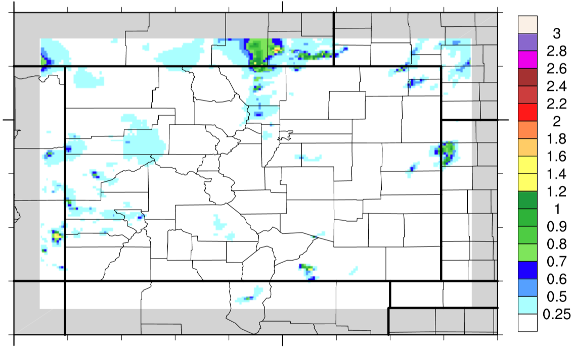
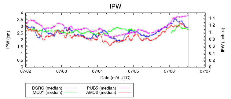
Plenty of deep, subtropical moisture was available to thunderstorms yesterday as precipitable water values climbed above an inch at all four normal reporting stations (Boulder, Grand Junction, Pueblo, and Shriever AFB). In fact, as of 6 AM this morning, Pueblo’s precipitable water is above 1.4 inches.
This moisture allowed for showers and thunderstorms to be efficient rainfall producers; luckily, no flash flooding/mudslide issues were reported as storm motions helped to mitigate the risk. A couple of strong/marginally severe storms were able to develop across the far eastern plains, as well.
Be sure and check out the radar-derived Storm Total Precipitation map below for a statewide overview of yesterday’s rainfall.