STP 07-21-2015: Dolores Remnants Provided Fuel for Scattered Showers and Thunderstorms

Issue Date: Tuesday, July 21st, 2015
Issue Time: 9:00 AM MDT

Summary:

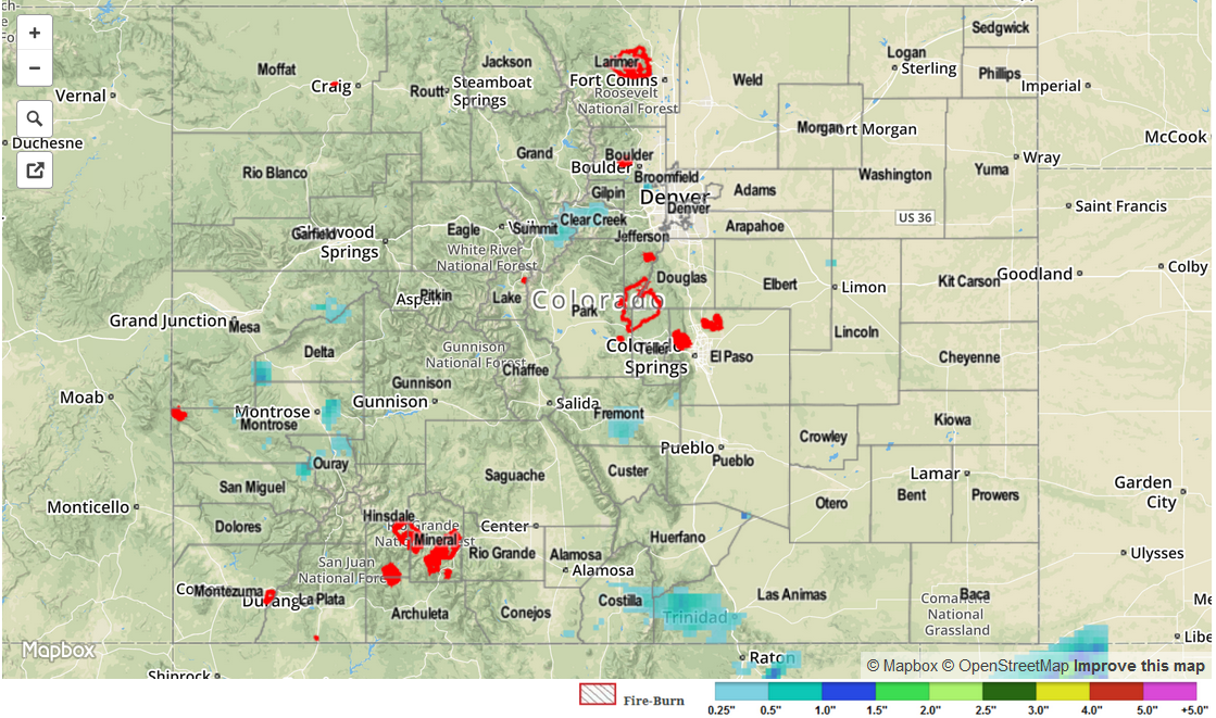
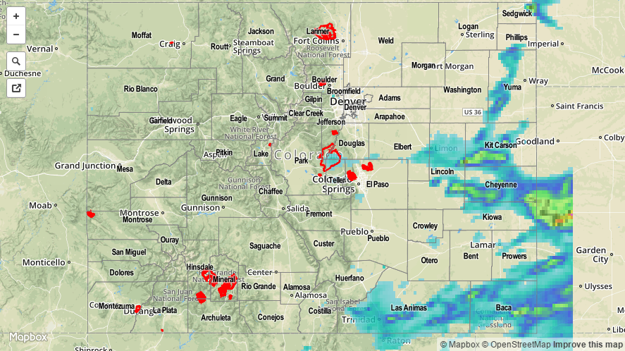
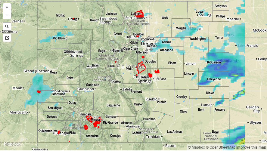
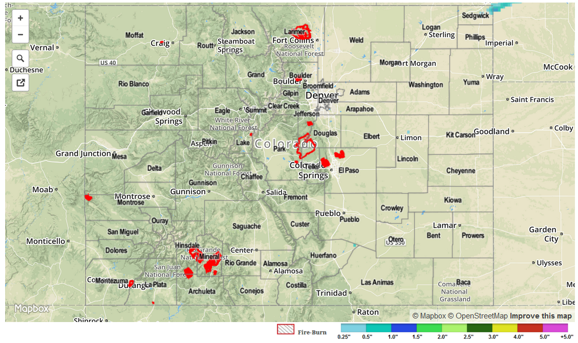
Most of yesterday’s activity occurred over the High Country as much of the environment across eastern Colorado remained capped. The two exception to this was 1) locations along the interface with the mountains, where a few showers/weak thunderstorms were able to move off of the higher terrain, and 2) near the CO/NM border across the Raton Ridge and Southeast Plains, where a weak cool front provided just enough forcing for weak showers and thunderstorms.

As far as yesterday’s rainfall totals are concerned, the best rainfall was concentrated across southern Colorado where the best moisture resided. This morning has seen a shift in that pattern, as dry air has worked in from the southwest, pushing the better moisture into northern Colorado, where scattered showers and thunderstorms are ongoing, mainly over and near preferred terrain.

From CoCoRaHS observers, the big rainfall winners of this period were:

Rio Grande County: 1.05 inches
Fremont County: 0.70 inches
Eagle County: 0.58 inches
Montrose County: 0.55 inches
Summit County: 0.52 inches

No flash flooding occurred yesterday.

STP_snapshot_20150721

STP 07-20-2015: Moisture Increased Statewide, Ingredients Favored Heavy Rain for Eastern Colorado

Issue Date: Monday, July 20th, 2015
Issue Time: 9:00 AM MDT

Summary:

As the remnants of Hurricane Dolores spun off the southern California coast, moisture shed by the storm invaded Colorado and increased precipitable water values across the state. A thick, morning cloud deck across western and central portions of Colorado left those areas with less instability in the afternoon, but eastern Colorado was mostly clear and able to produce strong-to-severe thunderstorms in the afternoon and evening as daytime heating did its job. Heavy rainfall was attendant to most strong thunderstorms across Eastern Colorado, especially the nearer one got to the CO/KS border. Check out some of the more impressive rainfall reports:

Kit Carson County: 4.20 inches, 3.32 inches, and 1.92 inches
Cheyenne County: 2.76 inches and 2.01 inches
Baca County: 1.37 inches
Sedgwick County: 0.90 inches

There were a few reports of heavy rainfall causing flooding across Kit Carson County. Take a look:

Stratton: Minor street and field flooding
3 miles E of Stratton: 4-6 inches of water running across Road 34 near Intersection of Highway 24
1 miles ESE of Stratton: 1-2 inches of running water over railroad tracks. Also, standing water in fields.
11 miles S of Seibert: Standing water in fields

20150720_STPImage
Storm Total Precip Legend

STP 07-19-2015: Subtropical Moisture Provided Fuel For Heavy Rain

Issue Date: 7/19/2015
Issue Time: 9:00AM

Summary:

The interaction of an atmospheric disturbance from the north and subtropical moisture from ex-hurricane Dolores provided some strong thunderstorms. Most of the heavier rainfall was limited to the far Northeast Plains. However, even parts of the Urban Corridor managed to pick up over 1 inch as storms moved off the mountains into the higher moisture. One hour rain rates of just under 1 inch was observed at an Urban Drainage ALERT gage, just south of Denver International Airport. As storms headed eastward, they intensified with rain rates of 1.0 to 1.25 inches estimated by radar over Kit Carson County.

In addition to the rainfall, hail and gusty winds accompanied some of the storms. Three-quarter inch hail was reported in Prowers County. However, the largest hail and heaviest rainfall likely fell over less populated parts of the Northeast Plains. Interestingly, this complex of storms intensified even further as it traveled across Kansas. Check out this morning’s water vapor map on the Flood Threat Bulletin to see how far it traveled overnight.

For 24-hour rainfall amounts in your area, be sure to check out our radar estimated rainfall map below. No official flooding reports were received yesterday.

20150719_STPImage
Storm Total Precip Legend

STP 07-18-2015: Dry Air Held On For One More Day

Issue Date: 7/18/2015
Issue Time: 9:24AM

Summary:

On Friday, a narrow slice of dry air hanging on over Colorado was being replaced with moisture from both the north and south yesterday. However, it managed to hold on, putting a lid on thunderstorm activity across the state. Quite a few storms did actually form, but were so high-based that they were only able to deliver a few, if any, drops of rain. In a strange twist of events, Alamosa, the state’s driest location with an annual average of less than 7 inches of rainfall, received the highest 24-hour total of about 0.1 inches. While lacking rainfall, many storms produced gusty winds, up to 55 mph.

In other weather related events, there were unfortunate news from Chaffee County, where a young woman was killed by a lightning strike. We want to reiterate here that lightning can occur even when it does not rain. Furthermore, lightning can occur on the periphery of a storm, making it wise to quickly seek lower ground or shelter when storms are visible.

With the lack of rainfall during the last two days, it did not take long for wildfire activity to pick up. A small fire is still ongoing in Garfield County. Although we cannot be sure, there is good reason to believe this fire was set by lightning in a “dry” thunderstorm. Many such storms were observed in the area on Friday.

For 24-hour rainfall amounts in your area, be sure to check out our radar estimated rainfall map below. No official flooding reports were received yesterday.

STP_snapshot_20150718