STP 06-14-2016: Strong/Severe Thunderstorms Produced Heavy Rain, Flash Flooding

Issue Date: Tuesday, June 14th, 2016
Issue Time: 9:00 AM MDT

Summary:

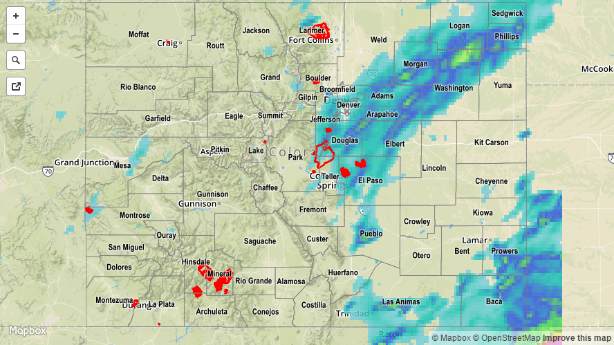
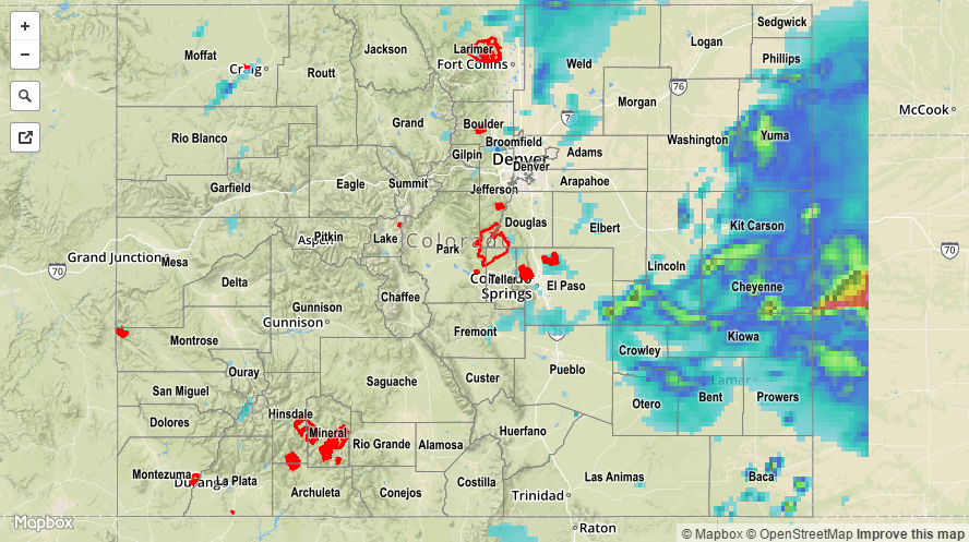
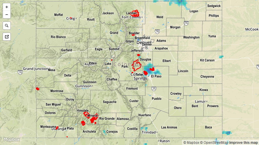
Instability, moisture, upper-level support, and sufficient wind shear all came together to produce an active period of showers and thunderstorms. The best coverage occurred along/east of the Continental Divide, where strong-to-severe thunderstorms rumbled, producing all modes of severe weather. Several rounds of thunderstorms were noted in several places from the Front Range eastward, each producing periods of heavy rain. Flash flooding/heavy rain was reported in several locations:

Flash Flood: 5 miles NNW of Peterson AFB at the intersection of Powers and Barnes
Flash Flood: 3 miles NW of Peterson AFB
Flash Flood: Near Maizeland Road and Academy Boulevard, Colorado Springs
Flash Flood: Flooding in a park in Parker reported, specific location not given

Heavy Rain: 2.10 inches, 2 miles NW of Peterson AFB
Heavy Rain: 1.83 inches, 4 miles WSW of Falcon
Heavy Rain: 1.46 inches/hour, South Academy Boulevard USGS Gauge
Heavy Rain: 1.02 inches/hour, USGS Penrose Gauge

Please refer to the STP map below for a statewide look at 24-hour precipitation.

20160614_STPImage
Storm Total Precip Legend

STP 06-13-2016: Scattered Thunderstorms Rumbled, Producing Heavy Rain at Times

Issue Date: Monday, June 13th, 2016
Issue Time: 9:00 AM MDT

Summary:

As the upper-level low continued its slow slide to the east over the Great Basin, a weak cool front sagged southward across eastern Colorado. Behind the front, moisture was reinforced as low-level upslope flow developed during the afternoon/evening hours. Scattered thunderstorms dotted the state from the Continental Divide and to the east, while more isolated showers/thunderstorms occurred to the west.

Over the lower elevations of eastern Colorado, a few storms were on the strong-to-severe side of the scale; especially those that interacted with one of the many outflow boundaries. Severe storm reports from yesterday include:

1.75 inch hail: 6 miles NE of La Junta, 1 mile W of Rocky Ford
1.25 inch hail: Olney Springs
1.0 inch hail: La Junta, 2 miles NNE of La Junta, 4 miles NNW of Rocky Ford, 10 miles ENE of Pueblo Depot, 7 miles NNW of Black Forest, 12 miles S of Karval
60+ mph winds: 4 miles S of Cheraw, La Junta, 5 miles N of Swink, Olney Springs

Flash flooding was reported 8 miles SE of Cheraw (Otero County), where cars were washed off Highway 50 in sports between mile markers 385 and 389. 8 inches of water was flowing across Highway 50 between mile marker 388 and the Bent County line.

Please refer to the STP map below for a statewide look at 24-hour precipitation.

20160613_STPImage
Storm Total Precip Legend

STP 06-12-2016: Uptick in Thunderstorm Coverage Over/Near the Mountains

Issue Date: Sunday, June 12th, 2016
Issue Time: 9:00 AM MDT

Summary:

Above average temperatures was the main story again, while thunderstorms increased in coverage over previous days. Most of the thunderstorm activity occurred over/near the mountains, but a couple rumbled across eastern portions of the Raton Ridge and far southeast plains. Most storms were high-based during the afternoon hours, with gusty winds and lightning being the main threats. During the evening/overnight hours, moisture recovered a bit and storms were able to produce a bit heavier rainfall, but not enough to cause any flash flooding issues. The lone heavy rain report from yesterday came from Montrose County, where a rain rate of 0.23 inches/10 minutes was observed 6 miles west of Montrose.

Rainfall winners according to CoCoRaHS observers (reports as of 7 AM MDT):

Jefferson County, Teller County: 0.23 inches
Denver County: 0.19 inches
Douglas County: 0.17 inches
Garfield County: 0.16 inches

Excessive snowmelt/reservoir releases continue to keep a few streams/rivers running high. Please see the STP map below for a look at 24-hour precipitation totals.

20160611_STPImage
Storm Total Precip Legend

STP 06-11-2016: Heat was the Main Story, but Isolated Thunderstorms Still Rumbled

Issue Date: Saturday, June 11th, 2016
Issue Time: 9:00 AM MDT

Summary:

Underneath the upper-level ridge, warm temperatures and sunshine were abundant across much of the state. Denver International Airport officially recorded 90 F for the first time in 2016, while many other locations ran 5-15 degrees F above normal. As the day warmed up, though, it played on the residual moisture to produce isolated thunderstorms, mainly over and adjacent to the higher terrain. Most storms were high-based, owing to the relatively dry lower levels, with gusty winds being the main threat.

However, outflow boundaries converged in El Paso County, which provided better low-level moisture, and an area of thunderstorms producing heavy rain developed during the evening hours. This was the “storm of the day” with regards to rainfall, accompanied by the following reports:

1.75 inches/45 minutes: 5 miles SSE of the Air Force Academy
1.4 inches/hour: 6 miles NNE of Colorado Springs

No flash flooding was reported yesterday, but minor street flooding was reported in Colorado Springs. Excessive snowmelt/reservoir releases continue to keep a few streams/rivers running high. Please see the STP map below for a look at 24-hour precipitation totals.

20160611_STPImage
Storm Total Precip Legend