STP 06-09-2017: Downtick In Storm Coverage and Intensity

Issue Date: Friday, June 9th, 2017
Issue Time: 10:15AM MDT

Summary:

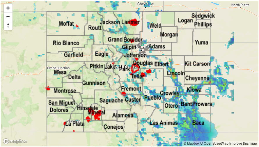
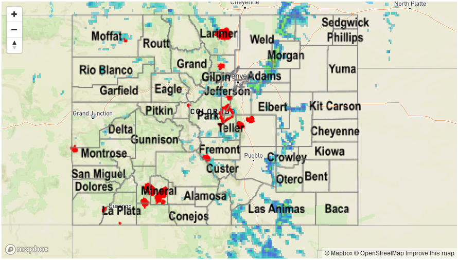
With moisture being scoured out from west to east on Thursday, shower and thunderstorm activity took a noticeable downtick compared to the previous 72-96 hours. Storms still developed across the higher terrain east of the Continental Divide, however, rainfall was limited to 0.25 to 0.5 inches. Some minor flooding developed on the Arkansas River near La Junta from the combination of snowmelt and the past few days of rainfall activity.

West of the Continental Divide, dry and hot weather continued with lower elevations reaching well above 90F.

For precipitation estimates in your area, check out our Precipitation Map below. Flash flooding was not reported on Thursday.
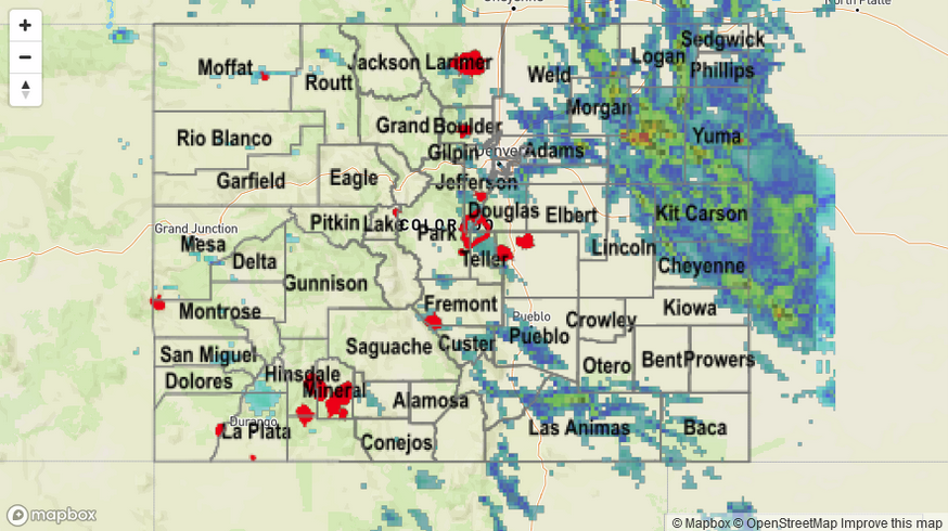
Storm Total Precip Legend

STP 06-08-2017: With An Abundant Moisture Supply, More Heavy Rainfall Out East

Issue Date: Thursday, June 8th, 2017
Issue Time: 9:45AM MDT

Summary:

Wednesday saw the highest moisture content of the young summer season, supporting scattered to widespread storm activity mainly east of the Continental Divide. Dew points approaching 60 F are rare in Colorado any time of year, but especially this early in the summer. Storm activity began over the higher terrain, then trickled down into the lower elevations. Two pockets of particularly heavy rainfall were observed. First, in the Southeast Mountains and nearby plains, where slow moving, localized storms produced over 2 inches of rainfall prompting several Flash Flood Warnings. Fortunately, flooding was not reported with this complex. Second, a complex of storms developed over the Northeast Plains by mid-afternoon, causing heavy rainfall as well as severe weather. Both large hail and tornadoes were reported in Washington County. An Areal Flood Advisory was also issued towards the latter stages of the storm’s life cycle. Officially, flooding was also not reported in this area, at least as of this morning.

Farther west on the other side of the Continental Divide, moisture was substantially lower and only isolated showers and weak storms were observed producing a few tenths of an inch of rain. Interestingly, law enforcement reported a funnel cloud in the San Luis Valley – certainly a rarity.

For precipitation estimates in your area, check out our Precipitation Map below.

Storm Total Precip Legend

STP 06-07-2017: Scattered Heavy Rainfall Producing Storms Out East; Very Warm and Mainly Dry Out West

Issue Date: Wednesday, June 7th, 2017
Issue Time: 10:30AM MDT

Summary:

With a ridge axis continued to be positioned overhead and an ample supply of low-level moisture, scattered to numerous thunderstorms were again observed east of the Continental Divide. Storms did not wait long to form, with heavy downpours already visible on radar before noon in the Front Range. Once again, most downpours were short-lived and produced up to 0.5 inches of rainfall, not enough to cause flooding.

Later in the afternoon, as storm updrafts organized into larger clusters, a few particularly impressive storms developed. A slow moving, training cell formed just north of Colorado Springs in the mid-afternoon, producing over 2 inches of rainfall in an hour or so. Flash flooding was reported near the Air Force Academy and this storm carried a Flash Flood Warning for a while. A Flash Flood Warning was also issued for the Hayden Pass fire scar due to a second consecutive day of moderate rainfall. Farther southeast, numerous flood advisories were issued for slow moving storms that produced 2-3 inches of rainfall in a 60-90 minute period. Fortunately, flooding was not reported with these (though most of the heavy rainfall fell in rural locations and flooding may have not been detected). A report of 1 inch hail also accompanied these cells.

Farther west on the other side of the Continental Divide, moisture was substantially lower and only isolated showers and weak storms were observed producing perhaps a few tenths of an inch of rain. Instead, very warm weather was the headline.

For precipitation estimates in your area, check out our Precipitation Map below.

Storm Total Precip Legend

STP 06-06-2017: Slow Moving Storms Caused Isolated Heavy Rainfall Out East

Issue Date: Tuesday, May 6th, 2017
Issue Time: 10:45AM MDT

Summary:

The Continental Divide is a famous line not only for hydrological reasons, but also for meteorological ones. This was on display on Monday as areas west of the line saw hot, mainly dry weather while areas to the east saw plenty of shower and storm activity. Storms fired over the highest terrain first, in accord with Colorado’s summertime climatology. Then, they moved south and eastwards at 15-25 mph, being steered in that direction by a high pressure ridge extending north-south from the Canadian border all the way into Mexico. Most storms were garden variety “pulse” storms with 30 minutes of heavy rainfall followed by some gusty winds. However, a few turned severe for mainly large hail (with some gusty winds as well).

Maximum observed rainfall was just over 1 inch from a storm east of Denver. However, higher amounts are likely to have occurred over rural parts of Weld County, where up to 2.25 inches fell.

For precipitation estimates in your area, check out our Precipitation Map below. Flooding was not reported on Monday.

Storm Total Precip Legend