Issue Date: Thursday, June 8th, 2017
Issue Time: 9:45AM MDT
Summary:
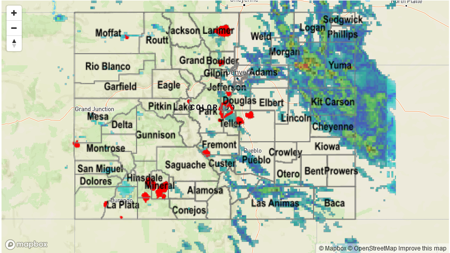
Wednesday saw the highest moisture content of the young summer season, supporting scattered to widespread storm activity mainly east of the Continental Divide. Dew points approaching 60 F are rare in Colorado any time of year, but especially this early in the summer. Storm activity began over the higher terrain, then trickled down into the lower elevations. Two pockets of particularly heavy rainfall were observed. First, in the Southeast Mountains and nearby plains, where slow moving, localized storms produced over 2 inches of rainfall prompting several Flash Flood Warnings. Fortunately, flooding was not reported with this complex. Second, a complex of storms developed over the Northeast Plains by mid-afternoon, causing heavy rainfall as well as severe weather. Both large hail and tornadoes were reported in Washington County. An Areal Flood Advisory was also issued towards the latter stages of the storm’s life cycle. Officially, flooding was also not reported in this area, at least as of this morning.
Farther west on the other side of the Continental Divide, moisture was substantially lower and only isolated showers and weak storms were observed producing a few tenths of an inch of rain. Interestingly, law enforcement reported a funnel cloud in the San Luis Valley – certainly a rarity.
For precipitation estimates in your area, check out our Precipitation Map below.
![]()