STP 07-23-2017: Repeat of Heavy Rain for the Southern High Country

Issue Date: Sunday, July 23, 2017
Issue Time: 09:50AM MDT

Summary:

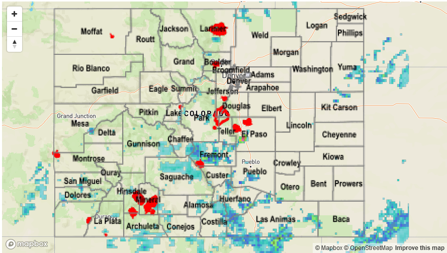
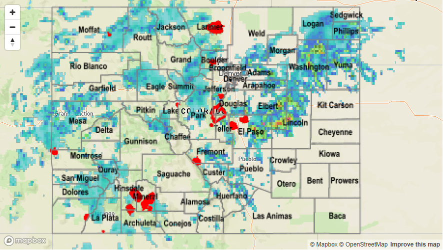
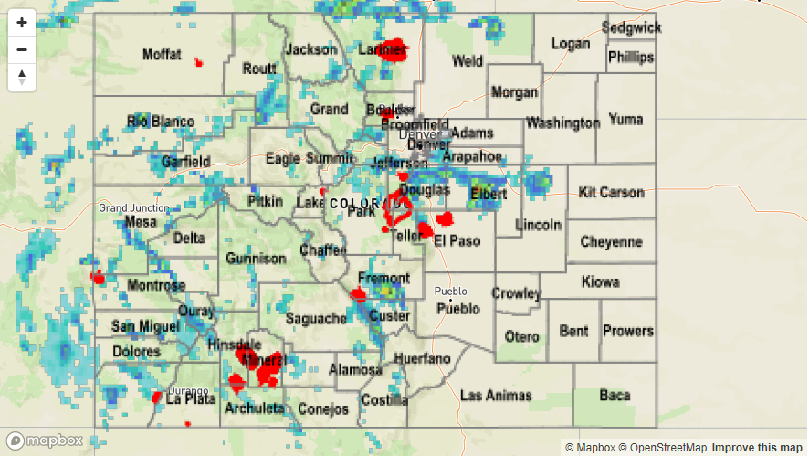
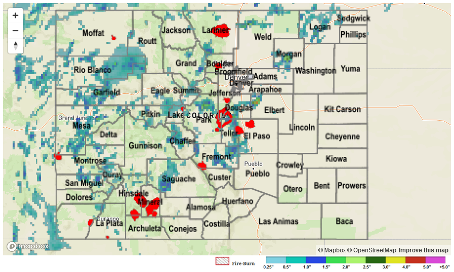
Storms began to fire over the mountains yesterday afternoon just after 11AM. Moisture was confined to the southern portion of the state and favored the higher terrain. The Southeast Mountains and Front Range had the highest totals, although there was also heavy rainfall over the San Juan Mountains and Southwest Slope. Isolated storms drifted into the southern Urban Corridor and southern Southeast Plains in the early evening hours. All showers and thunderstorms dissipated shortly after sundown and ceased by 10:30PM.

Over the mountains, the slow moving storms prompted a handful of Areal Flood Advisories for their local, heavy rainfall. The Wolf Creek Summit SNOTEL site in the Rio Grande National Forest reported 1.5 inches of rain over the course of the day, with the majority falling in a 2 hour window just after noon. The Apishapa SNOTEL site in the Southeast Mountains had 1.4 inches of rain the last 24-hours with the majority falling just after noon as well. In Las Animas County near the Spanish Peaks, 1.47 inches of heavy rainfall was reported to the NWS Pueblo office. Total storm rainfall estimates were as high as 1.8 inches over the southern mountains. There was one Flash Flood Warning issued for an isolated thunderstorm near southern Colorado Springs/Fort Carson. A USGS gauge at Fort Carson recorded 1.45 inches in 1 hour. Radar estimated totals for this storm were 2.5 inches with 1 hour rain rates as high as 1.5 inches. There were no flood reports as of Sunday morning.

Check out how much precipitation has fallen over the state in the last 24-hours on the map below:

Storm Total Precip Legend

STP 07-22-2017: Soggy Soil Continues for the Mountains

Issue Date: Saturday, July 22, 2017
Issue Time: 10:10AM MDT


Summary:

A plume of monsoon moisture helped support heavy rainfall again in the high country and plains once again yesterday. Storms began to fire over the higher terrain just after noon, and the high moisture allowed more coverage of storms than the previous day. In the late afternoon, the storms on the Front Range began to push off into the Urban Corridor. Subsequent outflow boundaries help fire a complex of storms over the Northeast Plains and Palmer Divide. Substantial cloud cover continues this morning from those storms yesterday over the eastern plains and high country. Numerous Areal Flood Advisories were issued yesterday for the heavy rainfall. A majority of the state recorded some trace of precipitation.

High rainfall totals returned again to the western slope. The most impressive total was the Weminuche Creek SNOTEL station in the San Juan Mountains that recorded 2.1 inches in 2-hours and had a 1-hour total rainfall of 1.8 inches. A CoCoRaHS station in Montezuma recorded 1.29 inches of rain in 50 minutes. Further north on the western slope around Garfield County, there were two road flooding incidents reported to the NWS Grand Junction. Both occurred near Rifle. Water was reported to be running over county road 233 for 150-200 yards and at county road 252 near Rifle Creek. Radar estimated storms totals were 2.2 inches. Also in Rifle, state highway 325 was closed due to mudslides between mile markers 5 and 6. The Glenwood Springs area had standing water on I-70 between mile markers 112 and 117. High storm totals in the mountains varied from just over 1 inch to 2.2 inches.

Over the Front Range, the Jones Pass SNOTEL station recorded 1.4 inches. Storm total was estimated to be 1.6 inches. As storms moved off the mountains in the Urban Corridor, a rainfall gauge near Rampart Range Road recorded 0.2 inches of rain in 30 min. Slaughterhouse Gulch rose 0.5 feet in 1 hour with the local, heavy rainfall. Gusty winds accompanied these thunderstorms and an outflow boundary with 64 mph gusts was recorded at Fort Morgan. Over the plains, a CoCoRaHS station in Washington County recorded 2.09 inches. Storm totals over the plains and Palmer Ridge were as high as 3 inches with max 1-hr rain rates up to 2.5 inches.

To see how much precipitation fell in your neighborhood over the last 24-hours, take a look at the Storm Total Precipitation Map below:

Storm Total Precip Legend

STP 07-21-2017: Monsoon Surge Continued To Support Heavy Rain

Issue Date: Friday, July 21, 2017
Issue Time: 11AM MDT

Summary:

Scattered to numerous thunderstorms once again dotted Colorado’s landscape on Thursday. With Precipitable water levels remaining near or above 1 inch, early morning sunshine quickly generated instability, forming storms before noon. As is common with monsoon surges, the higher terrain received the highest coverage of storm activity. Slow moving storms delivered a quick 0.5 – 0.75 inches of rainfall, though isolated higher amounts were observed. For example, three SNOTEL sites received 1.5 inches of rainfall or more, with most of that falling in a 1 hour period. In all 9 Flash Flood Warnings or Areal Flood Advisories were issued on Thursday afternoon by the Grand Junction and Pueblo National Weather Service offices.

Though most storms were limited to the higher terrain, a few managed to stay intact as they crawled eastward off the Palmer Ridge. A quick 1 inch per of rainfall (up to 0.5 inches in 10 minutes!) was observed in southern parts of Denver metro with up to 2.5 inches falling in rural Elbert County. That cell also produced hail, with a report of 1 inch stones falling in Elbert County.

Fortunately, flooding was not officially reported on Thursday. For rainfall estimates in your area, check out our Precipitation Map below.

Storm Total Precip Legend

STP 07-20-2017: Flooding in the High Country

Issue Date: Thursday, July 20, 2017
Issue Time: 10:15AM MDT

Summary:

High moisture returned to the western slope and high country yesterday. Slow storm motion under the ridge created heavy rains. There were numerous Areal Flood Advisories and a Flash Flood Warning for Central Chaffee County where 1.6 inches of rain fell. 1.4 inches of rain were recorded at two SNOTEL sites. One in the north Medicine Bow Forest and another at Schofield Pass. At Schofield Pass, 1.3 inches of rain was recorded in 1-hour. Radar total storm estimates in the mountains were as high as 2.2 inches. Most storm reports came from more urban areas, which experienced small stream and street flooding. Near Meeker, Colorado, a thunderstorm dropped 1.15 inches of rain in 1 hour around 5PM. Outside Nathrop, CR 162 was closed due to 15 inches of water flowing over the top of the road. In north central Park County, 0.35 inches was recorded in 5 minutes at a UDFCD gage. Several reports of minor street flooding were relayed to the NWS over Grand Junction. The highest estimated rainfall was 3 inches in rural Elbert County.

To see how much precipitation fell the last 24-hours over the state, see the Storm Precipitation Map below.