Issue Date: Friday, August 4, 2017
Issue Time: 10:10AM MDT
Summary:
Early morning showers from the previous night lingered over the Central Mountains and eastern plains. Strong northwesterly flow helped moved these storms to the SE throughout the morning, and they eventually exited the state by early afternoon. These storms stabilized the atmosphere over the San Juan Mountains, portions of the Front Range and far Southeast Plains. Thunderstorm from yesterday that moved into these regions quickly dissipated. Around 1PM diurnal heating created an upslope pattern and storms began to initiate over the high country starting in the north. The heavier rainfall and stronger thunderstorms formed over the Southeast Mountains, which had higher instability and more availability to moisture. As the storms moved to the SE off the higher terrain, they found themselves in a favorable environment over Elbert and Lincoln Counties. A cluster of strong storms formed that were able to produce heavy, local precipitation. Storms began to quiet down quickly after sunset, though some isolated showers were able to lingering overnight in the mountains.
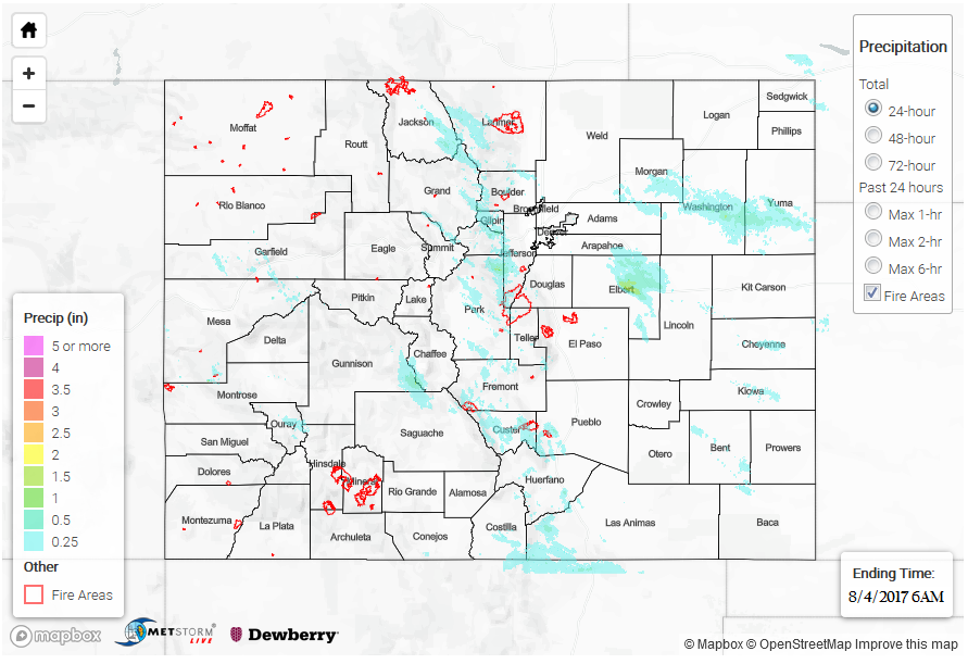
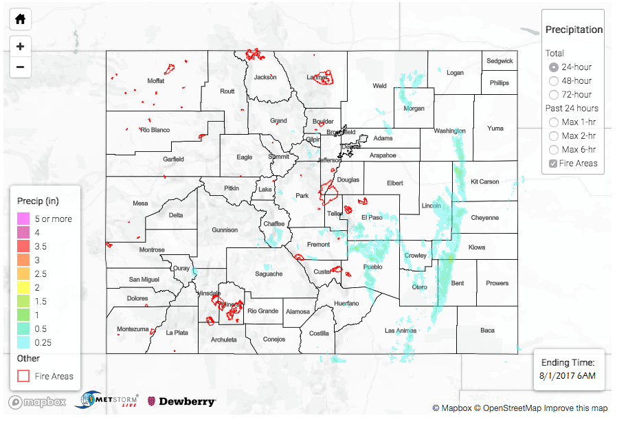
Both the thunderstorms over Elbert County and the Southeast Mountains had areal flood advisories issued for heavy rainfall. Over the plains, 1-hour rainfall was as high as 1.5 inches. Storm total rainfall was estimated at 2.8 inches. In the high country, most CoCoRaHS and SNOTEL stations recorded about 0.5 inches of rainfall for the 24-hour period. However, rainfall estimates were as high as 1.5 inches. A Flash Flood Warning was issued for the Hayden burn scar. Flash flooding occurred in the area of Dinkle Ditch, and Dinkle Ditch Road was washed out. There was high water reported in all the nearby creeks due to the runoff from the burn scar. An aerial flood advisory was issued for the Junkins burn scar as well, but, fortunately, there were no flooding reports as of this morning over that area.
For rainfall estimates in your area, scroll down and take a look at the State Precipitation Map below.