Issue Date: Tuesday, August 1, 2017
Issue Time: 10:15AM MDT
Summary:
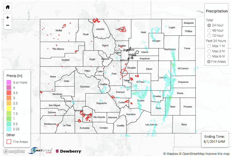
With a changing weather pattern marked by substantial dry air being imported into Colorado, heavy rainfall intensity and coverage dropped accordingly. Nonetheless, scattered thunderstorms still formed across eastern Colorado. Coverage was roughly separated into two areas: one closer to the foothills and higher elevations, and the other farther east on the plains where there was better moisture. Despite faster storm motion than past days, a quick 1 to 1.5 inches of rainfall in 60-90 minutes was common with the strongest cells. With the saturated soils in southeast Colorado, numerous Areal Flood Advisories were issued along the I-25 corridor between Colorado Springs and Walsenburg. Another, more isolated cell, formed over Chaffee County where a few reports of over 1 inch of rainfall were received. Scattered shower and thunderstorms were also observed over the southern San Juans. A few CoCoRaHS reports between 0.5 and 0.75 inches were tallied this morning.
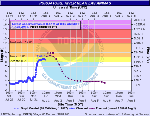
Finally, with the recent heavy rainfall in the Southeast Plains, many tributaries along the Arkansas River rose. The most notable was the Purgatoire River where a distinct river crest formed late Sunday. This crest made it to the Arkansas River confluence this morning (see below), but stayed below Minor flood stage.
Fortunately, flooding was not officially reported as of this morning. For rainfall estimates in your area, check out our State Precipitation Map below.